Těšetice (Olomouc District)
Těšetice | |
|---|---|
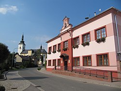 Municipal office and the Church of Saints Peter and Paul | |
 Flag  Coat of arms | |
 Těšetice Location in the Czech Republic | |
| Coordinates: 49°35′35″N 17°7′34″E / 49.59306°N 17.12611°ECoordinates: 49°35′35″N 17°7′34″E / 49.59306°N 17.12611°E | |
| Country | |
| Region | Olomouc |
| District | Olomouc |
| First mentioned | 1078 |
| Area | |
| • Total | 12.48 km2 (4.82 sq mi) |
| Elevation | 227 m (745 ft) |
| Population (2020-01-01[1]) | |
| • Total | 1,291 |
| • Density | 100/km2 (270/sq mi) |
| Time zone | UTC+1 (CET) |
| • Summer (DST) | UTC+2 (CEST) |
| Postal code | 783 46 |
| Website | www |

Těšetice is a municipality and village in Olomouc District in the Olomouc Region of the Czech Republic. It has about 1,300 inhabitants.
Těšetice lies approximately 10 kilometres (6 mi) west of Olomouc and 202 km (126 mi) east of Prague.
Administrative parts[]
Villages of Rataje and Vojnice are administrative parts of Těšetice.
References[]
- ^ "Population of Municipalities – 1 January 2020". Czech Statistical Office. 2020-04-30.
| Wikimedia Commons has media related to Těšetice (Olomouc District). |
| Authority control: National libraries |
|---|
This Olomouc Region location article is a stub. You can help Wikipedia by . |
Categories:
- Villages in Olomouc District
- Olomouc Region geography stubs