Dunham, Quebec
Dunham | |
|---|---|
City | |
 A vineyard in Dunham. | |
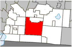 Location within Brome-Missisquoi RCM. | |
 Dunham Location in southern Quebec. | |
| Coordinates: 45°08′N 72°48′W / 45.133°N 72.800°WCoordinates: 45°08′N 72°48′W / 45.133°N 72.800°W[1] | |
| Country | Canada |
| Province | Quebec |
| Region | Montérégie |
| RCM | Brome-Missisquoi |
| Constituted | September 25, 1971 |
| Government | |
| • Mayor | Pierre Janecek |
| • Federal riding | Brome—Missisquoi |
| • Prov. riding | Brome-Missisquoi |
| Area | |
| • Total | 196.20 km2 (75.75 sq mi) |
| • Land | 195.18 km2 (75.36 sq mi) |
| Population (2011)[5] | |
| • Total | 3,471 |
| • Density | 17.8/km2 (46/sq mi) |
| • Pop 2006-2011 | |
| • Dwellings | 1,709 |
| Time zone | UTC−5 (EST) |
| • Summer (DST) | UTC−4 (EDT) |
| Postal code(s) | J0E 1M0 |
| Area code(s) | 450 and 579 |
| Highways | |
| Website | www |

Dunham is a city in the Canadian province of Quebec, located in Brome-Missisquoi Regional County Municipality. The population as of the Canada 2011 Census was 3,471.
Dunham is located approximately 10 kilometres (6.2 mi) north of the United States border. It is bordered by Saint-Ignace-de-Stanbridge and Stanbridge East to the west, Farnham to the northwest, Brigham and Cowansville to the north, Brome Lake to the northeast, Sutton to the east and Frelighsburg to the south. Selby Lake is located entirely within Dunham.
Demographics[]
Population[]
| hideCanada census – Dunham, Quebec community profile | |||
|---|---|---|---|
| 2011 | 2006 | ||
| Population: | 3,471 (+2.2% from 2006) | 3,396 (+5.6% from 2001) | |
| Land area: | 195.18 km2 (75.36 sq mi) | 195.14 km2 (75.34 sq mi) | |
| Population density: | 17.8/km2 (46/sq mi) | 17.4/km2 (45/sq mi) | |
| Median age: | 46.4 (M: 46.7, F: 46.1) | 44.2 (M: 44.5, F: 43.8) | |
| Total private dwellings: | 1,709 | 1,626 | |
| Median household income: | $67,068 | $50,395 | |
| References: 2011[5] 2006[6] earlier[7] | |||
|
|
|
Language[]
| Canada Census Mother Tongue - Dunham, Quebec[8] | ||||||||||||||||||
|---|---|---|---|---|---|---|---|---|---|---|---|---|---|---|---|---|---|---|
| Census | Total | French
|
English
|
French & English
|
Other
| |||||||||||||
| Year | Responses | Count | Trend | Pop % | Count | Trend | Pop % | Count | Trend | Pop % | Count | Trend | Pop % | |||||
2011
|
3,455
|
2,625 | 75.98% | 695 | 20.12% | 55 | 1.59% | 80 | 2.31% | |||||||||
2006
|
3,365
|
2,505 | 74.44% | 745 | 22.14% | 80 | 2.38% | 35 | 1.04% | |||||||||
2001
|
3,185
|
2,350 | 73.78% | 720 | 22.61% | 55 | 1.73% | 60 | 1.88% | |||||||||
1996
|
3,315
|
2,560 | n/a | 77.22% | 670 | n/a | 20.21% | 35 | n/a | 1.06% | 50 | n/a | 1.51% | |||||
See also[]
- List of cities in Quebec
- Lansford Whiting Ingalls (1812–1896) - father of Charles Ingalls and grandfather of Laura Ingalls Wilder, author of Little House on the Prairie was born in Dunham, but resided mostly in the United States
References[]
- ^ Reference number 19766 of the Commission de toponymie du Québec (in French)
- ^ Jump up to: a b Ministère des Affaires municipales, des Régions et de l'Occupation du territoire: Dunham
- ^ Parliament of Canada Federal Riding History: BROME--MISSISQUOI (Quebec)
- ^ 2011 Statistics Canada Census Profile: Dunham, Quebec
- ^ Jump up to: a b "2011 Community Profiles". 2011 Canadian Census. Statistics Canada. July 5, 2013. Retrieved 2014-03-13.
- ^ "2006 Community Profiles". 2006 Canadian Census. Statistics Canada. March 30, 2011. Retrieved 2014-03-13.
- ^ "2001 Community Profiles". 2001 Canadian Census. Statistics Canada. February 17, 2012.
- ^ Jump up to: a b Statistics Canada: 1996, 2001, 2006, 2011 census
External links[]
| show Adjacent Municipal Subdivisions |
|---|
| hide | |
|---|---|
| Cities & Towns |
|
| Municipalities |
|
| Townships | |
| Villages | |
| |
| show Authority control |
|---|
Categories:
- Cities and towns in Quebec
- Incorporated places in Brome-Missisquoi Regional County Municipality