Abercorn, Quebec
Abercorn | |
|---|---|
Village municipality | |
 Waterfall in the village of Abercorn, Québec | |
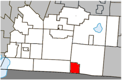 Location within Brome-Missisquoi RCM. | |
 Abercorn Location in southern Quebec. | |
| Coordinates: 45°02′N 72°40′W / 45.033°N 72.667°WCoordinates: 45°02′N 72°40′W / 45.033°N 72.667°W[1] | |
| Country | |
| Province | |
| Region | Montérégie |
| RCM | Brome-Missisquoi |
| Historic region | Eastern Townships |
| Settled | 1797 |
| Constituted | June 25, 1929 |
| Government | |
| • Mayor | Guy Gravel |
| • Federal riding | Brome—Missisquoi |
| • Prov. riding | Brome-Missisquoi |
| Area | |
| • Total | 27.00 km2 (10.42 sq mi) |
| • Land | 27.22 km2 (10.51 sq mi) |
| There is an apparent contradiction between two authoritative sources | |
| Population (2011)[4] | |
| • Total | 391 |
| • Density | 14.4/km2 (37/sq mi) |
| • Pop 2006-2011 | |
| • Dwellings | 238 |
| Time zone | UTC−5 (EST) |
| • Summer (DST) | UTC−4 (EDT) |
| Postal code(s) | J0E 1B0 |
| Area code(s) | 450 and 579 |
| Highways | |
| Census profile | 2446005[4] |
| MAMROT info | 46005[2] |
| Toponymie info | 88[1] |

Abercorn is a village in the Brome-Missisquoi Regional County Municipality in the Montérégie region of Québec, Canada. The population as of the Canada 2011 Census was 391.[2][4]
It is bordered by the larger township of Sutton to the north and east, by Frelighsburg to the west, and the town of Richford, Vermont in the United States to the south.
History[]
Thomas Spencer built the first log cabin near Abercorn in 1792. The village was originally called Sheppard's Mills in honour of Thomas Shepard, a New Hampshire loyalist who built the area's first grain and saw mill. Originally part of Sutton, Abercorn was established as a township in 1929.
Geography[]
The village is located on the northern edge of the Green Mountains in the Sutton Valley, flanked to the west by the Pinnacle and to the east by the Sutton Mountain range. The Sutton river runs through the valley, as does Route 139 and the Montreal, Maine and Atlantic Railway.
Located about 105 km from Montréal via Autoroute 10 and near the ski hills of Mount Sutton, Bromont, Jay Peak, Vermont, and Mont Owl's Head, Abercorn is a popular day trip and vacation spot for Montrealers.
Demographics[]
Population[]
Population trend:[5]
| Census | Population | Change (%) |
|---|---|---|
| 2011 | 391 | |
| 2006 | 366 | |
| 2001 | 330 | |
| 1996 | 344 | |
| 1991 | 321 | N/A |
Language[]
Home language (2006)[6]
| Language | Population | Pct (%) |
|---|---|---|
| French only | 210 | 56.575% |
| English only | 145 | 39.18% |
| Visible minorities and Aboriginal population | |||
|---|---|---|---|
| Canada 2006 Census | Population | % of Total Population | |
| Visible minority group Source:[7] |
South Asian | 0 | 0 |
| Chinese | 0 | 0 | |
| Black | 0 | 0 | |
| Filipino | 0 | 0 | |
| Latin American | 0 | 0 | |
| Southeast Asian | 0 | 0 | |
| Arab | 0 | 0 | |
| West Asian | 0 | 0 | |
| Korean | 0 | 0 | |
| Japanese | 0 | 0 | |
| Mixed visible minority | 0 | 0 | |
| Other visible minority | 0 | 0 | |
| Total visible minority population | 0 | 0 | |
| Aboriginal group Source:[7] |
First Nations | 0 | 0 |
| Métis | 0 | 0 | |
| Inuit | 0 | 0 | |
| Total Aboriginal population | 0 | 0 | |
| White | 365 | 100 | |
| Total population | 365 | 100 | |
See also[]
References[]
- ^ Jump up to: a b Reference number 88 of the Commission de toponymie du Québec (in French)
- ^ Jump up to: a b c d Geographic code 46005 in the official Répertoire des municipalités (in French)
- ^ Parliament of Canada Federal Riding History: BROME--MISSISQUOI (Quebec)
- ^ Jump up to: a b c d "(Code 2446005) Census Profile". 2011 census. Statistics Canada. 2012.
- ^ Statistics Canada: 1996, 2001, 2006, 2011 census
- ^ 2006 Statistics Canada Community Profile: Abercorn, Quebec
- ^ Jump up to: a b Community Profiles from the 2006 Census, Statistics Canada - Census Subdivision
External links[]
| show Adjacent Municipal Subdivisions |
|---|
| hide | |
|---|---|
| Cities & Towns |
|
| Municipalities |
|
| Townships | |
| Villages | |
| |
| Authority control |
|
|---|
- Villages in Quebec
- Incorporated places in Brome-Missisquoi Regional County Municipality