Dyo Potamoi
Dyo Potamoi
| |
|---|---|
 Dyo Potamoi | |
| Coordinates: 35°14′47″N 33°05′27″E / 35.24639°N 33.09083°ECoordinates: 35°14′47″N 33°05′27″E / 35.24639°N 33.09083°E | |
| Country (de jure) | |
| • District | Nicosia District |
| Country (de facto) | |
| • District | Güzelyurt District |
| Time zone | UTC+2 (EET) |
| • Summer (DST) | UTC+3 (EEST) |
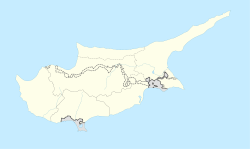
Dyo Potamoi (Greek: Δυο Ποταμοί or Δύο Ποταμοί, literally 'Two Rivers', Turkish: İkidere or İki Dere) is an abandoned hamlet in Cyprus, east of Kapouti. De facto, it is under the control of Northern Cyprus.
Dyo Potamoi has been abandoned since 1964. In 1960, it had 40 inhabitants, all of them Turkish Cypriots.[2]
References[]
- ^ In 1983, the Turkish Republic of Northern Cyprus unilaterally declared independence from the Republic of Cyprus. The de facto state is not recognised by any UN state except Turkey.
- ^ "DYO POTAMOI". Internal displacement in Cyprus. PRIO Cyprus Centre. Retrieved 6 November 2014.
Categories:
- Communities in Nicosia District
- Populated places in Güzelyurt District
- Former populated places in Cyprus
- Cyprus geography stubs


