Kyra, Cyprus
Kyra
| |
|---|---|
 Kyra | |
| Coordinates: 35°12′09″N 33°03′28″E / 35.20250°N 33.05778°ECoordinates: 35°12′09″N 33°03′28″E / 35.20250°N 33.05778°E | |
| Country (de jure) | |
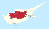
| • District | Nicosia District |
| Country (de facto) | |
| • District | Güzelyurt District |
| Population (2011)[2] | |
| • Total | 386 |
| Time zone | UTC+2 (EET) |
| • Summer (DST) | UTC+3 (EEST) |

Kyra (Greek: Κυρά; Turkish: Mevlevi) is a village located in the Nicosia District of Cyprus, 6 km east of Morphou. De facto, it is under the control of Northern Cyprus.
Originally inhabited by Greek Cypriots, since the Turkish invasion in 1974, the village has been solely inhabited by Turks.[3] The Church of Panagia is used by the Turkish army as a depot.
References[]
- ^ In 1983, the Turkish Republic of Northern Cyprus unilaterally declared independence from the Republic of Cyprus. The de facto state is not recognised by any UN state except Turkey.
- ^ "KKTC 2011 Nüfus ve Konut Sayımı" [TRNC 2011 Population and Housing Census] (PDF). TRNC State Planning Organization. 6 August 2013. p. 22. Archived from the original (PDF) on 6 November 2013.
- ^ https://docs.google.com/viewer?a=v&q=cache:HFPwLt8LC_AJ:www.unhchr.ch/Huridocda/Huridoca.nsf/0/f4f30ed4b0ee47f5c1256af4003755db/%24FILE/G0115564.pdf+Fterycha&hl=en&gl=uk&pid=bl&srcid=ADGEESjJWaRiEGn3eIn6YUUnIhuA6FmNv2q_uUpAFejCqfJngD6TmPkNyTFZ7lACAEWg4f823_M1QrgWdPN6j2kJZo7iVpwusSqFxL2I-1ee2GXe8hCBkxduvWQHg1kpf_FmdB2_WCFC&sig=AHIEtbQ8XjiXdelgW7MpJxFm8XIM5DM69Q
| Settlements |  | |
|---|---|---|
This Cyprus location article is a stub. You can help Wikipedia by . |
Categories:
- Communities in Nicosia District
- Populated places in Güzelyurt District
- Greek Cypriot villages depopulated during the 1974 Turkish invasion of Cyprus
- Cyprus geography stubs