Pano Zodeia
This article has multiple issues. Please help or discuss these issues on the talk page. (Learn how and when to remove these template messages)
|
Pano Zodeia
| |
|---|---|
 Pano Zodeia | |
| Coordinates: 35°09′49″N 33°00′57″E / 35.16361°N 33.01583°ECoordinates: 35°09′49″N 33°00′57″E / 35.16361°N 33.01583°E | |
| Country (de jure) | |
| • District | Nicosia District |
| Country (de facto) | |
| • District | Güzelyurt District |
| Time zone | UTC+2 (EET) |
| • Summer (DST) | UTC+3 (EEST) |

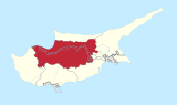
Pano Zodeia (Greek: (η) Πάνω Ζώδεια; Turkish: Yukarı Bostancı) is a village on the island of Cyprus, east of Morphou. De facto, it is under the control of Northern Cyprus.[2]
Green Line crossing[]
Pano Zodeia is the location of one of six Green Line crossings between the Republic of Cyprus and Northern Cyprus. The town on the Republic side of the border is Astromeritis. The crossing is only for vehicular traffic. It was opened on 31 August 2005.
References[]
- ^ In 1983, the Turkish Republic of Northern Cyprus unilaterally declared independence from the Republic of Cyprus. The de facto state is not recognised by any UN state except Turkey.
- ^ "PANO ZODEIA". www.prio-cyprus-displacement.net. Archived from the original on 2018-09-03. Retrieved 2018-09-03.
| Settlements |  | |
|---|---|---|
This Cyprus location article is a stub. You can help Wikipedia by . |
Categories:
- Communities in Nicosia District
- Populated places in Güzelyurt District
- Border crossings of Cyprus
- Greek Cypriot villages depopulated during the 1974 Turkish invasion of Cyprus
- Cyprus geography stubs