Exclusive economic zone of France
This article needs additional citations for verification. (July 2020) |
France has, due to its Overseas departments and regions that are scattered in all the oceans of Earth, the largest exclusive economic zone of the world. The total EEZ of France is 11,691,000 km2 (4,514,000 sq mi).[1] It covers approximately 8% of the surface of all the EEZs of the world, while the French Republic is only 0.45% of the world's land surface.
Geography[]

Monaco's waters are enclaves in the French EEZ.[2] The situation is more unclear for the Channel Islands. Some maps show the EEZ being enclaved by the French EEZ,[2] while others show the Guernsey EEZ extending to the border with the UK EEZ.[3][4][5][6]
Outside of mainland France and overseas departments or communities (Guadeloupe, Guyane, Martinique, Mayotte, Réunion and Saint Martin), none of the territories below, and therefore their EEZ, is part of the European Union.
| EEZ | Area of the EEZ (km2) | Representation |
|---|---|---|
| France métropolitaine | 334,604 | 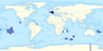 The EEZ of France. |
| Guyane | 133,949 | |
| Guadeloupe | 95,978 | |
| Martinique | 47,640 | |
| La Réunion | 315,058 | |
| Polynésie française | 4,771,088 | |
| Saint-Pierre-et-Miquelon | 12,334 | |
| Mayotte | 63,078 | |
| Wallis-et-Futuna | 258,269 | |
| Saint Martin | 1,066 | |
| Saint Barthélemy | 4,295 | |
| Nouvelle-Calédonie | 1,422,596 | |
| Île de Clipperton | 431,263 | |
| Îles Crozet | 574,558 | |
| Îles Kerguelen | 567,732 | |
| Île Saint-Paul and Île Amsterdam | 509,015 | |
| Îles Éparses (without Tromelin Island) | 352,117 | |
| Tromelin Island | 270,455 | |
| Total | 10,165,095 km2 (3,924,765 sq mi) |
Disputes[]
Active[]
- France claims some of Canada's EEZ at Saint Pierre and Miquelon, based on a new definition of the continental shelf and the exclusive economic zone between the two countries. Saint Pierre and Miquelon is entirely surrounded by Canada's EEZ.
- Mauritius claims sovereignty over Tromelin although it is not mentioned in the listing of the 8th article of the 1814 Paris Treaty. It is administered as part of the French Southern and Antarctic Lands.[8]
References[]
- ^ "UKNDA DISCUSSION PAPER" (PDF).
- ^ a b European French EEZ website miscellanees01.files.wordpress.com
- ^ "fisheries - House of Lords European Union Committee". publications.parliament.uk. Retrieved 2021-05-11.
- ^ Flanders Marine Institute (2019), Maritime Boundaries Geodatabase: Maritime Boundaries and Exclusive Economic Zones (200NM), version 11. at http://www.marineregions.org/ & https://doi.org/10.14284/386
- ^ mpatlas.org https://mpatlas.org/countries/GGY/map. Retrieved 2021-05-11.
{{cite web}}: Missing or empty|title=(help) - ^ "United Kingdom commercial sea fisheries landings by Exclusive Economic Zone of capture 2012-2019" (PDF). UK Government Marine Management Organisation. 2020.
{{cite web}}: CS1 maint: url-status (link) - ^ "Mesurer les Zones Économiques Exclusives". geoconfluences.ens-lyon.fr.
- ^ "Treaty of Paris". 1814. Art. VIII.
«His Britannic majesty stipulating for himself and his allies, engages to restore to his most Christian majesty, within the term which shall be hereafter fixed, the colonies, fisheries, factories, and establishments of every kind, which were possessed by France on the 1 January 1792, in the seas and on the continents of America, Africa, and Asia, with the exception however of the islands of Tobago and St. Lucie, and of the Isle of France and its dependencies, especially Rodrigues and Les Sechelles, which several colonies and possessions his most Christian majesty cedes in full right and sovereignty to his Britannic majesty, and also the portion of St. Domingo ceded to France by the treaty of Basle, and which his most Christian majesty restores in full right and sovereignty to his Catholic majesty»
External links[]
- Exclusive economic zones
- Borders of France
- Economy of France