Fengbin
show This article may be expanded with text translated from the corresponding article in Chinese. (September 2012) Click [show] for important translation instructions. |
Fengbin Township
豐濱鄉 Toyohama | |
|---|---|
 | |
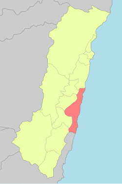 Fengbin Township in Hualien County | |
 Fengbin Township 豐濱鄉 Fengbin Township in Hualien County | |
| Coordinates: 23°35′28″N 121°30′14″E / 23.591055°N 121.503794°ECoordinates: 23°35′28″N 121°30′14″E / 23.591055°N 121.503794°E | |
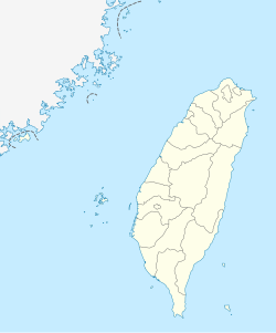
| Country | Taiwan |
| Province | Taiwan |
| County | Hualien |
| Area | |
| • Total | 162.4 km2 (62.7 sq mi) |
| Population (December 2014) | |
| • Total | 4,706 |
| • Density | 29/km2 (75/sq mi) |
| Website | http://www.feng-bin.gov.tw/bin/home.php |

| Fengbin Township | |
|---|---|
| Chinese name | |
| Chinese | 豐濱鄉 |
| Hanyu Pinyin | Fēngbīn Xiāng |
| Wade–Giles | Feng1-pin1 Hsiang1 |
| Pha̍k-fa-sṳ | Fûng-pîn-hiông |
| Hokkien POJ | Hong-pin-hiong |
| Amis name | |
| Amis | Fakong[1] |

Shitiping Port

Hualien-Taitung Coastal Highway passing through Fengbin Township
Fengbin Township[2] is a rural township located in Hualien County, Taiwan, bordering Taitung County. The Pacific Ocean lies to the east and the Hai'an Range to the west.
It has the smallest population in Hualien County with around 4,706 inhabitants. The population consists of the indigenous Amis, Kavalan and Sakizaya peoples.
Administrative divisions[]

Map of Fengbin (labeled as Byōtō) and surrounding area (1944)

Map including Fenglin (labeled as Mao-kung (Byōtō) 猫公) (1951)
- Jingpu Village
- Gangkou Village
- Fengbin Village
- Xinshe Village
- Jici Village
Tourist attractions[]
- Taiwan East Coast National Scenic Area
- Xiuguluan River Rafting
- Jici seaside resort
- Chenghong Bridge Recreation Area
- Shitiping Scenic Area
- Shitiping Port Whale Watching
Transportation[]
- Provincial Highway No. 11
- Provincial Highway No. 11A
| Wikimedia Commons has media related to Fengbin Township, Hualien. |
References[]
- ^ Sing ‘Olam. 阿美語簡明詞典(學生版) O Citing no Pangcah. Taipei: 臺灣族群母語推行委員會, 2011. ISBN 9789868693630
- ^ 臺灣地區鄉鎮市區級以上行政區域名稱中英對照表 Glossary of Names for Administrative Divisions. Ministry of the Interior. 26 March Minguo 104 (2015). Retrieved 5 October 2017. (in Chinese)
External links[]
| show Cities and townships of Hualien County |
|---|

| Authority control |
|
|---|
This article about a location in Taiwan is a stub. You can help Wikipedia by . |
Categories:
- Townships in Hualien County
- Taiwan geography stubs