Foley, Minnesota
City of Foley | |
|---|---|
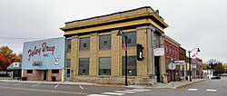 Buildings in Foley (2020) | |
 | |
| Coordinates: 45°39′50″N 93°54′40″W / 45.66389°N 93.91111°W | |
| Country | United States |
| State | Minnesota |
| County | Benton |
| Government | |
| • Mayor | Gerard Bettendorf |
| Area | |
| • Total | 2.55 sq mi (6.61 km2) |
| • Land | 2.55 sq mi (6.61 km2) |
| • Water | 0.00 sq mi (0.00 km2) |
| Elevation | 1,138 ft (347 m) |
| Population | |
| • Total | 2,603 |
| • Estimate (2019)[5] | 2,673 |
| • Density | 1,047.00/sq mi (404.21/km2) |
| Time zone | UTC-6 (Central (CST)) |
| • Summer (DST) | UTC-5 (CDT) |
| ZIP codes | 56329, 56357 |
| Area code(s) | 320 |
| FIPS code | 27-21536[3] |
| GNIS feature ID | 0643775[4] |
| Website | www.ci.foley.mn.us |

Foley is a city in Benton County, Minnesota, United States.The population was 2,603 at the 2010 census.[6] It is the county seat of Benton County.[7]
Foley is part of the St. Cloud Metropolitan Statistical Area.
History[]
Foley was named for its founder, John Foley.[8]


Geography[]
According to the United States Census Bureau, the city has a total area of 2.51 square miles (6.50 km2), all land.[9]
Minnesota State Highways 23 and 25 are two of the main routes in the city.
Demographics[]
| Historical population | |||
|---|---|---|---|
| Census | Pop. | %± | |
| 1900 | 172 | — | |
| 1910 | 710 | 312.8% | |
| 1920 | 837 | 17.9% | |
| 1930 | 798 | −4.7% | |
| 1940 | 961 | 20.4% | |
| 1950 | 1,089 | 13.3% | |
| 1960 | 1,112 | 2.1% | |
| 1970 | 1,271 | 14.3% | |
| 1980 | 1,606 | 26.4% | |
| 1990 | 1,854 | 15.4% | |
| 2000 | 2,154 | 16.2% | |
| 2010 | 2,603 | 20.8% | |
| 2019 (est.) | 2,673 | [5] | 2.7% |
| U.S. Decennial Census | |||
2010 census[]
As of the census[2] of 2010, there were 2,603 people, 964 households, and 631 families living in the city. The population density was 1,037.1 inhabitants per square mile (400.4/km2). There were 1,038 housing units at an average density of 413.5 per square mile (159.7/km2). The racial makeup of the city was 97.7% White, 0.8% African American, 0.3% Native American, 0.1% Asian, 0.2% from other races, and 1.0% from two or more races. Hispanic or Latino of any race were 0.8% of the population.
There were 964 households, of which 39.6% had children under the age of 18 living with them, 47.2% were married couples living together, 12.1% had a female householder with no husband present, 6.1% had a male householder with no wife present, and 34.5% were non-families. 27.7% of all households were made up of individuals, and 15.4% had someone living alone who was 65 years of age or older. The average household size was 2.55 and the average family size was 3.13.
The median age in the city was 31.6 years. 29% of residents were under the age of 18; 8.3% were between the ages of 18 and 24; 29.9% were from 25 to 44; 18.4% were from 45 to 64; and 14.4% were 65 years of age or older. The gender makeup of the city was 49.1% male and 50.9% female.
2000 census[]
As of the census[3] of 2000, there were 2,154 people, 756 households, and 499 families living in the city. The population density was 1,148.6 people per square mile (442.4/km2). There were 793 housing units at an average density of 422.8 per square mile (162.9/km2). The racial makeup of the city was 97.21% White, 1.35% African American, 0.37% Native American, 0.46% Asian, 0.09% from other races, and 0.51% from two or more races. Hispanic or Latino of any race were 0.46% of the population.
There were 756 households, out of which 39.2% had children under the age of 18 living with them, 50.5% were married couples living together, 11.5% had a female householder with no husband present, and 33.9% were non-families. 30.0% of all households were made up of individuals, and 16.1% had someone living alone who was 65 years of age or older. The average household size was 2.60 and the average family size was 3.23.
In the city, the population was spread out, with 27.6% under the age of 18, 11.7% from 18 to 24, 27.6% from 25 to 44, 15.2% from 45 to 64, and 17.8% who were 65 years of age or older. The median age was 33 years. For every 100 females, there were 99.8 males. For every 100 females age 18 and over, there were 93.2 males.
The median income for a household in the city was $38,393, and the median income for a family was $48,750. Males had a median income of $32,466 versus $21,731 for females. The per capita income for the city was $17,168. About 6.1% of families and 9.4% of the population were below the poverty line, including 8.8% of those under age 18 and 20.7% of those age 65 or over.
Media[]
The is a weekly newspaper headquartered in Foley. It is published on Tuesday and is owned by Star Publications.[10]
References[]
- ^ "2019 U.S. Gazetteer Files". United States Census Bureau. Retrieved July 26, 2020.
- ^ Jump up to: a b "U.S. Census website". United States Census Bureau. Retrieved 2012-11-13.
- ^ Jump up to: a b "U.S. Census website". United States Census Bureau. Retrieved 2008-01-31.
- ^ "US Board on Geographic Names". United States Geological Survey. 2007-10-25. Retrieved 2008-01-31.
- ^ Jump up to: a b "Population and Housing Unit Estimates". United States Census Bureau. May 24, 2020. Retrieved May 27, 2020.
- ^ "2010 Census Redistricting Data (Public Law 94-171) Summary File". American FactFinder. U.S. Census Bureau, 2010 Census. Retrieved 23 April 2011.[dead link]
- ^ "Find a County". National Association of Counties. Archived from the original on 2011-05-31. Retrieved 2011-06-07.
- ^ Upham, Warren (1920). Minnesota Geographic Names: Their Origin and Historic Significance. Minnesota Historical Society. p. 50.
- ^ "US Gazetteer files 2010". United States Census Bureau. Archived from the original on 2012-01-25. Retrieved 2012-11-13.
- ^ "Benton County News" (PDF). MN Newspaper Association. Retrieved January 30, 2020.
External links[]
| show Municipalities and communities of Benton County, Minnesota, United States |
|---|


Coordinates: 45°39′53″N 93°54′35″W / 45.66472°N 93.90972°W
| show Authority control |
|---|
- Cities in Minnesota
- Cities in Benton County, Minnesota
- County seats in Minnesota
- St. Cloud, Minnesota metropolitan area