Forstfeld
Forstfeld
Forschfald | |
|---|---|
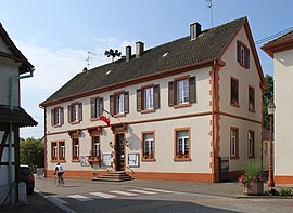 The town hall in Forstfeld | |
 Coat of arms | |
show Location of Forstfeld | |
 Forstfeld | |
| Coordinates: 48°51′40″N 8°02′22″E / 48.8611°N 8.0394°ECoordinates: 48°51′40″N 8°02′22″E / 48.8611°N 8.0394°E | |
| Country | France |
| Region | Grand Est |
| Department | Bas-Rhin |
| Arrondissement | Haguenau-Wissembourg |
| Canton | Bischwiller |
| Government | |
| • Mayor (2020–2026) | Philippe Boehmler |
| Area 1 | 4.9 km2 (1.9 sq mi) |
| Population (Jan. 2018)[1] | 745 |
| • Density | 150/km2 (390/sq mi) |
| Time zone | UTC+01:00 (CET) |
| • Summer (DST) | UTC+02:00 (CEST) |
| INSEE/Postal code | 67140 /67480 |
| Elevation | 111–129 m (364–423 ft) |
| 1 French Land Register data, which excludes lakes, ponds, glaciers > 1 km2 (0.386 sq mi or 247 acres) and river estuaries. | |


Forstfeld (French pronunciation: [fɔʁstfɛlt]; Alsatian: Forschfald) is a commune in the Bas-Rhin department in Grand Est in north-eastern France.
Between 1962 and 2006 the registered population increased from 449 to 691.
Twin towns[]
 Condat-sur-Vienne
See also[]
References[]
- ^ "Populations légales 2018". INSEE. 28 December 2020.
| Wikimedia Commons has media related to Forstfeld. |
This Bas-Rhin geographical article is a stub. You can help Wikipedia by . |
Categories:
- Communes of Bas-Rhin
- Bas-Rhin geography stubs