Frankfort Municipal Airport
Frankfort Municipal Airport | |||||||||||||||
|---|---|---|---|---|---|---|---|---|---|---|---|---|---|---|---|
| Summary | |||||||||||||||
| Airport type | Public | ||||||||||||||
| Owner | Frankfort Airport Authority | ||||||||||||||
| Operator | Montgomery Aviation | ||||||||||||||
| Location | Frankfort | ||||||||||||||
| Elevation AMSL | 861 ft / 262 m | ||||||||||||||
| Coordinates | 40°16′22″N 86°33′47″W / 40.27278°N 86.56306°WCoordinates: 40°16′22″N 86°33′47″W / 40.27278°N 86.56306°W | ||||||||||||||
| Map | |||||||||||||||
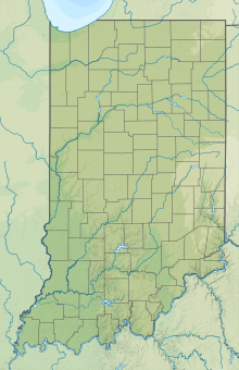
 FKR Location of airport in Indiana | |||||||||||||||
| Runways | |||||||||||||||
| |||||||||||||||
| Statistics | |||||||||||||||
| |||||||||||||||
Frankfort Municipal Airport (ICAO: KFKR, FAA LID: FKR) is a public airport located 3 miles (4.8 km) west of Frankfort, in Clinton County, Indiana, United States. The airport was founded in December 1960.
Facilities and aircraft[]
Frankfort Municipal Airport covers an area of 162 acres (66 ha) at an elevation of 861 feet (262 m) above mean sea level. It has two asphalt runways: 9/27 is a 5,000 by 75 feet (1,524 X 23 m) runway with approved GPS and NDB approaches, and 4/22 is a 2,527 by 70 feet (770 X 21 m) runway.[2]
For the 12-month period ending December 31, 2019, the airport had 19,181 aircraft operations, an average of 53 per day: 97% general aviation and 3% air taxi. In December 2021, there were 32 aircraft based at this airport: 27 single-engine, 3 multi-engine, 1 jet and 1 helicopter.
References[]
- ^ FAA Airport Form 5010 for FKR PDF. Federal Aviation Administration. effective December 2, 2021.
- ^ "AirNav: Airport Information".
External links[]
- "Frankfort Municipal Airport (FKR)". montgomeryaviation.net. Retrieved 2014-07-29.
- "AirNav: KFKR - Frankfort Municipal Airport". airnav.com. Retrieved 2014-07-29.
- Airports in Indiana
- Transportation in Clinton County, Indiana
- Buildings and structures in Clinton County, Indiana

