Anderson Municipal Airport
Anderson Municipal Airport Darlington Field | |||||||||||||||
|---|---|---|---|---|---|---|---|---|---|---|---|---|---|---|---|
| Summary | |||||||||||||||
| Airport type | Public | ||||||||||||||
| Owner | City of Anderson | ||||||||||||||
| Serves | Anderson, Indiana | ||||||||||||||
| Elevation AMSL | 919 ft / 280 m | ||||||||||||||
| Coordinates | 40°06′31″N 085°36′47″W / 40.10861°N 85.61306°WCoordinates: 40°06′31″N 085°36′47″W / 40.10861°N 85.61306°W | ||||||||||||||
| Website | CityOfAnderson.com/... | ||||||||||||||
| Map | |||||||||||||||
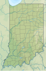
 AID Location of airport in Indiana/United States | |||||||||||||||
| Runways | |||||||||||||||
| |||||||||||||||
| Statistics (2009) | |||||||||||||||
| |||||||||||||||
Anderson Municipal Airport[1][2] (IATA: AID[3], ICAO: KAID, FAA LID: AID) (Darlington Field) is three miles east of Anderson, in Madison County, Indiana.[1] The National Plan of Integrated Airport Systems for 2011–2015 categorized it as a general aviation facility. The airport currently has no scheduled air service.
Previous air service[]
Prior to the closing of the General Motors factories in Anderson, the airport did have relatively small service to Detroit (Metro), Detroit (City), Kokomo, Buffalo, Indianapolis, and Dayton. This service, however, was very limited and intended for General Motors employees to go from factory to factory. These flights were served by snacks and even a Continental Breakfast.[4]
Facilities[]
The airport covers 619 acres (251 ha) at an elevation of 919 feet (280 m). It has two asphalt runways: 12/30 is 5,400 by 100 feet (1,646 x 30 m) and 18/36 is 3,400 by 75 feet (1,036 x 23 m).[1]
In 2009 the airport had 16,631 aircraft operations, average 45 per day: 93% general aviation, 6% air taxi, and 1% military. 78 aircraft were then based at the airport: 89% single-engine, 6% multi-engine, 3% ultralight, 1% helicopter, and 1% glider.[1]
References[]
- ^ a b c d e FAA Airport Form 5010 for AID PDF. Federal Aviation Administration. Effective November 15, 2012.
- ^ a b "Anderson Municipal Airport". City of Anderson. Archived from the original on August 15, 2010. Retrieved August 8, 2013.
- ^ "IATA Airport Code Search (AID: Anderson Municipal)". International Air Transport Association. Retrieved August 8, 2013.
- ^ General Motors Air Transport Timetable
External links[]
- Anderson Municipal Airport at City of Anderson website
- Aerial photo from Indiana DOT at the Wayback Machine (archived August 15, 2010)
- Aerial image as of April 1998 from USGS The National Map
- FAA Terminal Procedures for AID, effective February 24, 2022
- Resources for this airport:
- FAA airport information for AID
- AirNav airport information for KAID
- ASN accident history for AID
- FlightAware airport information and live flight tracker
- NOAA/NWS weather observations: current, past three days
- SkyVector aeronautical chart, Terminal Procedures
- Airports in Indiana
- Anderson, Indiana
- Transportation buildings and structures in Madison County, Indiana

