Madison County, Indiana
Madison County | |
|---|---|
U.S. county | |
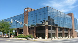 Madison County Courthouse in Anderson | |
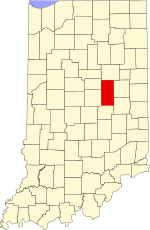 Location within the U.S. state of Indiana | |
 Indiana's location within the U.S. | |
| Coordinates: 40°10′N 85°43′W / 40.16°N 85.72°W | |
| Country | |
| State | |
| Founded | 4 January 1823 (authorized) |
| Named for | James Madison |
| Seat | Anderson |
| Largest city | Anderson |
| Area | |
| • Total | 452.90 sq mi (1,173.0 km2) |
| • Land | 451.92 sq mi (1,170.5 km2) |
| • Water | 0.99 sq mi (2.6 km2) 0.22%% |
| Population | |
| • Estimate (2019) | 129,569 |
| • Density | 286.7/sq mi (110.7/km2) |
| Time zone | UTC−5 (Eastern) |
| • Summer (DST) | UTC−4 (EDT) |
| Congressional district | 5th |
| Website | www |
| Indiana county number 48 | |

Madison County is a county in the U.S. state of Indiana. As of 2019, the estimated population was 129,569.[1] The county seat since 1836 has been Anderson,[2][3] one of three incorporated cities within the county.
Madison County is included in the Indianapolis-Carmel-Anderson, IN Metropolitan Statistical Area.
History[]
In 1787, the fledgling United States defined the Northwest Territory, which included the area of present-day Indiana. In 1800, Congress separated Ohio from the Northwest Territory, designating the rest of the land as the Indiana Territory.[4] President Thomas Jefferson chose William Henry Harrison as the territory's first governor, and Vincennes was established as the territorial capital.[5] After the Michigan Territory was separated and the Illinois Territory was formed, Indiana was reduced to its current size and geography.[4] By December 1816 the Indiana Territory was admitted to the Union as a state.
Starting in 1794, Native American titles to Indiana lands were extinguished by usurpation, purchase, or war and treaty. The United States acquired land from the Native Americans in the 1809 treaty of Fort Wayne, and by the treaty of St. Mary's in 1818 considerably more territory became property of the government. This included the future Madison County, which was authorized by the state legislature on 4 January 1823, designating areas covered by the Delaware New Purchase. No settler was allowed in the area until the government survey was completed in 1820, and in 1820 the first settlers entered the future county.[6]
The new county was named for James Madison, co-author of The Federalist Papers and the fourth President of the United States (1809 to 1817).[7] The then-small settlement of Pendleton was named as the county, but its non-central location soon fostered a desire for a more central location as the county seat. After considerable local competition, the town of Anderson was platted in 1827 on donated land with the stipulation that the seat be moved to that location. This move began in 1828 and was completed by 1836.[3]
The new county was completely wooded in 1820, with stands of white oak, poplar, walnut, sycamore, oak, and fir trees.[8] The settlers logged much of the area and cleared the remainder through burning; at present its terrain is completely devoted to agriculture or urban development, except for stands of brush in drainages.[9]
The county's first courthouse was authorized in the county's 1828 session, but this authorization was revoked in 1829. In 1831 a second authorization was passed, and the completed building was placed in service the following year.[10]
During the Indiana gas boom, natural gas deposits were discovered in the county in 1887, at Alexandria, and Anderson. The offer of free natural gas brought several factories to the county.[11]
Geography[]
The county's terrain is nearly flat, with the exception of hilly areas along the White River and Fall Creek. The highest terrain (around 1,010 feet/308 meters ASL) is a ridgeline at the county's SE corner.[12] The county is drained by the west branch of the White River, flowing west-southwestward through the county's lower central portion. Other drainages include Fall Creek, flowing west- and southwestward through the southern part of the county; Pipe Creek, which rises in Delaware County and flows southwestward through the county's NW corner; and Lick Creek, which rises in Henry County and flows westward through the county's SW portion.[9]
According to the 2010 United States Census, the county has a total area of 452.90 square miles (1,173.0 km2), of which 451.92 square miles (1,170.5 km2) (or 99.78%) is land and 0.99 square miles (2.6 km2) (or 0.22%) is water.[13]
Adjacent counties[]
- Grant County - north
- Delaware County - east
- Henry County - southeast
- Hancock County - south
- Hamilton County - west
- Tipton County - northwest
Protected areas[]
Cities[]

- Alexandria
- Anderson (county seat)
- Elwood (part)
Towns[]
Unincorporated towns[]
- Alfont
- Alliance
- Bloomer
- College Corner[14]
- Dundee
- Edgewood Village[15]
- Emporia
- Fishersburg
- Florida
- Gimco City[16]
- Hamilton
- Hardscrabble
- Huntsville
- Idlewold[17]
- Leisure
- Linwood
- Moonville
- New Columbus (also known as Ovid)
- North Anderson
- Ovid (also known as New Columbus)
- Perkinsville
- Prosperity
- Rigdon
- South Elwood[18]
- Sunview
- Woodlawn Heights
Townships[]
Major highways[]
 Interstate 69
 U.S. Route 36
 State Road 9
 State Road 13
 State Road 28
 State Road 32
 State Road 37
 State Road 38
 State Road 67
 State Road 109
 State Road 128
 State Road 232
 State Road 236
Railroads[]
- Central Indiana and Western Railroad
- CSX Transportation
- Indian Creek Railroad
- Norfolk Southern Railway
Climate and weather[]
| Anderson, Indiana | ||||||||||||||||||||||||||||||||||||||||||||||||||||||||||||
|---|---|---|---|---|---|---|---|---|---|---|---|---|---|---|---|---|---|---|---|---|---|---|---|---|---|---|---|---|---|---|---|---|---|---|---|---|---|---|---|---|---|---|---|---|---|---|---|---|---|---|---|---|---|---|---|---|---|---|---|---|
| Climate chart (explanation) | ||||||||||||||||||||||||||||||||||||||||||||||||||||||||||||
| ||||||||||||||||||||||||||||||||||||||||||||||||||||||||||||
| ||||||||||||||||||||||||||||||||||||||||||||||||||||||||||||
In recent years, average temperatures in Anderson have ranged from a low of 18 °F (−8 °C) in January to a high of 84 °F (29 °C) in July, although a record low of −24 °F (−31 °C) was recorded in January 1985 and a record high of 105 °F (41 °C) was recorded in July 1954. Average monthly precipitation ranged from 2.09 inches (53 mm) in January to 4.28 inches (109 mm) in July.[19]
Government[]
The county government is a constitutional body, and is granted specific powers by the Constitution of Indiana, and by the Indiana Code.
County Council: The legislative branch of the county government; controls spending and revenue collection in the county. Representatives are elected to four-year terms from county districts. They set salaries, the annual budget, and special spending. The council has limited authority to impose local taxes, in the form of an income and property tax that is subject to state level approval, excise taxes, and service taxes.[20][21]
Board of Commissioners: The executive body of the county; commissioners are elected county-wide to staggered four-year terms. One commissioner serves as president. The commissioners execute acts legislated by the council, collect revenue, and manage the county government.[20][21]
Court: The county maintains a small claims court that handles civil cases. The judge on the court is elected to a term of four years and must be a member of the Indiana Bar Association. The judge is assisted by a constable who is also elected to a four-year term. In some cases, court decisions can be appealed to the state level circuit court.[21]
County Officials: The county has other elected offices, including sheriff, coroner, auditor, treasurer, recorder, surveyor, and circuit court clerk. These officers are elected to four-year terms. Members elected to county government positions are required to declare party affiliations and to be residents of the county.[21]
Madison County is part of Indiana's 5th congressional district; Indiana Senate districts 20, 25 and 26;[22] and Indiana House of Representatives districts 35, 36 and 37.[23]
Demographics[]
| Historical population | |||
|---|---|---|---|
| Census | Pop. | %± | |
| 1830 | 2,238 | — | |
| 1840 | 8,874 | 296.5% | |
| 1850 | 12,375 | 39.5% | |
| 1860 | 16,518 | 33.5% | |
| 1870 | 22,770 | 37.8% | |
| 1880 | 27,527 | 20.9% | |
| 1890 | 36,487 | 32.5% | |
| 1900 | 70,470 | 93.1% | |
| 1910 | 65,224 | −7.4% | |
| 1920 | 69,151 | 6.0% | |
| 1930 | 82,888 | 19.9% | |
| 1940 | 88,575 | 6.9% | |
| 1950 | 103,911 | 17.3% | |
| 1960 | 125,819 | 21.1% | |
| 1970 | 138,451 | 10.0% | |
| 1980 | 139,336 | 0.6% | |
| 1990 | 130,669 | −6.2% | |
| 2000 | 133,358 | 2.1% | |
| 2010 | 131,636 | −1.3% | |
| 2019 (est.) | 129,569 | [26] | −1.6% |
| US Decennial Census[27] 1790-1960[28] 1900-1990[29] 1990-2000[30] 2010-2019[1] | |||
2010 census[]
As of the 2010 United States Census, there were 131,636 people, 51,927 households, and 34,319 families in the county.[31] The population density was 291.3 inhabitants per square mile (112.5/km2). There were 59,068 housing units at an average density of 130.7 per square mile (50.5/km2).[13] The racial makeup of the county was 87.7% white, 8.3% black or African American, 0.4% Asian, 0.2% American Indian, 1.5% from other races, and 1.8% from two or more races. Those of Hispanic or Latino origin made up 3.2% of the population.[31] In terms of ancestry, 21.5% were German, 12.5% were American, 11.5% were Irish, and 10.4% were English.[32]
Of the 51,927 households, 31.3% had children under the age of 18 living with them, 47.4% were married couples living together, 13.6% had a female householder with no husband present, 33.9% were non-families, and 28.3% of all households were made up of individuals. The average household size was 2.41 and the average family size was 2.93. The median age was 39.2 years.[31]
The median income for a household in the county was $47,697 and the median income for a family was $53,906. Males had a median income of $41,834 versus $31,743 for females. The per capita income for the county was $21,722. About 11.2% of families and 14.7% of the population were below the poverty line, including 22.6% of those under age 18 and 7.7% of those age 65 or over.[33]
See also[]
References[]
- ^ Jump up to: a b "American FactFinder". US Census Bureau. US Census Bureau. Archived from the original on 14 February 2020. Retrieved 22 April 2019.
- ^ "Find a County". National Association of Counties. Retrieved 7 June 2011.
- ^ Jump up to: a b Harden (1874), p. 23
- ^ Jump up to: a b "Government at Crossroads: An Indiana chronology". The Herald Bulletin. 5 January 2008. Retrieved 22 July 2009.
- ^ Brill, Marlene Targ (2005). Indiana. Marshall Cavendish. p. 35. ISBN 978-0-7614-2020-0.
- ^ Harden (1874), p. 17
- ^ Gannett, Henry (1905). The Origin of Certain Place Names in the United States. US Government Printing Office. p. 196.
- ^ Harden (1874), pp. 21-22
- ^ Jump up to: a b c Madison County IN (Google Maps, accessed 10 September 2020)
- ^ Harden (1874), pp. 27-28
- ^ Glass, James; Kohrman, David (2005). The Gas Boom of East Central Indiana (Images of America). Charleston: Arcadia. pp. 33–40. ISBN 9780738539638.
- ^ Madison County High Point, Indiana (PeakBagger.com, accessed 10 September 2020)
- ^ Jump up to: a b "Population, Housing Units, Area, and Density: 2010 - County". US Census Bureau. Archived from the original on 12 February 2020. Retrieved 10 July 2015.
- ^ College Corner, Duck Creek Township IN (Google Maps, accessed 12 September 2020)
- ^ Edgewood Village, Stony Creek Township IN (Google Maps, accessed 12 September 2020)
- ^ Gimco City, Alexandria IN (Google Maps, accessed 12 September 2020)
- ^ Idlewold, Pendleton IN (Google Maps, accessed 12 September 2020)
- ^ South Elwood, Elwood IN (Google Maps, accessed 12 September 2020)
- ^ Jump up to: a b "Monthly Averages for Anderson IN". The Weather Channel. Retrieved 27 January 2011.
- ^ Jump up to: a b Indiana Code. "Title 36, Article 2, Section 3". IN.gov. Retrieved 16 September 2008.
- ^ Jump up to: a b c d Indiana Code. "Title 2, Article 10, Section 2" (PDF). IN.gov. Retrieved 16 September 2008.
- ^ "Indiana Senate Districts". State of Indiana. Retrieved 14 July 2011.
- ^ "Indiana House Districts". State of Indiana. Retrieved 14 July 2011.
- ^ Leip, David. "Atlas of US Presidential Elections". uselectionatlas.org. Retrieved 8 April 2018.
- ^ The leading "other" candidate, Progressive Theodore Roosevelt, received 4,751 votes, while Socialist candidate Eugene Debs received 1,947 votes, Prohibition candidate Eugene Chafin received 455 votes, and Socialist Labor candidate Arthur Reimer received 157 votes.
- ^ "Population and Housing Unit Estimates". Retrieved 21 May 2020.
- ^ "US Decennial Census". US Census Bureau. Retrieved July 10, 2014.
- ^ "Historical Census Browser". University of Virginia Library. Retrieved July 10, 2014.
- ^ "Population of Counties by Decennial Census: 1900 to 1990". US Census Bureau. Retrieved July 10, 2014.
- ^ "Census 2000 PHC-T-4. Ranking Tables for Counties: 1990 and 2000" (PDF). US Census Bureau. Retrieved July 10, 2014.
- ^ Jump up to: a b c "Profile of General Population and Housing Characteristics: 2010 Demographic Profile Data". US Census Bureau. Archived from the original on 13 February 2020. Retrieved 10 July 2015.
- ^ "Selected Social Characteristics in the US – 2006-2010 American Community Survey 5-Year Estimates". US Census Bureau. Archived from the original on 14 February 2020. Retrieved 10 July 2015.
- ^ "Selected Economic Characteristics – 2006-2010 American Community Survey 5-Year Estimates". US Census Bureau. Archived from the original on 14 February 2020. Retrieved 10 July 2015.
Further reading[]
- Harden, Samuel. History of Madison County, Indiana, from 1820 to 1874: Giving a general review of principal events, statistical and historical items, derived from official sources.. Lewis Publishing Company (1874).
External links[]
- We Are Madison County
- The Madison County Council of Governments
- Madison County Sheriffs Department
- Madison County News
- Madison County ALERT News
- Madison County Government Center
- List of Madison County Cemeteries
| show Places adjacent to Madison County, Indiana |
|---|
| show Municipalities and communities of Madison County, Indiana, United States |
|---|

| show Authority control |
|---|
- Indiana counties
- Madison County, Indiana
- 1823 establishments in Indiana
- Populated places established in 1823
- Indianapolis metropolitan area