Eagle Creek Airpark
Eagle Creek Airpark | |||||||||||
|---|---|---|---|---|---|---|---|---|---|---|---|
| Summary | |||||||||||
| Airport type | Public | ||||||||||
| Owner | Indianapolis Airport Authority | ||||||||||
| Serves | Indianapolis, Indiana | ||||||||||
| Elevation AMSL | 823 ft / 251 m | ||||||||||
| Coordinates | 39°49′51″N 086°17′40″W / 39.83083°N 86.29444°W | ||||||||||
| Map | |||||||||||
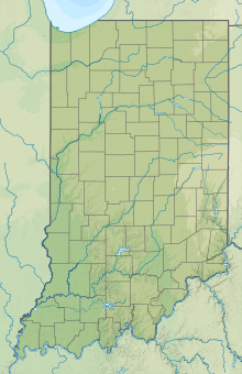
 EYE Location of airport in Indiana | |||||||||||
| Runways | |||||||||||
| |||||||||||
| Statistics | |||||||||||
| |||||||||||
Eagle Creek Airpark (ICAO: KEYE, FAA LID: EYE) is a public use airport located seven nautical miles (13 km) west of the central business district of Indianapolis, a city in Marion County, Indiana, United States. It is owned by the Indianapolis Airport Authority and serves as a reliever airport for Indianapolis International Airport.[1]
Although most U.S. airports use the same three-letter location identifier for the FAA and IATA, this airport is assigned EYE by the FAA but has no designation from the IATA.[2]
Facilities and aircraft[]
Eagle Creek Airpark covers an area of 315 acres (127 ha) at an elevation of 823 feet (251 m) above mean sea level. It has one asphalt paved runway designated 3/21 which measures 4,205 by 75 feet (1,282 x 23 m).[1]
For the 12-month period ending December 31, 2015, the airport had 21,879 aircraft operations, an average of 60 per day: 94% general aviation and 6% air taxi. In June 2018, there were 100 aircraft based at this airport: 78 single-engine, 17 multi-engine, and 5 jet.[1]
Eagle Creek Aviation Services, the airport's fixed-base operator (FBO) is an authorized service center for Cessna Citation, Cirrus Design and Twin Commander aircraft.[3] ECAS is also one of the eight U.S. service centers for the Embraer Phenom.[4]
References[]
- ^ a b c d FAA Airport Form 5010 for EYE PDF, effective June 21, 2018.
- ^ Great Circle Mapper: KEYE - Indianapolis, Indiana - Eagle Creek Airpark
- ^ Eagle Creek Aviation Services, the fixed-base operator (FBO)
- ^ Embraer Executive Jets: Service Center Network
External links[]
- Eagle Creek Airpark, official page from Indianapolis Airport Authority
- Aerial photo from Indiana Department of Transportation
- Aerial photo at Airliners.net
- FAA Terminal Procedures for EYE - Eagle Creek Airpark, effective February 24, 2022
- Resources for this airport:
- FAA airport information for EYE
- AirNav airport information for KEYE
- FlightAware airport information and live flight tracker
- NOAA/NWS weather observations: current, past three days
- SkyVector aeronautical chart, Terminal Procedures
- Airports in Indiana
- Transportation in Indianapolis
- Transportation buildings and structures in Marion County, Indiana

