Franktown, Colorado
Franktown, Colorado | |
|---|---|
 Franktown and the intersection of state highways 83 and 86. | |
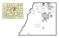 Location of the Franktown CDP in Douglas County, Colorado.
Colorado | |
 Franktown Location of the Franktown CDP in the United States. | |
| Coordinates: 39°23′26″N 104°44′55″W / 39.3905344°N 104.7486621°WCoordinates: 39°23′26″N 104°44′55″W / 39.3905344°N 104.7486621°W[2] | |
| Country | |
| State | |
| County | Douglas County |
| Government | |
| • Type | unincorporated community |
| Area | |
| • Total | 2.958 sq mi (7.661 km2) |
| • Land | 2.944 sq mi (7.625 km2) |
| • Water | 0.014 sq mi (0.036 km2) |
| Elevation | 6,197 ft (1,889 m) |
| Population (2010) | |
| • Total | 395 |
| • Density | 134/sq mi (52/km2) |
| Time zone | UTC-7 (MST) |
| • Summer (DST) | UTC-6 (MDT) |
| ZIP Code[3] | 80116 |
| Area codes | 303 & 720 |
| GNIS feature[1] | Franktown CDP |
| Primary Highways | |

Franktown is an unincorporated town, a post office, and a census-designated place (CDP) located in and governed by Douglas County, Colorado, United States. The CDP is a part of the Denver–Aurora–Lakewood, CO Metropolitan Statistical Area. The Franktown post office has the ZIP Code 80116 .[3] At the United States Census 2010, the population of the Franktown CDP was 395, while the population of the 80116 ZIP Code Tabulation Area was 3,942 including adjacent areas.[4] Douglas County governs the unincorporated town.
History[]
Franktown is named for Hon. J. Frank Gardner, an early resident.[5][6] Franktown was the first county seat of Douglas County, serving in this role from 1861 until 1863. James Frank Gardner, a would-be gold miner who built a squatter's cabin four miles north of here in 1859. A popular rest stop on the busy Jimmy Camp Trail (which followed Cherry Creek into Denver), "Frank's Town" was designated the seat of Douglas County in 1861; the settlement moved to its current location two years later. Though railroads made the trail obsolete after 1870, and the county offices moved to Castle Rock in 1874, Franktown remained a ranching and farming hub, held together by its church, school, grange, and handful of businesses. It never incorporated, and during the twentieth century no more than a hundred people called it home, but that's how the locals liked it. Even as suburban sprawl surrounded it in the 1990s, Franktown resisted efforts to develop, maintaining a distinctly rural identity.[7]
The Grange Franktown's strong agricultural roots made it a natural fit for the grange, a cooperative farmers' movement that swept rural America in the mid-1870s. Several dozen chapters formed in Colorado, including the Fonder Grange (founded near here in 1875) and its successor, Pikes Peak Grange No. 163 (established in Franktown in 1908). Both belonged to the statewide grange organization, which set up credit unions, insurance programs, and other services, and to the national grange association, which pursued long-range political goals. But it was the local chapters that really affected farmers' lives. The dances, holiday picnics, and town meetings they sponsored helped sparsely populated communities forge a sense of identity. Still active today, Pike's Peak Grange No. 163 in Franktown is listed on the National Register of Historic Places.
Castlewood Dam collapse[]
From the day it opened, Castlewood Dam was a catastrophe waiting to happen. Built in 1890, about five miles south of here on Cherry Creek, the barrier stored enough water to irrigate 30,000 acres of farmland-or would have, if it hadn't leaked so badly. The seeping began the year the dam was completed and was serious enough that a hundred-foot section crumbled in 1897. Although its builders vouched for the structure's integrity, the dam continued to leak sporadically for decades. Finally, on August 3, 1933, the inevitable happened: Castlewood collapsed, sending a billion-gallon torrent toward Denver. Only two people drowned, thanks to a switchboard operator's life-saving calls, but the flood devastated farms in this area and tore out six bridges in Denver, thirty miles downstream. The dam's remains can still be visited in nearby Castlewood Canyon State Park.
Timber industry[]
Frontier travelers often rejoiced upon reaching the timbered ridge just south of Franktown; it was the first woodland they encountered after hundreds of miles on the prairies. Early settlers in Colorado appreciated the forest, too-as a source of building material. Known as "the Pinery," it provided fast-growing Denver and other towns with most of their lumber during the 1860s. Several sawmills buzzed nonstop in and around Franktown, barely able to keep up with the demand. In the early 1870s, the Pinery supplied railroad ties to the Kansas Pacific and Denver & Rio Grande, both of which were laying tracks within twenty-five miles of here. Those routes eventually opened larger forests to exploitation and helped bring down this region's timber industry. By 1880, Franktown's sawmills had gone silent, but they had already left their mark: Pinery lumber built much of early Colorado.
Geography[]
Colorado State Highways 83 and 86 intersect in the center of Franktown. SH 83 leads north 9 miles (14 km) to Parker and south 45 miles (72 km) to Colorado Springs, while SH 86 leads east 9 miles (14 km) to Elizabeth and west 7 miles (11 km) to Castle Rock, the Douglas County seat.
The Franktown CDP has an area of 1,893 acres (7.661 km2), including 8.9 acres (0.036 km2) of water.[2]
Demographics[]
The United States Census Bureau initially defined the Franktown CDP for the United States Census 2000.
| Year | Pop. | ±% |
|---|---|---|
| 2000 | 99 | — |
| 2010 | 395 | +299.0% |
| 2020 | — | |
| Source: United States Census Bureau | ||
Education[]
The Douglas County School District serves Franktown.
See also[]
- Outline of Colorado
- State of Colorado
- Colorado cities and towns
- Colorado census designated places
- Colorado counties
- Colorado metropolitan areas
- Front Range Urban Corridor
- North Central Colorado Urban Area
- Denver-Aurora-Boulder, CO Combined Statistical Area
- Denver-Aurora-Broomfield, CO Metropolitan Statistical Area
- Colorado cities and towns
- Cherry Creek Rockshelter
- Franktown Cave, prehistorical archaeological site
References[]
- ^ Jump up to: a b c "U.S. Board on Geographic Names: Domestic Names". United States Geological Survey. Retrieved December 21, 2020.
- ^ Jump up to: a b c "State of Colorado Census Designated Places - BAS20 - Data as of January 1, 2020". United States Census Bureau. Retrieved December 21, 2020.
- ^ Jump up to: a b "Look Up a ZIP Code". United States Postal Service. Retrieved December 21, 2020.
- ^ "2010: DEC Summary File 1". United States Census Bureau. Retrieved December 21, 2020.
- ^ Gannett, Henry (1905). The Origin of Certain Place Names in the United States. Govt. Print. Off. pp. 131.
- ^ Dawson, John Frank. Place names in Colorado: why 700 communities were so named, 150 of Spanish or Indian origin. Denver, CO: The J. Frank Dawson Publishing Co. p. 22.
- ^ "History of Franktown/Granger Movement Timber, Douglas County, Co - Colorado Historical Markers on Waymarking.com". www.waymarking.com. Retrieved 2020-11-03.
External links[]
| Wikimedia Commons has media related to Franktown, Colorado. |
- Franktown @ Colorado.com
- Franktown @ UncoverColorado.com
- Save Franktown! website
- Douglas County website
- Douglas County School District
| show Municipalities and communities of Douglas County, Colorado, United States |
|---|

| show Authority control |
|---|
- Census-designated places in Douglas County, Colorado
- Census-designated places in Colorado
- Denver metropolitan area
- Former county seats in Colorado