Grand View Estates, Colorado
Grand View Estates, Colorado | |
|---|---|
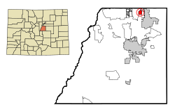
 Location of the Grand View Estates CDP in Douglas County, Colorado. | |
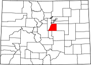
 Grand View Estates Location of the Grand View Estates CDP in the United States. | |
| Coordinates: 39°32′38″N 104°49′14″W / 39.5438903°N 104.8205782°WCoordinates: 39°32′38″N 104°49′14″W / 39.5438903°N 104.8205782°W[1] | |
| Country | |
| State | |
| County | Douglas County |
| Government | |
| • Type | unincorporated community |
| Area | |
| • Total | 1.017 sq mi (2.635 km2) |
| • Land | 0.998 sq mi (2.584 km2) |
| • Water | 0.020 sq mi (0.051 km2) |
| Elevation | 5,817 ft (1,773 m) |
| Population (2010) | |
| • Total | 528 |
| • Density | 529/sq mi (204/km2) |
| Time zone | UTC-7 (MST) |
| • Summer (DST) | UTC-6 (MDT) |
| ZIP Code[3] | 80134 |
| Area codes | 303 & 720 |
| GNIS feature[2] | Grand View Estates CDP |
Grand View Estates is an unincorporated community and a census-designated place (CDP) located in and governed by Douglas County, Colorado, United States. The CDP is a part of the Denver–Aurora–Lakewood, CO Metropolitan Statistical Area. The population of the Grand View Estates CDP was 528 at the United States Census 2010.[4] The area lies in ZIP code 80134..[3]
Geography[]
Grand View Estates is located in northern Douglas County between Stonegate and Parker to the east and Lone Tree to the west. It is just south of Exits 2 and 3 on the E-470 toll highway and is 20 miles (32 km) south of downtown Denver.
The Grand View Estates CDP has an area of 651 acres (2.635 km2), including 13 acres (0.051 km2) of water.[1]
Demographics[]
The United States Census Bureau initially defined the Grand View Estates CDP for the United States Census 2000.
| Year | Pop. | ±% |
|---|---|---|
| 2000 | 691 | — |
| 2010 | 528 | −23.6% |
| 2020 | — | |
| Source: United States Census Bureau | ||
Education[]
The Douglas County School District serves Grand View Estates.
See also[]
- Outline of Colorado
- State of Colorado
- Colorado cities and towns
- Colorado census designated places
- Colorado counties
- Colorado metropolitan areas
- Front Range Urban Corridor
- North Central Colorado Urban Area
- Denver-Aurora-Boulder, CO Combined Statistical Area
- Denver-Aurora-Broomfield, CO Metropolitan Statistical Area
- Colorado cities and towns
References[]
- ^ Jump up to: a b c "State of Colorado Census Designated Places - BAS20 - Data as of January 1, 2020". United States Census Bureau. Retrieved December 21, 2020.
- ^ Jump up to: a b c "U.S. Board on Geographic Names: Domestic Names". United States Geological Survey. Retrieved December 21, 2020.
- ^ Jump up to: a b "Zip Code 80134 Map and Profile". zipdatamaps.com. 2020. Retrieved December 21, 2020.
- ^ "2010: DEC Summary File 1". United States Census Bureau. Retrieved December 21, 2020.
External links[]
- Census-designated places in Douglas County, Colorado
- Census-designated places in Colorado
- Denver metropolitan area

