Fukagawa, Hokkaido
Fukagawa
深川市 | |
|---|---|
 Flag  Emblem | |
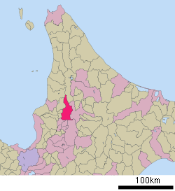 Location of Fukagawa in Hokkaido (Sorachi Subprefecture) | |
 Fukagawa Location in Japan | |
| Coordinates: 43°43′4″N 142°2′25″E / 43.71778°N 142.04028°ECoordinates: 43°43′4″N 142°2′25″E / 43.71778°N 142.04028°E | |
| Country | Japan |
| Region | Hokkaido |
| Prefecture | Hokkaido (Sorachi Subprefecture) |
| Government | |
| • Mayor | Takefumi Yamashita |
| Area | |
| • Total | 529.12 km2 (204.29 sq mi) |
| Population (2016) | |
| • Total | 21,618 |
| • Density | 41/km2 (110/sq mi) |
| Time zone | UTC+09:00 (JST) |
| City hall address | 17-17 Ni-jō, Fukagawa-shi, Hokkaidō 074-8650 |
| Website | www |
| Symbols | |
| Bird | Common cuckoo |
| Flower | Chrysanthemum |
| Tree | Japanese White Birch |

Fukagawa (深川市, Fukagawa-shi) is a city located in Sorachi Subprefecture, Hokkaido, Japan.
As of September 2016, the city has an estimated population of 21,618, and the density of 41 persons per km². The total area is 529.12 km².
Fukagawa is a small but vibrant city most known for its plentiful rice fields and apple and cherry orchards in Otoe, a township to the south of the downtown area. Fukagawa is growing largely in Otoe, anchored by its Roadside Station, which is the third-busiest in Hokkaido, according to an article in the Hokkaido Shimbun.
Geography[]
Fukagawa is located on the Ishikari Plain, and is roughly an equal distance in between Asahikawa to the northeast, and Takikawa to the southwest.[1][2]
Neighboring municipalities[]
Fukagawa borders on nine municipalities in Hokkaido Prefecture, spanning Sorachi, Kamikawa, and Rumoi subprefectures:
- Sorachi Subprefecture
- Ashibetsu
- Akabira
- Takikawa
- Moseushi
- Chippubetsu
- Numata
- Kamikawa Subprefecture
- Asahikawa
- Horokanai
- Rumoi Subprefecture
History[]
Fukagawa was settled by the tondenhei, or the colonist militia, between 1895 and 1896.[1][3]
- 1892 Fukagawa village was founded.
- 1915 Tadoshi village split off from Ichiyan village.
- 1918 Fukagawa village became Fukagawa town.
- 1962 Tadoshi village became Tadoshi town.
- 1963 Fukagawa town, Ichiyan village, Osamunai village, and Otoe village were merged to form Fukagawa city.
- 1970 Tadoshi town was merged into Fukagawa city.
Economy[]
The main economic activity of Fukugawa is rice production. Rice paddies in the city are irrigated by the , which is channeled off the Ishikari River. Potatoes and apples are also agricultural products of the city.[1]
Education[]
Junior college[]
High schools[]
Public[]
- Hokkaido Fukagawa Nishi High School
- Hokkaido Fukagawa Higashi High School
Private[]
- Clark Memorial International High School
Transportation[]
Both trains and buses provide a direct link to the prefectural capital, Sapporo.
Rail[]
- JR Hokkaido Hakodate Main Line : Fukagawa - Osamunai
- JR Hokkaido Rumoi Main Line : Fukagawa - Kita-Ichiyan
Road[]
- Hokkaido Expressway : Fukagawa IC
- Fukagaw-Rumoi Expressway : Fukagawa-Nishi IC
- Route 12
Sister city[]
 Abbotsford, British Columbia, Canada[4]
Tourism[]
One of the main tourist attractions is Mount Kamui, a popular ski resort technically in Asahikawa, but only minutes away from Fukagawa by car or bus.[5]
References[]
- ^ Jump up to: a b c "Fukagawa". Encyclopedia of Japan. Tokyo: Shogakukan. 2013. OCLC 56431036. Archived from the original on 2007-08-25. Retrieved 2013-09-20.
- ^ "深川(市)" [Fukagawa]. Nihon Daihyakka Zensho (Nipponika) (in Japanese). Tokyo: Shogakukan. 2013. OCLC 153301537. Archived from the original on 2007-08-25. Retrieved 2013-09-20.
- ^ History of Fukagawa
- ^ Sister city of Fukagawa
- ^ Kamui Ski Links
External links[]
- Official Website (in Japanese)
| show |
|---|
| show Authority control |
|---|
This Hokkaidō location article is a stub. You can help Wikipedia by . |
- Fukagawa, Hokkaido
- Cities in Hokkaido
- 1963 establishments in Japan
- Hokkaidō geography stubs