Gertak Sanggul
Gertak Sanggul | |
|---|---|
| Other transcription(s) | |
| • Jawi | ڬرتق سڠڬول |
| • Chinese | 美湖 |
 | |
 | |
 Gertak Sanggul | |
| Coordinates: 5°16′56.7336″N 100°11′38.2878″E / 5.282426000°N 100.193968833°ECoordinates: 5°16′56.7336″N 100°11′38.2878″E / 5.282426000°N 100.193968833°E | |
| Country | |
| State | |
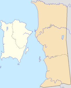
| District | Southwest Penang Island |
| City | |
| Government | |
| • Local government | Penang Island City Council |
| • Mayor of Penang Island | Yew Tung Seang |
| • Bayan Lepas State Assemblyman | Azrul Mahathir Aziz (Amanah) |
| • Balik Pulau Member of Parliament | Muhammad Bakhtiar Wan Chik (PKR) |
| Population (2010) | |
| • Total | 925 |
| Time zone | UTC+8 (MST) |
| • Summer (DST) | Not observed |
| Postal code | 11910 |
| Website | mbpp |

Gertak Sanggul is a village within the city of George Town in the Malaysian state of Penang.[1] It is located within the Southwest Penang Island District, at the southwestern coast of Penang Island. Gertak Sanggul is an agricultural village, with fisheries and pig farming as its economic mainstays.[2]
Etymology[]
According to urban legend, Gertak Sanggul was named during World War II, when Penang was under Japanese occupation.[3] The Malay ladies in the area, who typically tied their hair into buns (Malay: sanggul), would ride their bicycles along the area's uneven roads, causing their buns to come undone. The Japanese administrators on Penang Island henceforth referred to the area as Gertak Sanggul.
Demographics[]
According to the 2010 National Census conducted by Malaysia's Department of Statistics, Gertak Sanggul contained a population of 925.[5] Ethnic Chinese formed 3⁄5 of Gertak Sanggul's population, whilst the Malays made up close to 36% of the population.
Transportation[]
The main thoroughfare within Gertak Sanggul is Jalan Gertak Sanggul, which forms part of the pan-island Federal Route 6. The road links the town with Balik Pulau to the north and Teluk Kumbar to the east.
Rapid Penang bus route 308 is the sole public bus service that runs into Gertak Sanggul, connecting the town with a handful of destinations along the eastern seaboard of Penang Island, including Bayan Lepas, Bayan Baru, Queensbay Mall, Universiti Sains Malaysia and Sungai Nibong.[6]
Education[]
Gertak Sanggul is served by a single primary school, SRJK (C) Poi Eng.[7]
References[]
- ^ "George Town meliputi 'pulau', jelas Datuk Bandar" (PDF). Buletin Mutiara. 1 May 2015.
- ^ "Gertak Sanggul Local Property & Real Estate Trends, News & Guides | PropertyGuru Malaysia". www.propertyguru.com.my. Retrieved 2018-02-12.
- ^ "Kisah gadis di sebalik nama Gertak Sanggul". BH Online (in Malay). 2015-05-17. Retrieved 2018-02-12.
- ^ "Population Distribution and Demography" (PDF). Malaysian Department of Statistics. Archived from the original (PDF) on 13 November 2013.
- ^ "TABURAN PENDUDUK MENGIKUT PBT & MUKIM 2010". Department of Statistics, Malaysia. Retrieved 15 December 2017.
- ^ http://www.rapidpg.com.my/journey-planner/route-maps/details/308.gif
- ^ "SJK(C) POI ENG – PULAU PINANG – Carian Sekolah Malaysia". www.sekolahmy.com (in ms-MY). Retrieved 2018-02-12.
{{cite web}}: CS1 maint: unrecognized language (link)
- Towns in Penang