Teluk Kumbar
Teluk Kumbar | |
|---|---|
| Other transcription(s) | |
| • Jawi | تلوق كومبر |
| • Chinese | 公巴 |
| • Hokkien | Kong-pa (Tâi-lô) |
 | |
 | |
 Teluk Kumbar | |
| Coordinates: 5°17′16.4178″N 100°13′55.2576″E / 5.287893833°N 100.232016000°ECoordinates: 5°17′16.4178″N 100°13′55.2576″E / 5.287893833°N 100.232016000°E | |
| Country | |
| State | |
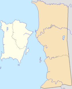
| District | Southwest Penang Island |
| City | |
| Government | |
| • Local government | Penang Island City Council |
| • Mayor of Penang Island | Yew Tung Seang |
| • Bayan Lepas State Assemblyman | Azrul Mahathir Aziz (Amanah) |
| • Balik Pulau Member of Parliament | Muhammad Bakhtiar Wan Chik (PKR) |
| Population (2010) | |
| • Total | 1,084 |
| Time zone | UTC+8 (MST) |
| • Summer (DST) | Not observed |
| Postal code | 11920 |
| Website | mbpp |


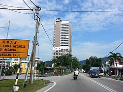
Teluk Kumbar is a town within the city of George Town in the Malaysian state of Penang.[1] It is located within the Southwest Penang Island District, at the southern coast of Penang Island between Bayan Lepas to the east and Gertak Sanggul to the west.
Etymology[]
Teluk Kumbar in Malay literally means 'kumbar bay', a reference to the salak trees (Salacca zalacca; Malay: kumbar) that grew within the area.[2][3]
History[]
According to historians in Universiti Sains Malaysia, Teluk Kumbar was founded by two Malay pioneers - Nakhoda Seedin from Deli and Panglima Long from Setul - sometime in the late 18th century.[4] The agricultural town was one of the handful of autonomous Malay settlements that were established at the south of Penang Island at the time.
Until the late 20th century, the town's residents depended on rice farming and fishing as the main economic activities.[2] In the 1990s, the development of Teluk Kumbar was spearheaded by the Penang Regional Development Authority (PERDA), an agency of the Malaysian federal government which was tasked with the development of rural areas within Penang.
Demographics[]
According to the 2010 National Census conducted by Malaysia's Department of Statistics, Teluk Kumbar contained a population of 1,084.[6] Ethnic Malays formed more than 3⁄4 of Teluk Kumbar's population, whilst the Chinese made up another 1⁄5 of the population.
Transportation[]
Jalan Teluk Kumbar is the main thoroughfare within the town. It forms part of the pan-island Federal Route 6, linking Teluk Kumbar with Bayan Lepas to the east and Gertak Sanggul to the west. To alleviate worsening traffic congestion in the area, the Malaysian Public Works Department has widened a stretch of the road leading to the town in 2017.[7]
Rapid Penang bus routes 308, 401 and 401E include stops within Teluk Kumbar.[8][9][10] These routes connect the town with various destinations, including Penang's capital city of George Town, the Penang International Airport, Universiti Sains Malaysia, Queensbay Mall, Sungai Nibong, Bayan Lepas and Balik Pulau.
Education[]
Teluk Kumbar is served by four primary schools, two high schools and an Islamic religious school.
Primary schools
High schools
Islamic school
- SM Al-Itqan[17]
References[]
- ^ "George Town meliputi 'pulau', jelas Datuk Bandar" (PDF). Buletin Mutiara. 1 May 2015.
- ^ a b Raudhah. "Teluk Kumbar". cis.penanglib.gov.my (in Malay). Retrieved 2018-02-14.
- ^ Quattrocchi, Umberto (2017). CRC World Dictionary of Palms: Common Names, Scientific Names, Eponyms, Synonyms, and Etymology. CRC Press. ISBN 9781351651493.
- ^ Haji Salleh, Muhammad (2015). Early History of Penang. Penang: Universiti Sains Malaysia. ISBN 9789838616577.
- ^ "Population Distribution and Demography" (PDF). Malaysian Department of Statistics. Archived from the original (PDF) on 13 November 2013.
- ^ "TABURAN PENDUDUK MENGIKUT PBT & MUKIM 2010". Department of Statistics, Malaysia. Retrieved 15 December 2017.
- ^ "Widening of Bayan Lepas-Teluk Kumbar stretch ready in December - Metro News | The Star Online". www.thestar.com.my. Retrieved 2018-02-09.
- ^ http://www.rapidpg.com.my/journey-planner/route-maps/details/308.gif
- ^ http://www.rapidpg.com.my/journey-planner/route-maps/details/401.gif
- ^ http://www.rapidpg.com.my/journey-planner/route-maps/details/401e.gif
- ^ "SK SERI BAYU - PULAU PINANG - Carian Sekolah Malaysia". www.sekolahmy.com (in Malay). Retrieved 2018-02-14.
- ^ "SK SUNGAI BATU - PULAU PINANG - Carian Sekolah Malaysia". www.sekolahmy.com (in Malay). Retrieved 2018-02-14.
- ^ "SK TELOK KUMBAR - PULAU PINANG - Carian Sekolah Malaysia". www.sekolahmy.com (in Malay). Retrieved 2018-02-14.
- ^ "SJK(C) YANG CHENG - PULAU PINANG - Carian Sekolah Malaysia". www.sekolahmy.com (in Malay). Retrieved 2018-02-14.
- ^ "SMK TELOK KUMBAR". smktelokkumbar.blogspot.my. Retrieved 2018-02-14.
- ^ "Portal Rasmi SMK Teluk Kumbar 2 – Laman Web Rasmi SMK Teluk Kumbar 2". smktkdua.edu.my. Retrieved 2018-02-14.
- ^ "Pengenalan – Pusat Pendidikan Al-Itqan". www.alitqan.edu.my. Retrieved 2018-02-14.
- Towns in Penang