Ghardaïa Province
Ghardaïa Province
ولاية غرداية | |
|---|---|
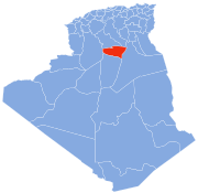
 Map of Algeria highlighting Ghardaïa | |
| Coordinates: 32°29′N 3°40′E / 32.483°N 3.667°ECoordinates: 32°29′N 3°40′E / 32.483°N 3.667°E | |
| Country | |
| Date created | 1984 |
| Capital | Ghardaïa |
| Government | |
| • PPA president | Mr. Boughali Ibrahim |
| • Wāli | Mr. Boualem Omrani [1] |
| Area | |
| • Total | 24,711 km2 (9,541 sq mi) |
| Population (2020) | |
| • Total | 422,080 [2] |
| Time zone | UTC+01 (CET) |
| Area Code | +213 (0) 29 |
| ISO 3166 code | DZ-47 |
| Districts | 7 |
| Municipalities | 9 |
| Website | Wilayadeghardaia.org |

Ghardaïa (Arabic: ولاية غرداية) is located in the north of the Algerian desert, and the headquarters of the state is the city of Ghardaia 600 km south of the capital Algiers, its total area is estimated at 24711 km2, its extension from north to south is 138 km, and from east to west it rises from 200 to 250 km, above sea level With 486 m.
Geographical location[]
The province is bordered by the province of Djelfa and the province of Laghouat to the north, the province of El Menia in the south, the province of Ouargla to the east and the province of El Bayadh in the west.
The city of Ghardaia, the capital of the province, is 200 km Laghouat, 200 km from Ouargla, 270 km from El Menia and 430 km from El Bayadh, and is crossed by the national road N° 1 linking the Algerian capital to the Great South.
Climate[]
Since the state is located in desert areas, of the region is arid desert, the temperature range is wide between day and night, and between winter and summer, the winter temperature ranges between 1 to 25 degrees, and between 18 to 48 degrees in summer. The weather is fair in spring and autumn, and the sky is clear most days of the year.
The average rainfall in the state is about 60 mm / year, mostly in the winter season. How much cold northwesterly winds blow in the winter and south-westerly winds laden with sand in the spring and in the summer a hot south known as Sirocco.
History[]
The province was created from Laghouat Province in 1984. In 2019, the province of El Menia seperaates,
Administrative divisions[]
The province is made up of 7 districts, which are divided into 9 communes or municipalities.

Districts[]
Communes[]
The governors[]
The position of Wali of Ghardaia was held by many national political figures since its establishment on 4 February 1984 under Law No. 84-09 which reorganized the Algerian territories by increasing the number of provinces from thirty-one to forty-eight.
| Number | Wali | Beginning | End |
|---|---|---|---|
| 01 | Mohideen Charfi | 1984 | 31/08/1985 |
| 02 | Ahmed Hakimi | 31/08/1985 | 26/07/1986 |
| 03 | Mahmoud Si Youssef | 26/07/1986 | 29/07/1990 |
| 04 | Khaled Rugij | 29/07/1990 | 21/08/1991 |
| 05 | Khair Edinn Sharif | 21/08/1991 | 11/07/1995 |
| 06 | Mukhtar Othmani | 11/07/1995 | 22/08/1999 |
| 07 | Mahmoud Baazizi | 22/08/1999 | 04/08/2001 |
| 08 | Abdel Malek Boudiaf | 04/08/2001 | 11/08/2005 |
| 09 | Yahia Fahim | 11/08/2005 | 30/09/2010 |
| 10 | Ahmed Adli | 30/09/2010 | 24/10/2013 |
| 11 | Mahmoud Gomaa | 24/10/2013 | 22/07/2015 |
| 12 | Ezzedine Meshri | 22/07/2015 | 26/06/2020 |
| 13 | Boualem Omrani | 26/06/2020 | So far - |
Transportation[]
Road transport[]
The state of Ghardaia is characterized by the presence of a road transport network, represented by a network of highways, in addition to a huge fleet of large and small buses, yellow taxis, and others.
Air transport[]
Ghardaia Airport - Numirat Moufdi Zakaria (IATA: GHA, ICAO: DAUG) is an international airport located in the city of Ghardaia, and the airport was named after the Algerian poet Moufdi Zakaria.
Ghardaia state road network [3][]
The state of Ghardaia is characterized by a wide road network that connects the regions of the state with each other, as well as the state of Ghardaia, with the neighboring states, as well as the highway (north-south).
National roads[]
- National Road No. 01 (North-South highway).
- National Road No. 49.
- National Road No. 107.
State roads[]
- State Road No. 33 The link between the municipality of Berriane and El Guerrara
- State Road No. 105 The link between the municipality of El Atteuf and the national road n ° 01
- State Road No. 105B Avoidance road to the municipality of El Atteuf
- State Road No. 106 The link between the municipality of Sebseb, via the municipality of Metlili, to the national road N° 01
- State Road No. 147 The link between the municipality of Dhayet Bendhahoua, passing through the municipality of Ghardaia and Bounoura, up to the national road No. 01
- State Road No. 201 The link between the municipality of Zelfana and El Guerrara
- State Road No. 347 The link between the municipality of El Guerrara and Guettara
References[]
- ^ https://www.bing.com/search?q=%D8%AA%D9%86%D8%B5%D9%8A%D8%A8+%D9%88%D8%A7%D9%84%D9%8A+%D8%A8%D9%88%D8%B9%D9%84%D8%A7%D9%85+%D8%B9%D9%85%D8%B1%D8%A7%D9%86%D9%8A&go=Search&qs=ds&form=QBRE
- ^ https://www.dcwghardaia.dz/index.php/wilaya#:~:text=%D9%8A%D9%82%D8%AF%D8%B1%20%D8%B9%D8%AF%D8%AF%20%D8%B3%D9%83%D8%A7%D9%86%20%D9%88%D9%84%D8%A7%D9%8A%D8%A9%20%D8%BA%D8%B1%D8%AF%D8%A7%D9%8A%D8%A9,%D9%85%D8%AA%D9%85%D8%B1%D9%83%D8%B2%20%D9%81%D9%8A%20%D8%B3%D9%87%D9%84%20%D9%88%D8%A7%D8%AF%D9%8A%20%D9%85%D9%8A%D8%B2%D8%A7%D8%A8.
- ^ https://www.openstreetmap.org/relation/1279666#map=9/32.4368/3.6337
External links[]
- (in French) Official website
| show Authority control |
|---|
This article about a location in Ghardaïa Province is a stub. You can help Wikipedia by . |
- Ghardaïa Province
- Provinces of Algeria
- States and territories established in 1984
- Algeria geography stubs