Mila Province
Mila Province
ولاية ميلة | |
|---|---|
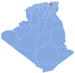 Map of Algeria highlighting Mila | |
| Coordinates: 36°27′N 06°16′E / 36.450°N 6.267°ECoordinates: 36°27′N 06°16′E / 36.450°N 6.267°E | |
| Country | |
| Capital | Mila, Algeria |
| Area | |
| • Total | 9,375 km2 (3,620 sq mi) |
| Population (2008)[1] | |
| • Total | 768,419 |
| • Density | 82/km2 (210/sq mi) |
| Time zone | UTC+01 (CET) |
| Area Code | +213 43, +213 31 |
| ISO 3166 code | DZ-43 |
| Districts | 13 |
| Municipalities | 32 |

Mila (Arabic: ولاية ميلة) is a province (wilaya) of Algeria, whose capital is Mila. Other localities include Teleghma, Grarem Gouga, Hamala and Rouached.
History[]
The province was created from parts of Constantine Province, Jijel Province, Oum el Bouaghi Province and Sétif Province in 1984.
Administrative divisions[]
The province is divided into 13 districts (daïras), which are further divided into 32 communes or municipalities.
Districts[]
Communes[]
- Ahmed Rachedi
- Aïn Beida Harriche
- Aïn Mellouk
- Aïn Tine
- Amira Arras
- Benyahia Abderrahmane
- Bouhatem
- Chelghoum Laïd
- Chigara
- Derradji Bousselah
- El Mechira
- Elayadi Barbes
- Ferdjioua
- Grarem Gouga
- Hamala
- Mila
- Minar Zarza
- Oued Athmania
- Oued Endja
- Oued Seguen
- Ouled Khalouf
- Rouached
- Sidi Khelifa
- Sidi Merouane
- Tadjenanet
- Tassadane Haddada
- Teleghma
- Terrai Bainen
- Tessala Ldematai
- Tiberguent
- Yahia Beniguecha
- Zeghaia
References[]
- ^ Office National des Statistiques, Recensement General de la Population et de l’Habitat 2008 Archived 2008-07-24 at the Wayback Machine Preliminary results of the 2008 population census. Accessed on 2008-07-02.

| show Authority control |
|---|
This article about a location in Mila Province is a stub. You can help Wikipedia by . |
Categories:
- Mila Province
- Provinces of Algeria
- States and territories established in 1984
- Algeria geography stubs