Gonjo County
This article does not cite any sources. (December 2009) |
Gonjo County
贡觉县 • གོ་འཇོ་རྫོང་། | |
|---|---|
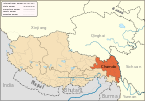
 Location of Gonjo County within Tibet Autonomous Region | |
| Coordinates: 30°51′37″N 98°16′21″E / 30.86028°N 98.27250°ECoordinates: 30°51′37″N 98°16′21″E / 30.86028°N 98.27250°E | |
| Country | People's Republic of China |
| Autonomous region | Tibet |
| Prefecture-level city | Chamdo |
| Seat | Akar |
| Time zone | UTC+8 (China Standard) |

Gonjo County, (Tibetan: གོ་འཇོ་རྫོང་, Wylie: go 'jo rdzong, ZYPY: Gonjo Zong; simplified Chinese: 贡觉县; traditional Chinese: 貢覺縣; pinyin: Gòngjué Xiàn) is a county of the Chamdo Prefecture in the east of the Tibet Autonomous Region, bordering Sichuan province to the east.
Town and townships[]

- Bolo Town (འབོ་ལོ་; 莫洛镇)
- (མིག་མདོ་; 敏都乡)
- Zêba Township (རྩེ་བ་; 则巴乡)
- Langmai Township (གླང་སྨད་; 罗麦乡)
- (གསེར་གདོང་; 沙东乡)
- (ཁེར་རི་; 克日乡)
- Bumgyê Township (འབུམ་སྐྱེས་; 木协乡)
- (ཨ་དབང་; 阿旺乡)
- Lhato Township (ལྷ་ཐོ་; 拉妥乡)
- (བྱང་གསུམ་; 雄松乡)
- Lha'gyai Township (ལྷ་རྒྱལ་; 哈加乡)
- Gyanbê Township (སྐྱ་འབེལ་; 相皮乡)
Categories:
- Counties of Tibet
- Chamdo
- Chamdo geography stubs