Nyalam County
Nyalam County
གཉའ་ལམ་རྫོང་། · 聂拉木县 | |
|---|---|
 | |
 Location of Nyalam County within Tibet Autonomous Region | |
 Nyalam Location of the county seat in Tibet Autonomous Region | |
| Coordinates (Nyalam County government): 28°09′19″N 85°58′56″E / 28.1552°N 85.9822°ECoordinates: 28°09′19″N 85°58′56″E / 28.1552°N 85.9822°E | |
| Country | People's Republic of China |
| Autonomous region | Tibet |
| Prefecture-level city | Xigazê |
| County seat | Nyalam Town |
| Time zone | UTC+8 (China Standard) |

Nyalam County (simplified Chinese: 聂拉木县; traditional Chinese: 聶拉木縣; pinyin: Nièlāmù Xiàn; Tibetan: gnya' lam rdzong) is a county in Tibet's Shigatse Prefecture. It borders on Nepal.
The land area of the county is 7,903 km2 (3,051 sq mi). The population as of 2003 was 10,000. The postal code for the county is 858300.
The county seat is in Nyalam Town.
The other town of the county is Dram, also known under its Tibetan name Dram, or Nepali Khasa. It is located near the border and is the point of entry from Nepal. At "merely" 2300 meters elevation about the sea level, Zhangmu has mild and humid subtropical climate, which is a rarity for Tibet.
It is one of the four counties that comprise the Qomolangma National Nature Preserve (Nyalam, Tingri, Dinggyê, and Kyirong).[1]
Towns and townships[]

- Nyalam Town (གནའ་ལམ་, 聂拉木镇)
- Dram Town (འགྲམ་, 樟木镇)
- (ཡར་སླེབས་, 亚来乡)
- (ཟུར་མཚོ་, 琐作乡)
- Nailung Township (ནས་ལུང་, 乃龙乡)
- Mainpu Township (སྨན་ཕུ་, 门布乡)
- (སྤོ་རོང་, 波绒乡)
Transport[]
- Nyalam County
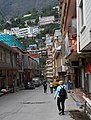
Zhangmu
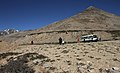
Zhangmu to Lalung La
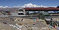
Lalung La
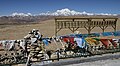
Lalung La


References[]
- ^ Department of Forestry, Government of the Tibet Autonomous Region, People’s Republic of China, ‘’Report on Protected Lands in the Tibet Autonomous Region’’ Lhasa: Tibet Autonomous Region Government Publishing House, 2006
External links[]
- Zhangmu town tourist information
- Sara Shneiderman "Swapping Identities: Borderland exchanges along the Nepal-TAR frontier"
| County-level divisions |
|  | ||||
|---|---|---|---|---|---|---|
| Settlements | ||||||
| Landmarks |
| |||||
| Geography | ||||||
| Transport | ||||||
This Tibet location article is a stub. You can help Wikipedia by . |
- Nyalam County
- Counties of Tibet
- Shigatse
- Tibet geography stubs