Goongerah, Victoria
This article needs additional citations for verification. (August 2007) |
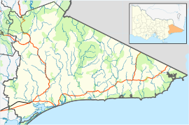

Goongerah is a community on the Brodribb River, located in Gippsland, Australia, near Mount Ellery. The town's population is about sixty.
Goongerah Post Office opened on 21 November 1952 and closed in 1974.[2] Goongerah had one of the smallest primary schools in Victoria, with about 11 students. It closed in 2019.
Goongerah is home to GECO (the Goongerah Environment Centre Office), which is dedicated to fighting for the protection of native forests in East Gippland from logging, such as Goolengook.
References[]
- ^ Australian Bureau of Statistics (27 June 2017). "Goongerah (State Suburb)". 2016 Census QuickStats. Retrieved 5 September 2020.

- ^ Premier Postal History, Post Office List, retrieved 11 April 2008
This article about a location in Gippsland (region) is a stub. You can help Wikipedia by . |
Categories:
- Towns in Victoria (Australia)
- Towns in East Gippsland
- Shire of East Gippsland
- Gippsland geography stubs