Graceville, Florida
Graceville, Florida | |
|---|---|
 Welcome to Graceville Sign located on HWY 77 | |
 | |
| Coordinates: 30°57′33″N 85°30′48″W / 30.95917°N 85.51333°WCoordinates: 30°57′33″N 85°30′48″W / 30.95917°N 85.51333°W | |
| Country | |
| State | |
| County | Jackson |
| Government | |
| • Mayor | |
| Area | |
| • Total | 4.44 sq mi (11.49 km2) |
| • Land | 4.33 sq mi (11.21 km2) |
| • Water | 0.11 sq mi (0.28 km2) |
| Elevation | 151 ft (46 m) |
| Population (2010) | |
| • Total | 2,278 |
| • Estimate (2019)[4] | 2,125 |
| • Density | 490.99/sq mi (189.55/km2) |
| Time zone | UTC-6 (Central (CST)) |
| • Summer (DST) | UTC-5 (CDT) |
| ZIP code | 32440 |
| Area code(s) | 850 |
| FIPS code | 12-27000[2] |
| GNIS feature ID | 0283260[3] |

Graceville is a city in Jackson County, Florida, United States. It is near the Alabama state line. The population was 2,278 at the 2010 census. A large portion of Graceville's rural acreage is located in Holmes County, Florida, United States.
Geography[]
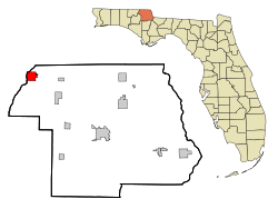
The City of Graceville is located at 30°57′33″N 85°30′48″W / 30.95917°N 85.51333°W (30.959044, −85.513280).[5]
Land area: 916 sq mi (2,370 km2). Region of the country: Southeast Average temperature: 67.2 Average high temperature: 79.0 Average low temperature: 55.0 Annual rain: 66.0 inches Annual snowfall: 0.0 inches Earthquake index: 0.0
Graceville is one of the only areas in the state of Florida that is divided into two counties. The city limits are located inside Jackson County while a majority of its rural acreage is located inside Holmes County.
Florida State Roads 2 and 77 are the two main highways through the city. FL-2 runs from west to east through the center of town, leading east 7 mi (11 km) to Campbellton and west 10 mi (16 km) to Esto. FL-77 runs from south to north through the center of town, leading northeast 22 mi (35 km) to Dothan, Alabama via a connection with Alabama State Route 109, and south 12 mi (19 km) to Chipley.
Jackson County is a rural community primarily composed of business in agriculture, manufacturing, service, and retail trade. In addition, many government facilities are located within the county, including a federal prison and three state correctional institutions. Elevation ranges from 50 to 330 feet (100 m) above sea level. Marianna is 185 feet (56 m) above sea level.
Soil composition ranges from sandy to clay base. The most typical soil is sandy loam. Jackson County has a vast deposit of nearly pure limestone. The county abounds in lakes including Lake Seminole, Compass Lake, Merritt's Mill Pond and Ocheessee Pond. The Chattahoochee River-Apalachicola River, which is navigable and has a nine-foot channel depth, forms the county's eastern border. The Chipola River flows south through the center of the county.
According to the U.S. Census Bureau, Holmes County has a total area of 489 square miles (1,270 km2), of which 479 square miles (1,240 km2) is land and 10 square miles (26 km2) (2.1%) is water.[5] It is the fifth-smallest county in Florida by total area.
Demographics[]
| Historical population | |||
|---|---|---|---|
| Census | Pop. | %± | |
| 1910 | 734 | — | |
| 1920 | 840 | 14.4% | |
| 1930 | 1,012 | 20.5% | |
| 1940 | 1,181 | 16.7% | |
| 1950 | 1,638 | 38.7% | |
| 1960 | 2,307 | 40.8% | |
| 1970 | 2,560 | 11.0% | |
| 1980 | 2,918 | 14.0% | |
| 1990 | 2,675 | −8.3% | |
| 2000 | 2,402 | −10.2% | |
| 2010 | 2,278 | −5.2% | |
| 2019 (est.) | 2,125 | [4] | −6.7% |
| U.S. Decennial Census[6] | |||
As of the census[2] of 2000, there were 2,402 people, 933 households, and 572 families residing in the city. The population density was 559.0 inhabitants per square mile (215.7/km2). There were 1,076 housing units at an average density of 250.4 per square mile (96.6/km2). The racial makeup of the city was 73.48% White, 23.90% African American, 0.92% Native American, 0.17% Asian, 0.25% from other races, and 1.29% from two or more races. Hispanic or Latino of any race were 1.46% of the population.
There were 933 households, out of which 26.8% had children under the age of 18 living with them, 44.3% were married couples living together, 13.8% had a female householder with no husband present, and 38.6% were non-families. 33.9% of all households were made up of individuals, and 17.3% had someone living alone who was 65 years of age or older. The average household size was 2.35 and the average family size was 3.08.
In the city, the population was spread out, with 23.4% under the age of 18, 13.3% from 18 to 24, 23.1% from 25 to 44, 19.7% from 45 to 64, and 20.6% who were 65 years of age or older. The median age was 37 years. For every 100 females, there were 84.3 males. For every 100 females age 18 and over, there were 80.0 males.
The median income for a household in the city was $23,031, and the median income for a family was $32,778. Males had a median income of $25,969 versus $20,109 for females. The per capita income for the city was $14,245. About 15.1% of families and 20.7% of the population were below the poverty line, including 25.0% of those under age 18 and 18.9% of those age 65 or over.
Education[]
- Graceville Elementary School
- Graceville High School
- Poplar Springs High School
- Baptist College of Florida
Notable people[]
- Neal Anderson, former professional football player.
- John Wayne Mixson, former lieutenant Governor of Florida, former Governor of Florida
- Ricky Polston, Chief Justice of the Florida Supreme Court
- Colston Weatherington, Former professional football player.
- Graceville Oilers
- Bob Snyder (musician)
Transportation[]
Graceville was served by the Louisville and Nashville Railroad at the end of the stub Georgiana Branch which reached the town on July 16, 1902,[7] and, later, by the Seaboard System from 1983, and then by the Alabama and Florida Railroad, when the line was spun off as a shortline. The line was freight-only, the last L&N passenger local having come off circa late 1950. Train 27 departed Georgiana, Alabama, at 7:15 a.m., arriving at Graceville at 10:40 a.m. Returning train 28 departed Graceville at 11:05 a.m. and arrived at Georgiana at 2:35 p.m. Following World War II, with the improvement of local roads and the availability of private vehicles, the railroad petitioned the Alabama Public Service Commission to discontinue daily except Sunday trains between Georgiana and Graceville on November 6, 1947. "Passenger travel on trains 27 and 28 is now, and has been for several years, at a very low ebb, there being times when the train crew exceeds the number of passengers on the train," explained the railroad company in court documents dated October 31, 1950, appealing the commission's refusal to allow discontinuance. The operating deficit averaged ~$188 per day.[8]
The A&F abandoned the line between Geneva and Graceville on January 16, 1984.[9] The Atlanta and St. Andrews Bay Railroad also built a seven-mile connection into town from the east from their Dothan-Panama City mainline at Campbellton, completed July 14, 1971,[10] but this, too, was abandoned by 1996 after the possible bridge traffic from the A&F disappeared. The "Bay Line" would buy the small yard and wye in town from the A&F. Only a few rails embedded in former town grade crossings mark the abandoned right of ways.
References[]
- ^ "2019 U.S. Gazetteer Files". United States Census Bureau. Retrieved July 2, 2020.
- ^ Jump up to: a b "U.S. Census website". United States Census Bureau. Retrieved 2008-01-31.
- ^ "US Board on Geographic Names". United States Geological Survey. 2007-10-25. Retrieved 2008-01-31.
- ^ Jump up to: a b "Population and Housing Unit Estimates". United States Census Bureau. May 24, 2020. Retrieved May 27, 2020.
- ^ "US Gazetteer files: 2010, 2000, and 1990". United States Census Bureau. 2011-02-12. Retrieved 2011-04-23.
- ^ "Census of Population and Housing". Census.gov. Retrieved June 4, 2015.
- ^ Herr, Kincaid A., "The Louisville & Nashville Railroad 1850-1963", The University Press of Kentucky, 2000, ppbk. ed. 2009, ISBN 978-0-8131-9318-2, page 141.
- ^ Court document 93 F. Supp. 544 (1950), Louisville & N. R. Co. v. Alabama Public Service Commission et al. Civ. No. 698, United States District Court, M. D. Alabama, N. D., October 31, 1950.
- ^ "Alabama Rail Plan 2008" (PDF). December 2008. pp. Table 4-1. Archived from the original (PDF) on 14 August 2011. Retrieved 10 September 2010.
- ^ Lewis, Edward A. (1986). American Shortline Railway Guide (3rd ed.). Kalmbach Publishing Company. pp. 25. ISBN 0890240736.
| show Municipalities and communities of Jackson County, Florida, United States |
|---|

| show Authority control |
|---|
- Cities in Jackson County, Florida
- Cities in Florida