Green Line (Luas)
| Luas Green Line | ||
|---|---|---|
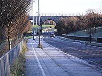
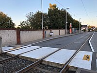
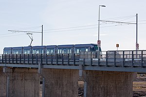 Dublin-bound Luas after passing over the R118 north of Cherrywood | ||
| Overview | ||
| Status | Operational | |
| Owner | Transport Infrastructure Ireland | |
| Locale | Ireland | |
| Termini | Broombridge Parnell Sandyford Brides Glen | |
| Stations | 35 | |
| Service | ||
| Type | Light rail | |
| Operator(s) | Transdev | |
| Depot(s) | ||
| History | ||
| Opened | 30 June 2004 | |
| Technical | ||
| Line length | 12-mile (19 km) | |
| Number of tracks | Double track | |
| Character | Primary | |
| Track gauge | 1,435 mm (4 ft 8+1⁄2 in) standard gauge | |
| Electrification | 750 V DC Overhead catenary | |
| ||
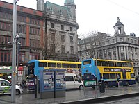
The Green Line (Irish: Líne Uaine) is one of the two lines of Dublin's Luas light rail system. The Green Line was formerly entirely in the south side of Dublin city. It mostly follows the route of the old Harcourt Street railway line, which was reserved for possible re-use when it closed in 1958. The Green Line allows for passenger transfers at O’ Connell GPO and Marlborough to Luas Red Line services and also allows commuters to use Broombridge as an interchange station to reach outer suburbs such as Castleknock and Ongar.
The Green Line from St Stephen's Green to Sandyford launched on 30 June 2004. An extension to the Bride's Glen stop at Cherrywood was opened on 16 October 2010.
As of 2018, the Green line is operating at near maximum capacity during the morning and evening rush hours, and it experiences mass overcrowding and congestion at these times. To assist in alleviating this congestion, seven new longer trams came into service in 2018, with a further eight entering service in 2020. Platforms between St Stephen's Green and Sandyford have been lengthened to accommodate the new trams.[1]
Course of the line[]
The section south of St Stephen's Green makes significant re-use of the old Harcourt Street railway line while the northbound route of the newer Cross City section mainly re-uses the old Midland Great Western Railway line after skirting the former site of Broadstone railway works and station.
Southern section[]
Between Harcourt Street and Charlemont, the Green Line takes a large loop east around buildings which did not exist between 1859 and 1959. As such, there is no train bridge on Adelaide Road for the current line, as there had been for the Harcourt Street Line.
The line then follows the old alignment of the Harcourt Street line from Charlemont station as far as the current Sandyford stop (known as "Stillorgan" on the Harcourt Street line). After Sandyford the line detours over the Leopardstown Road/Brewery Road junction so as to run west around the Leopardstown Racecourse before rejoining the original alignment just north of Carrickmines.[2] The Harcourt Street line had run around the eastern edge of the racecourse, via Silverpark. Remnants of the old Foxrock Station are visible at the back of The Hedgerows in Foxrock. The route deviation was seemingly intended to serve the new properties that would have been built during the "Celtic Tiger" boom, before the Extension was open.
After this detour around Leopardstown Racecourse, the current line runs roughly along the original alignment with some minor detours, particularly prevalent at Laughanstown.
The Carrickmines/Bride's Glen section was also intended to have terminated into what should have a "Celtic Tiger" town centre, similar to the Tallaght area stops, until the Line B2 extension to Fassaroe/Bray was built. This is why, as of 2018, this end of the Green Line seemingly goes to the middle of nowhere, through fields, as nearly all the property that was intended to be serviced by the line, was never built. This is also why there were unused "Ghost" stops built, to serve these unbuilt areas.
There are some other cosmetic differences between the Harcourt Street Line and the current Green Line, such as the positioning of the Ranelagh stop. The location of Ranelagh on the former line was at the current Beechwood stop. The old Ranelagh stop was the last stop on the old line before the train reached the city.
Luas Cross City[]
Luas Cross City (Irish: Luas Traschathrach), formerly called Luas BXD, is an extension to the Green Line which runs from St. Stephen's Green to Broombridge railway station.[3]
Construction of Luas Cross City began in June 2013 and it opened on 9 December 2017.[4][5] The Rosie Hackett Bridge carrying the new line over the river Liffey was opened on 20 May 2014.
The new section begins at the former city centre terminus, St. Stephen's Green, crosses the Red Line near the Abbey stop, and continues northwards, terminating at Broombridge station. There it connects passengers using Iarnród Éireann commuter services to Maynooth railway station and M3 Parkway railway station.
Stops[]
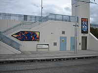
| Image | Name Name in Irish |
Zone | Location | Transport interchange |
Serves |
|---|---|---|---|---|---|
|
Broombridge Droichead Broome |
Green 1 | Broombridge railway station 53°22′22″N 6°17′56″W / 53.372684°N 6.298975°W |
|
Tolka Valley Park
Dublin Industrial Estate |

|
Cabra Cabrach |
Green 1 | Connaught Street / Fassaugh Road 53°21′51″N 6°16′54″W / 53.364200°N 6.281745°W |
Cabra Mount Bernard Park National Botanic Gardens Glasnevin Cemetery | |
| Phibsborough Baile Phib |
Green 1 | North Circular Road / Cabra Road 53°21′37″N 6°16′48″W / 53.360235°N 6.279945°W |
Phibsborough Dalymount Park St Peter's Church, Phibsborough | ||
| Grangegorman Gráinseach Ghormáin |
Green 1 | Grangegorman 53°21′28″N 6°16′39″W / 53.357700°N 6.277520°W |
Mater Misericordiae University Hospital | ||

|
Broadstone —DIT An Chloch Leathan — ITBhÁC |
Green 1 / Central | Western Way 53°21′16″N 6°16′23″W / 53.354517°N 6.272976°W |
|
King's Inns 14 Henrietta Street Blessington Street Park |
|
Dominick Doiminic |
Central | Dominick Street Lower 53°21′05″N 6°15′56″W / 53.351386°N 6.265649°W |
Cineworld Dublin
14 Henrietta Street | |
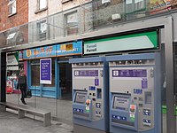
|
Parnell | Central | Parnell Street East 53°21′11″N 6°15′38″W / 53.352993°N 6.260424°W (Southbound only) |
Many bus routes on Parnell Street / Parnell Square | Gate Theatre James Joyce Centre Hugh Lane Gallery Dublin Writers Museum Mountjoy Square |
|
Marlborough Maoilbhríde |
Central | Marlborough Street South 53°20′59″N 6°15′29″W / 53.349843°N 6.258149°W (Southbound only) |
|
Department of Education and Skills St Mary's Pro-Cathedral |
|
Trinity An Trionóid |
Central | College Street 53°20′44″N 6°15′29″E / 53.345455°N 6.258085°E (Southbound only) |
Many bus routes on College Green |
College Green,
Dame Street |

|
O'Connell Upper Ó Conaill Uachtarach |
Central | O'Connell Street North 53°21′06″N 6°15′40″W / 53.351572°N 6.261067°W (Northbound only) |
Many bus routes on O'Connell Street | O'Connell Street Savoy Cinema |
|
O'Connell - GPO Ó Conaill - AOP |
Central | O'Connell Street South 53°20′59″N 6°15′37″W / 53.349625°N 6.260295°W (Northbound only) |
Many bus routes on O'Connell Street |
O'Connell Street,
Henry Street |
| Westmoreland | Central | Westmoreland Street 53°20′46″N 6°15′33″E / 53.346070°N 6.259072°E (Northbound only) |
|
The National Wax Museum Plus
Trinity College | |
|
Dawson Dásain |
Central | Dawson Street 53°20′29″N 6°15′29″W / 53.341516°N 6.258192°W |
|
Dawson Street
Kildare Street Leinster House National Museum of Ireland – Archaeology |

|
St. Stephen's Green Faiche Stiabhna |
Central | St. Stephen's Green West 53°20′21″N 6°15′41″W / 53.339179°N 6.261350°W |
St. Stephen's Green
Grafton Street | |

|
Harcourt Sráid Fhearchair |
Central | Harcourt Street 53°20′01″N 6°15′46″W / 53.333644°N 6.262734°W |
National Concert Hall Iveagh Gardens Synge Street CBS | |
|
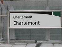
Charlemont | Central / Green 2 | Grand Parade 53°19′50″N 6°15′31″W / 53.330610°N 6.258630°W |
Portobello Cathal Brugha Barracks Grand Canal | |
|
Ranelagh Raghnallach |
Green 2 | Ranelagh 53°19′34″N 6°15′22″W / 53.326127°N 6.256212°W |
|
Ranelagh |
|
Beechwood Coill na Feá |
Green 2 | Dunville Avenue / Beechwood Road 53°19′15″N 6°15′17″W / 53.320924°N 6.254658°W |
Rathmines Sandford Park School | |

|
Cowper | Green 2 | Cowper Road 53°19′15″N 6°15′17″W / 53.320924°N 6.254658°W |
Dartry
Gonzaga College | |
|
Milltown Baile an Mhuilinn |
Green 2 | Richmond Avenue South 53°18′35″N 6°15′07″W / 53.309654°N 6.251807°W |
Milltown Golf Club Alexandra College Trinity Hall | |
|
Windy Arbour Na Glasáin |
Green 2 | Churchtown Road Lower / St. Columbanus' Road 53°18′06″N 6°15′02″W / 53.301759°N 6.250675°W |
Windy Arbour, Churchtown, Clonskeagh University College Dublin (Belfield campus; walk 1.7 km / 1 mile) Islamic Cultural Centre of Ireland De La Salle College Churchtown Central Mental Hospital | |

|
Dundrum Dún Droma |
Green 2/3 | Dundrum / Taney Road 53°17′33″N 6°14′42″W / 53.292424°N 6.245123°W |
|
Dundrum Dundrum Town Centre (main entrance) |

|
Balally Baile Amhlaoibh |
Green 3 | Drummartin 53°17′10″N 6°14′12″W / 53.286030°N 6.236712°W |
Luas Park + Ride |
Goatstown Dundrum Town Centre (Dundrum South) Wesley College Mount Anville Secondary School |
|
Kilmacud Cill Mochuda |
Green 3 | Benildus Avenue / Drummartin Link Road 53°16′59″N 6°13′27″W / 53.282948°N 6.224090°W |
Kilmacud St Benildus College | |

|
Stillorgan Stigh Lorgan |
Green 3 | Blackthorn Avenue 53°16′40″N 6°12′17″W / 53.277643°N 6.204595°W |
Luas Park + Ride |
Stillorgan Beacon Hospital |

|
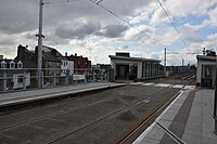
Sandyford Áth an Ghainimh |
Green 3/4 | Blackthorn Avenue 53°16′39″N 6°12′17″W / 53.277618°N 6.204634°W |
|
Sandyford |
|
Central Park An Pháirc Láir |
Green 4 | South County Business Park 53°16′12″N 6°12′14″W / 53.270099°N 6.203786°W |
|
Leopardstown Park Hospital Leopardstown Racecourse Kilmacud Crokes GAA South County Business Park |
|
Glencairn Gleann an Chairn |
Green 4 | Murphystown Road 53°15′59″N 6°12′36″W / 53.266281°N 6.209923°W |
|
Glencairn House |
|
The Gallops An Eachrais |
Green 4 | Murphystown Way 53°15′40″N 6°12′21″W / 53.261157°N 6.205870°W |
|
Stepaside |
|
Leopardstown Valley Gleann Baile na Lobhair |
Green 4 | Ballyogan Road 53°15′30″N 6°11′54″W / 53.258316°N 6.198373°W |
|
Leopardstown shopping centre |
| Ballyogan Wood Coill Bhaile Uí Ógáin |
Green 4 | Ballyogan Vale 53°15′18″N 6°11′04″W / 53.255078°N 6.184431°W |
|
Ballyogan The Park Carrickmines Stepaside Golf Course | |
| Carrickmines Carraig Mhaighin |
Green 5 | Glenamuck Road North 53°15′16″N 6°10′18″W / 53.254350°N 6.171621°W |
|
Carrickmines, Cabinteely, Foxrock, Cornelscourt Carrickmines Golf Club | |
|
Laughanstown Baile an Lachnáin |
Green 5 | Laughanstown (Lehaunstown) 53°15′02″N 6°09′18″W / 53.250636°N 6.154953°W |
Cabinteely | |

|
Cherrywood Coill na Sílíní |
Green 5 | Cherrywood Park / Valley Drive 53°14′43″N 6°08′45″W / 53.245382°N 6.145839°W |
|
Cherrywood
Cherrywood Business Park |

|
Brides Glen Gleann Bhríde |
Green 5 | Cherrywood Business Park 53°14′31″N 6°08′34″W / 53.241870°N 6.142782°W |
|
Cherrywood, |

Bridges[]
The line re-uses some existing bridges and viaducts and has had new bridges specially constructed. The new build William Dargan Bridge at Dundrum crosses the Slang River. The River Liffey is crossed by the new Rosie Hackett Bridge southbound and the existing O'Connell Bridge northbound. The River Dodder is crossed by the Nine Arches Bridge originally constructed for the Harcourt Street railway line in 1854.
Depots[]
The Green line initially was provisioned with a works depot just past the Sandyford terminus and opposite the old Stillorgan Railway station building. The depot could stable 32 trams.[6] When the Green line was extended to Broombridge a further depot was constructed over part of the old Liffey Junction site. It was named Hamilton Depot in honour of William Rowan Hamilton who developed the quaternion mathematical number system.[7] The primary control facility for the Luas system for such functions as power and signally lies at the Red line Luas depot at Red Cow. Following a storm damage incident in October 2017 at Red Cow it was found the depots at Broombridge and Sandyford were not able to take over the function and the whole Luas system was suspended for two days.[8]
Planned developments[]
Green Line upgrade to metro[]
A portion of the Luas Green Line between Charlemont and Sandyford was built with the eventual intention that it be upgraded to carry metro services.[9] In the development of rail based public transport in Greater Dublin, it was envisaged that Metro North would be completed and operating by 2012.[10] It was further planned under the Platform for Change[11] that Metro South, due to operate from St. Stephen's Green to Sandyford would follow this by, according to the Platform for Change, 2020.
However, due to the Great Recession, Metro North was delayed until 2015 at which point it was revived as the "new Metro North".[12] At this stage, efforts were undertaken by the National Transport Authority to improve upon the original Metro North design and alignment. Originally, Metro North's 2012 alignment would connect to Iarnród Éireann's Western Commuter line at Drumcondra. However, new consideration was given by the NTA in the intervening period between 2015 and 2018 to divert the metro line from Drumcondra to Cross Guns Bridge, a point where the Western and South Western Commuter lines meet. Diverting to this area and building a brand new station called Glasnevin would enable the Metro to interchange with two rail lines both of which, would be high frequency DART lines[13] at the time of the metro's opening. As the scale of the new metro North project grew, the decision was made to upgrade the Green Line from Charlemont to Sandyford to metro standard and connect it to Metro North all at once. This decision was made due to the Green Line's overcapacity issues.[14] It was forecast that without an increase of capacity and frequency the tram service provided by the Green Line would eventually become dangerously overcrowded. When the new project was announced to the public in 2018, it was announced as MetroLink, a metro line running from Swords, under Dublin Airport to Dublin city centre, emerging in the Charlemont area, before continuing on the newly upgraded Green Line to Sandyford.
Green Line upgrade deferred[]
If completed as was planned, metro trains would replace Luas trams between Ranelagh and Sandyford, with a new station interchange between the two lines at Charlemont (Luas trams would continue from Charlemont north to Broombridge. The Luas would also continue operating between Sandyford and Bride's Glen).[15]
During the public consultation process for this proposal, Dublin City Council submitted that a large sewer was blocking the path of where the tunnel was planned to emerge, just south of the existing Charlemont tram stop.[16] This necessitated the realignment of the tunnel portal to just north of the current Beechwood Luas stop. This realignment also meant that the planned upgrade of the Luas line would grow in size from a possible 9 months to nearly 48,[17] as the tunnel boring machine needed to reach the new portal in Beechwood before the Green Line upgrade works could begin. This would therefore delay the opening of the entire Metrolink line. The constructability report detailed, however, that if the Green Line Upgrade was done as a second phase to the northern section, then the northern could open on schedule. By completing the Green Line upgrade as a second phase, time savings could also be made on the upgrade works.
Status of proposed upgrade[]
This news, when announced in March 2019, was widely reported as the upgrade having been "shelved"[18] or "abandoned."[19] However, the project is still planned as part of the Greater Dublin Transport Strategy 2016-2035[20] which the National Transport Authoirty remains legislatively bound to pursue. In May 2019, this commitment was reaffirmed by Transport Infrastructure Ireland in an episode of 98FM's On the Move transport podcast:[16]
The goal is still, of the Strategy, to deliver a metro to Sandyford. Simply, we are not going to do it now, or in the short term.
— Paolo Carbone, Head of Public Transport Capital Programmes at Transport Infrastructure Ireland
As of April 2020, it is still the position of both Transport Infrastructure Ireland and the National Transport Authority to upgrade the Green Line from Beechwood to Sandyford to metro standard as no change has been made the Greater Dublin Transport Strategy. The Green Line Upgrade will commence at some point after Metrolink opens in 2027, as is currently planned. However, due to the economic downturn as expected from the Coronavirus disease 2019 crisis, this may be subject to change.[21]
Luas Finglas[]
In July 2020, a public consultation was announced seeking feedback on the extension of the Luas Green line from Broombridge, across the River Tolka through Tolka Valley Park, through West Finglas before terminating at Charlestown.[citation needed]
Gallery[]

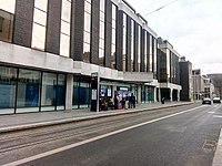
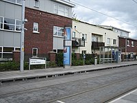
Dominick stop construction site on Luas Cross City line, taken in Dominick Street Lower

The Nine Arches Bridge over the River Dodder at Milltown

Driving cab of a Luas Green Line tram

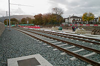
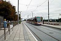
Trams pass near Cherrywood in 2010


References[]
- ^ "'It doesn't feel safe': There's been an increase in complaints about Luas overcrowding". TheJournal.ie. 17 March 2018. Retrieved 30 July 2018.
- ^ "Ordnance Survey Ireland". OSI. Archived from the original on 29 August 2012. Retrieved 20 November 2014.
- ^ "Luas City Broombridge (Line BXD)". Archived from the original on 16 April 2015. Retrieved 11 April 2015.
- ^ "Green light given to Luas link-up, first passengers 2017". RTÉ. Archived from the original on 5 August 2012. Retrieved 5 August 2012.
- ^ "Taoiseach launches new Luas Cross City service in Dublin". RTÉ. 9 December 2017. Retrieved 9 December 2017.
- ^ "Trams and Depots". Transport Infrastructure Ireland. Depots. Archived from the original on 10 August 2018. Retrieved 27 February 2019.
- ^ "The Irish father of algebra to be honoured with new Luas depot". thejournal.ie. 16 October 2014. Archived from the original on 10 July 2018. Retrieved 27 February 2019.
- ^ "Luas to improve backup plans following storm-related service disruptions". The Irish Times. 20 October 2017. Archived from the original on 3 November 2017. Retrieved 28 February 2019.
- ^ "Luas lines being built to different standards". The Irish Times. 28 June 2003. (subscription required)
- ^ O'Brien, Tim (14 September 2007). "RPA puts four consortiums on shortlist to build metro". The Irish Times. (subscription required)
- ^ "Strategy 2000 - 2016 A Platform for Change Summary Report" (PDF). Dublin Transportation Office.
- ^ "new Metro North will best address future transport needs in Swords and Fingal region: NTA New line to run underground in city centre, and to serve Airport". National Transport Authority. 29 September 2015.
- ^ (PDF) https://www.irishrail.ie/Admin/IrishRail/media/Content/DART-brochure.PDF. Missing or empty
|title=(help)[dead link] - ^ Baker, Kevin (15 May 2018). "MetroLink Explainer: Why there are no easy options left for upgrading the Luas Green Line capacity". DublinOnTrack.ie. Archived from the original on 14 April 2019.
- ^ "Preferred route for MetroLink revealed". Irish Independent. Retrieved 27 July 2018.
- ^ Jump up to: a b "Episode 4: Metrolink". 98FM.
- ^ London Bridge Associates Ltd (16 April 2019). "Constructability Report - Green Line Closure" (PDF). MetroLink.
- ^ Kelly, Olivia (20 April 2019). "Luas closure would have lasted 2½ years". The Irish Times. (subscription required)
- ^ Kelly, Olivia (21 February 2019). "MetroLink southside section is set to be abandoned". The Irish Times. (subscription required)
- ^ "Transport Strategy for the Greater Dublin Area 2016 - 2035" (PDF). National Transport Authority.
- ^ Quinn, Jack (22 April 2020). "COVID-19: Capital projects like Dublin MetroLink may be deferred". Newstalk.
External links[]
| Wikimedia Commons has media related to LUAS tram system. |
- Luas
- Luas Green Line stops
- Railway lines opened in 2004
- 2004 establishments in Ireland