Kilmacud
This article needs additional citations for verification. (September 2009) |
Kilmacud
Cill Mhic Oda | |
|---|---|
Suburb | |
 Local shops on Lower Kilmacud Road | |
 Kilmacud Location in Ireland | |
| Coordinates: 53°17′11″N 6°13′02″W / 53.2863°N 6.2173°WCoordinates: 53°17′11″N 6°13′02″W / 53.2863°N 6.2173°W | |
| Country | Ireland |
| Province | Leinster |
| County | Dún Laoghaire–Rathdown |
| Time zone | UTC+0 (WET) |
| • Summer (DST) | UTC-1 (IST (WEST)) |

Kilmacud (Irish: Cill Mhic Oda, meaning 'The Church of the Son Of Oda') is a suburban area of Dublin in Dún Laoghaire–Rathdown, Ireland, at least partly contiguous with Stillorgan.
Location[]
Kilmacud is north of Sandyford, east of Dundrum and south of Goatstown. The west end of the Lower Kilmacud Road starts in Goatstown, heading in a southerly direction. It then goes southeast through what appears to be a narrow shortcut and on out to the end of Drummartin Road and turns east. From there it continues eastwards through to the Stillorgan dual carriageway or N11. In total, it is about 2.6 kilometres or 1.6 miles long. The Upper Kilmacud Road starts in Dundrum and going uphill initially it continues eastward, levels off, and continues until a sharp corner brings it northward and downhill. It joins the Lower Kilmacud Road close to St. Laurence's Boys School. It is about 2.9 kilometres or 1.8 miles long.
The area of Kilmacud and Stillorgan are at least overlapping. For example, Kilmacud Crokes GAA club is located in Stillorgan and Stillorgan's Roman Catholic parish is called Kilmacud. Kilmacud can be described as the area between and immediately around the Upper and Lower Kilmacud Roads. A now-gone placename sign for Stillorgan stood up until the 1970s near Beaufield Park, which is on the section of the Lower Kilmacud Road running between the shops near St. Laurence's Church, and the Stillorgan Shopping Centre. This would have been on the western edge of Stillorgan, and many of the existing housing estates mentioned earlier would not have been in place prior to the 1950s, so it would have marked the beginnings of a built-up area. The area now referred to as Kilmacud would have been on the western side of the sign, with the Chapel of SS Laurence and Cuthbert close by. This was long before the current church dedicated just to St. Laurence O'Toole, which opened in 1969.
Education[]
Kilmacud's primary schools are Scoil Lorcán Naofa (St. Laurence's, named for the one time archbishop of Dublin Laurence O'Toole), St Raphaela's Primary School and Mount Anville National School, the secondary schools are St. Benildus College, Mount Anville Secondary School and St. Raphaelas School.
Transport[]
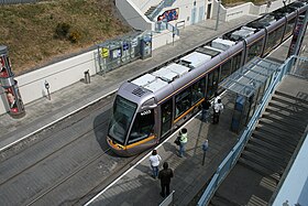
The Luas Green Line light-rail system runs south of Kilmacud and has two stops in the area, Stillorgan and Kilmacud, the former being on the edge of the Sandyford Industrial Estate and beside the main reservoir while the Kilmacud stop is south of the grounds of St. Benildus College.
Some early route plans for the planned Dublin Metro, Metrolink, proposed a stop alongside Kilmacud's Luas stop on its way from Swords to Sandyford.[1] However, as of February 2019, it was questioned whether this section of the line would be completed as originally proposed.[2]
Sport[]
Kilmacud Crokes is a major G.A.A. club whose clubhouse, Glenalbyn is located directly opposite the Stillorgan shopping centre.
References[]
- ^ https://static.rasset.ie/documents/news/2018/03/metrolink-nta-tii-public-consultation-document.pdf Archived 2020-09-28 at the Wayback Machine[bare URL]
- ^ "Southside section of MetroLink set to be abandoned". 21 February 2019. Archived from the original on 21 February 2019. Retrieved 21 February 2019.
Places in Dún Laoghaire–Rathdown | ||
|---|---|---|
| Villages and suburbs |
|  |
| ||
- Places in Dún Laoghaire–Rathdown
- Civil parishes of Rathdown, County Dublin