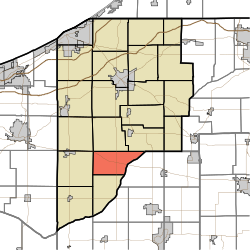
Hanna Township, LaPorte County, Indiana
Hanna Township | |
|---|---|
 | |
| Coordinates: 41°24′26″N 86°44′50″W / 41.40722°N 86.74722°WCoordinates: 41°24′26″N 86°44′50″W / 41.40722°N 86.74722°W | |
| Country | United States |
| State | Indiana |
| County | LaPorte |
| Government | |
| • Type | Indiana township |
| Area | |
| • Total | 26.52 sq mi (68.7 km2) |
| • Land | 26.39 sq mi (68.3 km2) |
| • Water | 0.13 sq mi (0.3 km2) |
| Elevation | 682 ft (208 m) |
| Population (2010) | |
| • Total | 965 |
| • Density | 36.6/sq mi (14.1/km2) |
| FIPS code | 18-31198[2] |
| GNIS feature ID | 453369 |

Hanna Township is one of twenty-one townships in LaPorte County, Indiana. As of the 2010 census, its population was 965 and it contained 391 housing units.[3]
Geography[]
According to the 2010 census, the township has a total area of 26.52 square miles (68.7 km2), of which 26.39 square miles (68.3 km2) (or 99.51%) is land and 0.13 square miles (0.34 km2) (or 0.49%) is water.[3]
References[]
- ^ "US Board on Geographic Names". United States Geological Survey. 2007-10-25. Retrieved 2008-01-31.
- ^ "U.S. Census website". United States Census Bureau. Retrieved 2008-01-31.
- ^ a b "Population, Housing Units, Area, and Density: 2010 - County -- County Subdivision and Place -- 2010 Census Summary File 1". United States Census. Archived from the original on 2020-02-12. Retrieved 2013-05-10.
External links[]
Municipalities and communities of LaPorte County, Indiana, United States | ||
|---|---|---|
| Cities | ||
| Towns | ||
| Townships | ||
| CDPs | ||
| Other unincorporated communities |
| |
| Footnotes | ‡This populated place also has portions in an adjacent county or counties | |
| ||
This LaPorte County, Indiana location article is a stub. You can help Wikipedia by . |
Categories:
- Townships in LaPorte County, Indiana
- Townships in Indiana
- LaPorte County, Indiana geography stubs