Rolling Prairie, Indiana
Rolling Prairie, Indiana | |
|---|---|
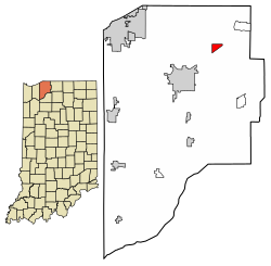 Location in LaPorte County, Indiana | |
 Rolling Prairie Location in LaPorte County, Indiana | |
| Coordinates: 41°40′15″N 86°36′57″W / 41.67083°N 86.61583°WCoordinates: 41°40′15″N 86°36′57″W / 41.67083°N 86.61583°W | |
| Country | United States |
| State | Indiana |
| County | LaPorte |
| Township | Kankakee |
| Area | |
| • Total | 1.07 sq mi (2.77 km2) |
| • Land | 1.06 sq mi (2.74 km2) |
| • Water | 0.02 sq mi (0.04 km2) |
| Elevation | 830 ft (250 m) |
| Population (2010) | |
| • Total | 582 |
| ZIP code | 46371 |
| FIPS code | 18-65736[2] |
| GNIS feature ID | 442265 |


Rolling Prairie is an unincorporated community and census-designated place (CDP) in Kankakee Township, LaPorte County, Indiana, United States. As of the 2010 census, it had a population of 582.[3]
History[]
The first cabin was built here in 1831 by Ezekiel Provolt. More settlers arrived, built cabins and named the settlement "Nauvoo". On November 26, 1853, the village was platted by J. W. Walker and named "Portland".[4] The name of "Rolling Prairie", descriptive of the undulating terrain, was later adopted by one of the railroad companies operating through the town.[5]
Rolling Prairie had a stop on the South Shore Line until 1994,[6] when it was closed along with several other flag stops with low ridership.
Geography[]
Rolling Prairie is located in northeastern LaPorte County at 41°40′15″N 86°36′57″W / 41.67083°N 86.61583°W, in the northeast part of Kankakee Township. U.S. Route 20 passes through the southern side of the community, leading east 19 miles (31 km) to South Bend and west 15 miles (24 km) to Michigan City. Indiana State Road 2 passes just south of Rolling Prairie, leading southwest 7 miles (11 km) to La Porte, the county seat.
According to the U.S. Census Bureau, the Rolling Prairie CDP has an area of 1.1 square miles (2.8 km2), of which 0.02 square miles (0.04 km2), or 1.39%, are water.[7]
Education[]
Rolling Prairie has a public library, a branch of the La Porte County Public Library.[8] Rolling Prairie Elementary School occupies the building that was previously Rolling Prairie High School before the high school was merged with New Carlisle High School to form New Prairie High School. The elementary is one of three elementary schools in the New Prairie United School Corporation.
Demographics[]
| Historical population | |||
|---|---|---|---|
| Census | Pop. | %± | |
| U.S. Decennial Census[9] | |||
References[]
- ^ "US Board on Geographic Names". United States Geological Survey. 2007-10-25. Retrieved 2008-01-31.
- ^ "U.S. Census website". United States Census Bureau. Retrieved 2008-01-31.
- ^ "Profile of General Population and Housing Characteristics: 2010 Census Summary File 1 (DP-1), Rolling Prairie CDP, Indiana". American FactFinder. U.S. Census Bureau. Archived from the original on February 13, 2020. Retrieved January 23, 2020.
- ^ History of La Porte County, Indiana: Together with Sketches of Its Cities, Villages, and Townships. C. C. Chapman & Co. 1880. pp. 728.
- ^ From Needmore to Prosperity - Baker, Ronald L. (1995) ISBN 0-253-32866-7
- ^ Dodson, Paul (June 17, 1994). "South Shore Railroad Will Close 7 Flagstops". South Bend, IN: South Bend Tribune. p. B2.
- ^ "U.S. Gazetteer Files: 2019: Places: Indiana". U.S. Census Bureau Geography Division. Retrieved January 23, 2020.
- ^ "Homepage". La Grange County Public Library. Retrieved 8 March 2018.
- ^ "Census of Population and Housing". Census.gov. Retrieved June 4, 2016.
Municipalities and communities of LaPorte County, Indiana, United States | ||
|---|---|---|
| Cities | ||
| Towns | ||
| Townships | ||
| CDPs | ||
| Other unincorporated communities |
| |
| Footnotes | ‡This populated place also has portions in an adjacent county or counties | |
| ||
This LaPorte County, Indiana location article is a stub. You can help Wikipedia by . |
- Census-designated places in LaPorte County, Indiana
- Census-designated places in Indiana
- LaPorte County, Indiana geography stubs