Scipio Township, LaPorte County, Indiana
Scipio Township | |
|---|---|
 | |
| Coordinates: 41°33′59″N 86°45′52″W / 41.56639°N 86.76444°WCoordinates: 41°33′59″N 86°45′52″W / 41.56639°N 86.76444°W | |
| Country | United States |
| State | Indiana |
| County | LaPorte |
| Government | |
| • Type | Indiana township |
| Area | |
| • Total | 32.32 sq mi (83.7 km2) |
| • Land | 32.07 sq mi (83.1 km2) |
| • Water | 0.25 sq mi (0.6 km2) |
| Elevation | 797 ft (243 m) |
| Population (2010) | |
| • Total | 4,570 |
| • Density | 142.5/sq mi (55.0/km2) |
| FIPS code | 18-68346[2] |
| GNIS feature ID | 453835 |

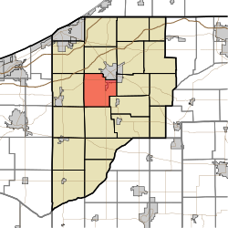
Scipio Township is one of twenty-one townships in LaPorte County, Indiana. As of the 2010 census, its population was 4,570 and it contained 1,910 housing units.[3]
Camp Colfax[]
During the Civil War, Camp Colfax was located about two blocks north of the location of the marker. It was a plot of ground at the west edge of La Porte, (at this time, the City of La Porte's west boundary was L Street) beyond L Street and a small lake in existence then which became known as Camp Lake, and bounded on the north be Second Street.
The 9th Regiment organized and mustered into service at Indianapolis, 25 April 1861, for three months service. At the end of the three months service, the 9th returned and went into rendezvous at Camp Colfax, under the command of Col. Robert H. Milroy. (Abstracted from information in files of La Porte County Historical Society, Inc., La Porte, IN)
The camp was named in honor of Schuyler Colfax, U. S. Representative 1855-1869 and Vice-President 1869–1873.
Geography[]
According to the 2010 census, the township has a total area of 32.32 square miles (83.7 km2), of which 32.07 square miles (83.1 km2) (or 99.23%) is land and 0.25 square miles (0.65 km2) (or 0.77%) is water.[3]
Door Village is located in Scipio Township.
References[]
- ^ "US Board on Geographic Names". United States Geological Survey. 2007-10-25. Retrieved 2008-01-31.
- ^ "U.S. Census website". United States Census Bureau. Retrieved 2008-01-31.
- ^ a b "Population, Housing Units, Area, and Density: 2010 - County -- County Subdivision and Place -- 2010 Census Summary File 1". United States Census. Archived from the original on 2020-02-12. Retrieved 2013-05-10.
External links[]
Municipalities and communities of LaPorte County, Indiana, United States | ||
|---|---|---|
| Cities | ||
| Towns | ||
| Townships | ||
| CDPs | ||
| Other unincorporated communities |
| |
| Footnotes | ‡This populated place also has portions in an adjacent county or counties | |
| ||
This LaPorte County, Indiana location article is a stub. You can help Wikipedia by . |
- Townships in LaPorte County, Indiana
- Townships in Indiana
- LaPorte County, Indiana geography stubs