Hookstown, Pennsylvania
Hookstown, Pennsylvania | |
|---|---|
| Borough of Hookstown | |
 Hookstown Free Methodist Church | |
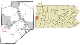 Location in Beaver County and the U.S. state of Pennsylvania. | |
| Coordinates: 40°35′56″N 80°28′27″W / 40.59889°N 80.47417°WCoordinates: 40°35′56″N 80°28′27″W / 40.59889°N 80.47417°W | |
| Country | United States |
| State | Pennsylvania |
| County | Beaver |
| Settled | 1797 |
| Incorporated | 1843 |
| Government | |
| • Type | Borough Council |
| Area | |
| • Total | 0.14 sq mi (0.35 km2) |
| • Land | 0.14 sq mi (0.35 km2) |
| • Water | 0.00 sq mi (0.00 km2) |
| Elevation | 1,020 ft (310 m) |
| Population (2010) | |
| • Total | 147 |
| • Estimate (2019)[2] | 138 |
| • Density | 1,022.22/sq mi (393.66/km2) |
| Time zone | UTC-5 (Eastern (EST)) |
| • Summer (DST) | UTC-4 (EDT) |
| Zip code | 15050 |
| Area code(s) | 724 |
| FIPS code | 42-35576 |

Hookstown is a borough in Beaver County, Pennsylvania, United States. The population was 147 at the 2010 census.[3]
History[]
Hookstown is named after Matthias Hook,[4] early pioneer and Revolutionary War soldier, and his family. The only known surviving relatives are the McCormick family, who still reside in Hookstown and surrounding areas in western Pennsylvania.
Through his daughter Catherine Hook who married George Griffey there are many who can trace their roots back to Mathias living throughout the country. There has been a Griffey reunion held annually for more than a hundred years every June in West Springfield, PA.
Hookstown was the birthplace of Robert Justice.
In 1975 Little Blue Run Lake, the U.S.'s largest coal slurry waste impound, was built directly west of the town and has caused environmental damage to the surrounding communities.[citation needed]
Geography[]
Hookstown is located in western Beaver County at 40°35′56″N 80°28′27″W / 40.59889°N 80.47417°W (40.598869, -80.474150).[5] Pennsylvania Route 168 runs through the community, leading northeast 3 miles (5 km) to the Ohio River borough of Shippingport and south 1.5 miles (2.4 km) to U.S. Route 30, the Lincoln Highway.
According to the United States Census Bureau, the borough has a total area of 0.14 square miles (0.35 km2), all of it land.[3]
Surrounding neighborhoods[]
Hookstown is entirely surrounded in the center of Greene Township
Demographics[]
| Historical population | |||
|---|---|---|---|
| Census | Pop. | %± | |
| 1860 | 296 | — | |
| 1870 | 259 | −12.5% | |
| 1880 | 308 | 18.9% | |
| 1890 | 297 | −3.6% | |
| 1900 | 259 | −12.8% | |
| 1910 | 250 | −3.5% | |
| 1920 | 191 | −23.6% | |
| 1930 | 203 | 6.3% | |
| 1940 | 239 | 17.7% | |
| 1950 | 247 | 3.3% | |
| 1960 | 295 | 19.4% | |
| 1970 | 246 | −16.6% | |
| 1980 | 228 | −7.3% | |
| 1990 | 169 | −25.9% | |
| 2000 | 152 | −10.1% | |
| 2010 | 147 | −3.3% | |
| 2019 (est.) | 138 | [2] | −6.1% |
| Sources:[6][7][8] | |||
As of the census[7] of 2000, there were 152 people, 66 households, and 48 families residing in the borough. The population density was 1,279.5 people per square mile (489.1/km²). There were 72 housing units at an average density of 606.1 per square mile (231.7/km²). The racial makeup of the borough was 97.37% White, 0.66% Native American, 0.66% Asian, and 1.32% from two or more races. Hispanic or Latino of any race were 0.66% of the population.
There were 66 households, out of which 21.2% had children under the age of 18 living with them, 56.1% were married couples living together, 10.6% had a female householder with no husband present, and 25.8% were non-families. 24.2% of all households were made up of individuals, and 12.1% had someone living alone who was 65 years of age or older. The average household size was 2.30 and the average family size was 2.65.
In the borough the population was spread out, with 16.4% under the age of 18, 4.6% from 18 to 24, 21.7% from 25 to 44, 32.2% from 45 to 64, and 25.0% who were 65 years of age or older. The median age was 50 years. For every 100 females, there were 81.0 males. For every 100 females age 18 and over, there were 84.1 males.
The median income for a household in the borough was $27,500, and the median income for a family was $40,208. Males had a median income of $47,969 versus $25,000 for females. The per capita income for the borough was $16,499. About 4.3% of families and 6.6% of the population were below the poverty line, including 5.3% of those under the age of eighteen and 7.9% of those sixty five or over.
References[]
- ^ "2019 U.S. Gazetteer Files". United States Census Bureau. Retrieved July 28, 2020.
- ^ Jump up to: a b "Population and Housing Unit Estimates". United States Census Bureau. May 24, 2020. Retrieved May 27, 2020.
- ^ Jump up to: a b "Geographic Identifiers: 2010 Demographic Profile Data (G001): Hookstown borough, Beaver County, Pennsylvania". U.S. Census Bureau, American Factfinder. Archived from the original on February 12, 2020. Retrieved February 24, 2014.
- ^ Gannett, Henry (1905). The Origin of Certain Place Names in the United States. Govt. Print. Off. pp. 160.
- ^ "US Gazetteer files: 2010, 2000, and 1990". United States Census Bureau. 2011-02-12. Retrieved 2011-04-23.
- ^ "Census of Population and Housing". U.S. Census Bureau. Retrieved 11 December 2013.
- ^ Jump up to: a b "U.S. Census website". United States Census Bureau. Retrieved 2008-01-31.
- ^ "Incorporated Places and Minor Civil Divisions Datasets: Subcounty Resident Population Estimates: April 1, 2010 to July 1, 2012". Population Estimates. U.S. Census Bureau. Archived from the original on 11 June 2013. Retrieved 11 December 2013.

| show Municipalities and communities of Beaver County, Pennsylvania, United States |
|---|

| show Authority control |
|---|
- Populated places established in 1797
- Pittsburgh metropolitan area
- Boroughs in Beaver County, Pennsylvania