Indianapolis
Indianapolis | |
|---|---|
State capital and consolidated city-county | |
| City of Indianapolis and Marion County | |
From top to bottom, left to right: Downtown Indianapolis, Indiana Statehouse, Soldiers' and Sailors' Monument, Scottish Rite Cathedral, Indiana World War Memorial Plaza and Depew Memorial Fountain, and the Indianapolis 500 at Indianapolis Motor Speedway | |
 Flag  Seal | |
| Nickname(s): "Indy"; "Circle City"; "Crossroads of America"; "Naptown"; "Racing Capital of the World"; "Amateur Sports Capital of the World"; "Railroad City"[1] | |
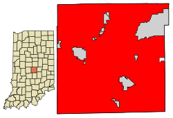 Location within Marion County | |
 Indianapolis Location within Indiana | |
| Coordinates: 39°46′07″N 86°09′29″W / 39.76861°N 86.15806°WCoordinates: 39°46′07″N 86°09′29″W / 39.76861°N 86.15806°W | |
| Country | |
| State | |
| County | Marion |
| Founded | January 6, 1821[2] |
| Incorporated (town) | September 3, 1832[2] |
| Incorporated (city) | March 30, 1847[2] |
| City-county consolidation | January 1, 1970[3] |
| Government | |
| • Type | Strong mayor–council |
| • Body | Indianapolis City-County Council |
| • Mayor | Joe Hogsett (D) |
| Area | |
| • State capital and consolidated city-county | 367.97 sq mi (953.03 km2) |
| • Land | 361.66 sq mi (936.70 km2) |
| • Water | 6.30 sq mi (16.33 km2) |
| Elevation | 718 ft (219 m) |
| Population | |
| • State capital and consolidated city-county | 887,642 |
| • Rank | 15th in the United States 1st in Indiana |
| • Density | 2,454.35/sq mi (947.63/km2) |
| • Metro | 2,111,040 (33rd) |
| Demonym(s) | Indianapolitan[8] |
| Time zone | UTC−5 (EST) |
| • Summer (DST) | UTC−4 (EDT) |
| ZIP Codes | show
61 total ZIP codes: |
| Area code(s) | 317 and 463 |
| FIPS code | 18-36003[9] |
| GNIS feature ID | 2395423[5] |
| Primary airport | Indianapolis International Airport |
| Interstates | |
| U.S. routes | |
| State routes | |
| Public transit | |
| Website | www |


Indianapolis (/ˌɪndiəˈnæpəlɪs/),[10][11] colloquially known as Indy, is the state capital and most-populous city of the U.S. state of Indiana and the seat of Marion County. According to the United States Census Bureau, the consolidated population of Indianapolis and Marion County in 2020 was 997,642.[12] The "balance" population, which excludes semi-autonomous municipalities in Marion County, was 887,642.[6] It is the 15th most populous city in the U.S., the third-most populous city in the Midwest, after Chicago, Illinois and Columbus, Ohio, and the fourth-most populous state capital after Phoenix, Arizona; Austin, Texas; and Columbus. The Indianapolis metropolitan area is the 33rd most populous metropolitan statistical area in the U.S., with 2,048,703 residents.[13] Its combined statistical area ranks 28th, with a population of 2,431,361.[14] Indianapolis covers 368 square miles (950 km2), making it the 16th largest city by land area in the U.S.
Indigenous peoples inhabited the area dating to as early as 10,000 BC.[15] In 1818, the Delaware relinquished their tribal lands in the Treaty of St. Mary's.[16] In 1821, Indianapolis was founded as a planned city for the new seat of Indiana's state government. The city was platted by Alexander Ralston and Elias Pym Fordham on a 1-square-mile (2.6 km2) grid next to the White River. Completion of the National and Michigan roads and arrival of rail later solidified the city's position as a manufacturing and transportation hub.[17] Two of the city's nicknames reflect its historical ties to transportation—the "Crossroads of America" and "Railroad City".[18][19][1] Since the 1970 city-county consolidation, known as Unigov, local government administration operates under the direction of an elected 25-member city-county council headed by the mayor.
Indianapolis anchors the 29th largest economic region in the U.S., based primarily on the sectors of finance and insurance, manufacturing, professional and business services, education and health care, government, and wholesale trade.[20] The city has notable niche markets in amateur sports and auto racing.[21][22] The city is home to three Fortune 500 companies, two major league sports clubs, four university campuses, and several museums, including the world's largest children's museum.[23][24] However, the city is perhaps best known for annually hosting the world's largest single-day sporting event, the Indianapolis 500.[25] Among the city's historic sites and districts, Indianapolis is home to the largest collection of monuments dedicated to veterans and war casualties in the U.S. outside of Washington, D.C.[26][27]
History[]
Etymology[]
The name Indianapolis is derived from the state's name, Indiana (meaning "Land of the Indians", or simply "Indian Land"[28]), and polis, the Greek word for "city." Jeremiah Sullivan, justice of the Indiana Supreme Court, is credited with coining the name.[29] Other names considered were Concord, Suwarrow, and Tecumseh.[30]
Founding[]


In 1816, the year Indiana gained statehood, the U.S. Congress donated four sections of federal land to establish a permanent seat of state government.[31] Two years later, under the Treaty of St. Mary's (1818), the Delaware relinquished title to their tribal lands in central Indiana, agreeing to leave the area by 1821.[16] This tract of land, which was called the New Purchase, included the site selected for the new state capital in 1820.[32] The indigenous people of the land prior to systematic removal are the Miami Nation of Indiana (Miami Nation of Oklahoma) and Indianapolis makes up part of Cession 99; the primary treaty between the indigenous population and the United States was the Treaty of St. Mary's (1818).[33]
The availability of new federal lands for purchase in central Indiana attracted settlers, many of them descendants of families from northwestern Europe. Although many of these first European and American settlers were Protestants, a large proportion of the early Irish and German immigrants were Catholics. Few African Americans lived in central Indiana before 1840.[34] The first European Americans to permanently settle in the area that became Indianapolis were either the McCormick or Pogue families. The McCormicks are generally considered to be the first permanent settlers; however, some historians believe George Pogue and family may have arrived first, on March 2, 1819, and settled in a log cabin along the creek that was later called Pogue's Run. Other historians have argued as early as 1822 that John Wesley McCormick, his family, and employees became the area's first European American settlers, settling near the White River in February 1820.[35]
On January 11, 1820, the Indiana General Assembly authorized a committee to select a site in central Indiana for the new state capital.[36] The state legislature approved the site, adopting the name Indianapolis on January 6, 1821.[2] In April, Alexander Ralston and Elias Pym Fordham were appointed to survey and design a town plan for the new settlement.[37] Indianapolis became a seat of county government on December 31, 1821, when Marion County, was established. A combined county and town government continued until 1832 when Indianapolis incorporated as a town. Indianapolis became an incorporated city effective March 30, 1847. Samuel Henderson, the city's first mayor, led the new city government, which included a seven-member city council. In 1853, voters approved a new city charter that provided for an elected mayor and a fourteen-member city council. The city charter continued to be revised as Indianapolis expanded.[38] Effective January 1, 1825, the seat of state government moved to Indianapolis from Corydon, Indiana. In addition to state government offices, a U.S. district court was established at Indianapolis in 1825.[39]
Growth occurred with the opening of the National Road through the town in 1827, the first major federally funded highway in the United States.[40] A small segment of the ultimately failed Indiana Central Canal was opened in 1839.[41] The first railroad to serve Indianapolis, the Jeffersonville, Madison and Indianapolis Railroad, began operation in 1847, and subsequent railroad connections fostered growth.[42] Indianapolis Union Station was the first of its kind in the world when it opened in 1853.[43]
Civil War and Gilded Age[]


During the American Civil War, Indianapolis was mostly loyal to the Union cause. Governor Oliver P. Morton, a major supporter of President Abraham Lincoln, quickly made Indianapolis a rallying place for Union army troops. On February 11, 1861, President-elect Lincoln arrived in the city, en route to Washington, D.C. for his presidential inauguration, marking the first visit from a president-elect in the city's history.[44] On April 16, 1861, the first orders were issued to form Indiana's first regiments and establish Indianapolis as a headquarters for the state's volunteer soldiers.[45][46] Within a week, more than 12,000 recruits signed up to fight for the Union.[47]
Indianapolis became a major logistics hub during the war, establishing the city as a crucial military base.[48][49] Between 1860 and 1870, the city's population more than doubled.[42] An estimated 4,000 men from Indianapolis served in 39 regiments, and an estimated 700 died during the war.[50] On May 20, 1863, Union soldiers attempted to disrupt a statewide Democratic convention at Indianapolis, forcing the proceedings to be adjourned, sarcastically referred to as the Battle of Pogue's Run.[51] Fear turned to panic in July 1863, during Morgan's Raid into southern Indiana, but Confederate forces turned east toward Ohio, never reaching Indianapolis.[52] On April 30, 1865, Lincoln's funeral train made a stop at Indianapolis, where an estimated crowd of more than 100,000 people passed the assassinated president's bier at the Indiana Statehouse.[49][53]
Following the Civil War—and in the wake of the Second Industrial Revolution—Indianapolis experienced tremendous growth and prosperity. In 1880, Indianapolis was the world's third largest pork packing city, after Chicago and Cincinnati, and the second largest railroad center in the United States by 1888.[54][55] By 1890, the city's population surpassed 100,000.[42] Some of the city's most notable businesses were founded during this period of growth and innovation, including L. S. Ayres (1872), Eli Lilly and Company (1876), Madam C. J. Walker Manufacturing Company (1910), and Allison Transmission (1915). Once home to 60 automakers, Indianapolis rivaled Detroit as a center of automobile manufacturing.[56] The city was an early focus of labor organization.[42] The Indianapolis Street Car Strike of 1913 and subsequent police mutiny and riots led to the creation of the state's earliest labor-protection laws, including a minimum wage, regular work weeks, and improved working conditions.[57] The International Typographical Union and United Mine Workers of America were among several influential labor unions based in the city.[42]
Progressive Era to World War II[]

Some of the city's most prominent architectural features and best known historical events date from the turn of the 20th century. The Soldiers' and Sailors' Monument, dedicated on May 15, 1902, would later become the city's unofficial symbol.[58] Ray Harroun won the inaugural running of the Indianapolis 500, held May 30, 1911, at Indianapolis Motor Speedway. Indianapolis was one of the hardest hit cities in the Great Flood of 1913, resulting in five known deaths[59][60][61] and the displacement of 7,000 families.[62]
Post–World War II[]

As a stop on the Underground Railroad, Indianapolis had one of the largest black populations in the Northern States, until the Great Migration.[63] Led by D. C. Stephenson, the Indiana Klan became the most powerful political and social organization in Indianapolis from 1921 through 1928, controlling City Council and the Board of School Commissioners, among others. At its height, more than 40% of native-born white males in Indianapolis claimed membership in the Klan. While campaigning in the city in 1968, Robert F. Kennedy delivered one of the most lauded speeches in 20th century American history, following the assassination of civil rights leader Martin Luther King Jr.[64][65][66] As in most U.S. cities during the Civil Rights Movement, the city experienced strained race relations. A 1971 federal court decision forcing Indianapolis Public Schools to implement desegregation busing proved controversial.[67]
Under the mayoral administration of Richard Lugar, the city and county governments restructured, consolidating most public services into a new entity called Unigov. The plan removed bureaucratic redundancies, captured increasingly suburbanizing tax revenue, and created a Republican political machine that dominated Indianapolis politics until the 2000s.[68][69] Unigov went into effect on January 1, 1970, increasing the city's land area by 308.2 square miles (798 km2) and population by 268,366 people.[70][71] It was the first major city-county consolidation to occur in the United States without a referendum since the creation of the City of Greater New York in 1898.[72]
Amid the changes in government and growth, the city invested in an aggressive strategy to brand Indianapolis as a sports tourism destination, known as the Indianapolis Project.[73] Under the administration of the city's longest-serving mayor, William Hudnut (1976–1992), millions of dollars were poured into sport facilities and public relations campaigns as part of an economic development strategy.[22] The strategy was successful in landing the U.S. Olympic Festival in 1983, securing the 1984 relocation of the NFL Baltimore Colts, and hosting the 1987 Pan American Games.[22]
Modern Indianapolis[]
Economic development initiatives focused on revitalizing the city's downtown continued in the 1990s under the mayoral administration of Stephen Goldsmith. During this period, a number of cultural amenities were completed at White River State Park, the Canal Walk continued development,[41] Circle Centre Mall was completed,[74] and new sports venues (Victory Field and Bankers Life Fieldhouse) were opened. In 1999, several cultural districts were designated to capitalize on cultural assets within historically significant neighborhoods unique to the city's heritage as a means to promote continued economic development.[75]
During the 2000s, the city invested heavily in infrastructure projects, including two of the largest building projects in the city's history: the $1.1 billion Indianapolis International Airport Colonel H. Weir Cook Terminal and $720 million Lucas Oil Stadium, both opened in 2008.[76][77] A $275 million expansion of the Indiana Convention Center was completed in 2011.[78] Construction began that year on DigIndy, a $1.9 billion project to correct the city's combined sewer overflows by 2025.[79] Rapid transit was reintroduced to Indianapolis with the opening of IndyGo's $96 million Red Line bus rapid transit project in 2019.[80]
Geography[]

Indianapolis is in the East North Central region of the Midwestern United States, in central Indiana. According to the U.S. Census Bureau, the Indianapolis (balance) encompasses a total area of 368.2 square miles (954 km2), of which 361.5 square miles (936 km2) is land and 6.7 square miles (17 km2) is water. The consolidated city boundaries are coterminous with Marion County, with the exception of the autonomous municipalities of Beech Grove, Lawrence, Southport, and Speedway.[42][81] Indianapolis is the 16th largest city by land area in the U.S.
Indianapolis is within the Tipton Till Plain, a flat to gently sloping terrain underlain by glacial deposits known as till.[82] The lowest point in the city is about 650 feet (198 m) above mean sea level, with the highest natural elevation at about 900 feet (274 m) above sea level.[82] Few hills or short ridges, known as kames, rise about 100 feet (30 m) to 130 feet (40 m) above the surrounding terrain.[82] The city lies just north of the Indiana Uplands, a region characterized by rolling hills and high limestone content. The city is also within the EPA's Eastern Corn Belt Plains ecoregion, an area of the U.S. known for its fertile agricultural land.[83]
Topographic relief slopes gently toward the White River and its two primary tributaries, Fall and Eagle creeks. In total, there are about 35 streams in the city, including Indian Creek and Pogue's Run.[84] Major bodies of water include Indian Lake, Geist Reservoir, and Eagle Creek Reservoir.
Cityscape[]

Indianapolis is a planned city. On January 11, 1820, the Indiana General Assembly authorized a committee to select a site in central Indiana for the new state capital, appointing Alexander Ralston and Elias Pym Fordham to survey and design a town plan for Indianapolis. Ralston had been a surveyor for the French architect Pierre L'Enfant, assisting him with the plan for Washington, D.C. Ralston's original plan for Indianapolis called for a town of 1 square mile (2.6 km2), near the confluence of the White River and Fall Creek.[85]

The plan, known as the Mile Square, is bounded by East, West, North, and South streets, centered on a traffic circle, called Monument Circle (originally Governor's Circle), from which Indianapolis's "Circle City" nickname originated.[86] Four diagonal streets radiated a block from Monument Circle: Massachusetts, Virginia, Kentucky, and Indiana avenues.[87] The city's address numbering system begins at the intersection of Washington and Meridian streets.[88] Before its submersion into a sanitary tunnel, Pogue's Run was included into the plan, disrupting the rectilinear street grid to the southeast.
Noted as one of the finest examples of the City Beautiful movement design in the United States, the Indiana World War Memorial Plaza Historic District began construction in 1921 in downtown Indianapolis.[89][90] The district, a National Historic Landmark, encompasses several examples of neoclassical architecture, including the American Legion, Central Library, and Birch Bayh Federal Building and United States Courthouse. The district is also home to several sculptures and memorials, Depew Memorial Fountain, and open space, hosting many annual civic events.[90]
After completion of the Soldiers' and Sailors' Monument, an ordinance was passed in 1905 restricting building heights on the traffic circle to 86 ft (26 m) to protect views of the 284 ft (87 m) monument.[91] The ordinance was revised in 1922, permitting buildings to rise to 108 ft (33 m), with an additional 42 ft (13 m) allowable with a series of setbacks.[91] A citywide height restriction ordinance was instituted in 1912, barring structures over 200 ft (61 m).[92] Completed in 1962, the City-County Building was the first skyscraper in the city, surpassing the Soldiers' and Sailors' Monument in height by nearly 100 ft (30 m).[93] A building boom, lasting from 1982 to 1990, saw the construction of six of the city's ten tallest buildings.[94][95] The tallest is Salesforce Tower, completed in 1990 at 811 ft (247 m).[96] Indiana limestone is the signature building material in Indianapolis, widely included in the city's many monuments, churches, academic, government, and civic buildings.[94]
Compared with similar-sized American cities, Indianapolis is unique in that it contains some 200 farms covering thousands of acres of agricultural land within its municipal boundaries.[97] Equestrian farms and corn and soybean fields interspersed with suburban development are commonplace on the city's periphery, especially in Franklin Township. The stark contrast between Indianapolis's urban neighborhoods and rural villages is a result of the 1970 city-county consolidation, which expanded the city's incorporated boundary to be coterminous with Marion County.[98]
Neighborhoods[]

The city is divided into 99 community areas for statistical purposes, though many smaller neighborhoods exist within them.[99] Indianapolis's neighborhoods are often difficult to define because the city lacks historical ethnic divisions, as in Chicago, or physical boundaries, seen in Pittsburgh and Cincinnati.[100] Instead, most neighborhoods are subtle in their distinctions.[100] The Indianapolis Historic Preservation Commission recognizes several neighborhoods as historic districts, including Central Court, Chatham Arch, Golden Hill, Herron-Morton Place, Lockerbie Square, Old Northside, Old Southside and Oliver Johnson's Woods. Expansion of the interurban system at the turn of the 20th century facilitated growth of several streetcar suburbs, including Broad Ripple, Irvington, University Heights, and Woodruff Place.[100]
The post–World War II economic expansion and subsequent suburbanization had a profound impact on the physical development of the city's neighborhoods. From 1950 to 1970, 97,000 housing units were built in Marion County.[100] Most of this new construction occurred outside Center Township, expediting out-migration from the city's urban neighborhoods to suburban areas, such as Castleton, Eagledale, and Nora. Between 1950 and 1990, over 155,000 residents left Center Township, resulting in urban blight and disinvestment.[100] Since the 2000s, Downtown Indianapolis and surrounding neighborhoods have seen increased reinvestment attributed to nationwide demographic trends, driven by empty nesters and millennials.[101] By 2020, Downtown is projected to have 30,000 residential units, compared to 18,300 in 2010.[102]
Renewed interest in urban living has been met with some dispute regarding gentrification and affordable housing.[103][104][105] According to a Center for Community Progress report, neighborhoods like Cottage Home and Fall Creek Place have experienced measurable gentrification since 2000.[106] The North Meridian Street Historic District is among the most affluent urban neighborhoods in the U.S., with a mean household income of $102,599 in 2017.[107]
Climate[]


Indianapolis has a humid continental climate (Köppen climate classification Dfa), but can be considered a borderline humid subtropical climate (Köppen: Cfa) using the −3 °C (27 °F) isotherm. It experiences four distinct seasons.[108] The city is in USDA hardiness zone 6a.[109]
Typically, summers are hot, humid and wet. Winters are generally cold with moderate snowfall. The July daily average temperature is 75.4 °F (24.1 °C). High temperatures reach or exceed 90 °F (32 °C) an average of 18 days each year,[110] and occasionally exceed 95 °F (35 °C). Spring and autumn are usually pleasant, if at times unpredictable; midday temperature drops exceeding 30 °F or 17 °C are common during March and April, and instances of very warm days (80 °F or 27 °C) followed within 36 hours by snowfall are not unusual during these months. Winters are cold, with an average January temperature of 28.1 °F (−2.2 °C). Temperatures dip to 0 °F (−18 °C) or below an average of 4.7 nights per year.[110]
The rainiest months occur in the spring and summer, with slightly higher averages during May, June, and July. May is typically the wettest, with an average of 5.05 inches (12.8 cm) of precipitation.[110] Most rain is derived from thunderstorm activity; there is no distinct dry season, although occasional droughts occur. Severe weather is not uncommon, particularly in the spring and summer months; the city experiences an average of 20 thunderstorm days annually.[111]
The city's average annual precipitation is 42.4 inches (108 cm), with snowfall averaging 25.9 inches (66 cm) per season. Official temperature extremes range from 106 °F (41 °C), set on July 14, 1936,[112] to −27 °F (−33 °C), set on January 19, 1994.[112][113]
| showClimate data for Indianapolis (Indianapolis International Airport), 1991–2020 normals,[a] extremes 1871–present[b] |
|---|
Demographics[]
| Historical population | |||
|---|---|---|---|
| Census | Pop. | %± | |
| 1840 | 2,695 | — | |
| 1850 | 8,091 | 200.2% | |
| 1860 | 18,611 | 130.0% | |
| 1870 | 48,244 | 159.2% | |
| 1880 | 75,056 | 55.6% | |
| 1890 | 105,436 | 40.5% | |
| 1900 | 169,164 | 60.4% | |
| 1910 | 233,650 | 38.1% | |
| 1920 | 314,194 | 34.5% | |
| 1930 | 364,161 | 15.9% | |
| 1940 | 386,972 | 6.3% | |
| 1950 | 427,173 | 10.4% | |
| 1960 | 476,258 | 11.5% | |
| 1970 | 744,624 | 56.3% | |
| 1980 | 700,807 | −5.9% | |
| 1990 | 731,327 | 4.4% | |
| 2000 | 781,926 | 6.9% | |
| 2010 | 820,445 | 4.9% | |
| 2020 | 887,642 | 8.2% | |
| U.S. Decennial Census[117] 2010–2020[6] | |||
| Racial composition | 2016[118] | 2010[119] | 1990[120] | 1970[120] |
|---|---|---|---|---|
| White | 61.6% | 61.8% | 75.8% | 81.6% |
| —Non-Hispanic | 56.5% | 58.6% | 75.2% | 80.9%[121] |
| Black or African American | 28.0% | 27.5% | 22.6% | 18.0% |
| Hispanic or Latino (of any race) | 9.9% | 9.4% | 1.1% | 0.8%[121] |
| Asian | 2.8% | 2.1% | 0.9% | 0.1% |
The U.S. Census Bureau considers Indianapolis as two entities: the consolidated city and the city's remainder, or balance. The consolidated city is coterminous with Marion County, except the independent municipalities of Beech Grove, Lawrence, Southport, and Speedway.[122] The city's balance excludes the populations of ten semi-autonomous municipalities that are included in totals for the consolidated city.[81] These are Clermont, Crows Nest, Homecroft, Meridian Hills, North Crows Nest, Rocky Ripple, Spring Hill, Warren Park, Williams Creek, and Wynnedale.[122][3] An eleventh town, Cumberland, is partially included.[123][124] In 2018 estimates, the city's consolidated population was 876,862 and its balance was 867,125.[125][126] At the 2010 Census, the city's population density was 2,270 people per square mile (880/km2).[127] Indianapolis is the most populous city in Indiana, containing nearly 13% of the state's total population.[81]
The Indianapolis metropolitan area, officially the Indianapolis–Carmel–Anderson metropolitan statistical area (MSA), consists of Marion County and the surrounding counties of Boone, Brown, Hamilton, Hancock, Hendricks, Johnson, Madison, Morgan, Putnam, and Shelby. In 2018, the metropolitan area's population was 2,048,703, the most populous in Indiana and home to 30% of the state's residents.[13][128] With a population of 2,431,361, the larger Indianapolis–Carmel–Muncie combined statistical area (CSA) covers 18 counties, home to 36% of Indiana residents.[14][129] Indianapolis is also situated within the Great Lakes Megalopolis, the largest of 11 megaregions in the U.S.

According to the U.S. Census of 2010, 97.2% of the Indianapolis population was reported as one race: 61.8% White, 27.5% Black or African American, 2.1% Asian (0.4% Burmese, 0.4% Indian, 0.3% Chinese, 0.3% Filipino, 0.1% Korean, 0.1% Vietnamese, 0.1% Japanese, 0.1% Thai, 0.1% other Asian); 0.3% American Indian, and 5.5% as other. The remaining 2.8% of the population was reported as multiracial (two or more races).[130] The city's Hispanic or Latino community comprised 9.4% of the city's population in the 2010 U.S. Census: 6.9% Mexican, 0.4% Puerto Rican, 0.1% Cuban, and 2% as other.[130]
In 2010, the median age for Indianapolis was 33.7 years. Age distribution for the city's inhabitants was 25% under the age of 18; 4.4% were between 18 and 21; 16.3% were age 21 to 65; and 13.1% were age 65 or older.[130] For every 100 females, there were 93 males. For every 100 females age 18 and over, there were 90 males.[131]
The U.S. Census of 2010 reported 332,199 households in Indianapolis, with an average household size of 2.42 and an average family size of 3.08.[130] Of the total households, 59.3% were family households, with 28.2% of these including the family's own children under the age of 18; 36.5% were husband-wife families; 17.2% had a female householder (with no husband present) and 5.6% had a male householder (with no wife present). The remaining 40.7% were non-family households.[130] As of 2010, 32% of the non-family households included individuals living alone, 8.3% of these households included individuals age 65 years of age or older.[130]
The U.S. Census Bureau's 2007–2011 American Community Survey indicated the median household income for Indianapolis city was $42,704, and the median family income was $53,161.[132] Median income for males working full-time, year-round, was $42,101, compared to $34,788 for females. Per capita income for the city was $24,430, 14.7% of families and 18.9% of the city's total population living below the poverty line (28.3% were under the age of 18 and 9.2% were age 65 or older).[132]
Based on 2015 estimates, the Indianapolis metropolitan area had the 18th highest percentage of LGBT residents in the U.S., with 4.2% of residents identifying as gay, lesbian, bisexual, or transgender.[133]
In 2015, Brookings characterized the Indianapolis metropolitan area as a minor-emerging immigrant gateway with a foreign-born population of 126,767, or 6.4% of the total population, a 131% increase from 2000.[134] Much of this growth can be attributed to thousands of Burmese-Chin refugees who have settled in Indianapolis, particularly Perry Township, since the late-1990s.[135] Indianapolis is home to one of the largest concentrations of Chin people outside of Myanmar (formerly Burma), with an estimated population ranging from 17,000 to 24,000.[136][137][138]
Religion[]

Of the 42.42% of the city's residents who identify as religious, Roman Catholics make up the largest group, at 11.31%.[139] The second highest religious group in the city are Baptists at 10.31%, with Methodists following behind at 4.97%. Presbyterians make up 2.13% of the city's religiously affiliated population, followed by Pentecostals and Lutherans. Another 8.57% are affiliated with other Christian faiths.[139] 0.32% of religiously affiliated persons identified themselves as following Eastern religions, while 0.68% of the religiously affiliated population identified as Jewish, and 0.29% as Muslim.[139] According to the nonpartisan and nonprofit Public Religion Research Institute's American Values Atlas, 22% of residents identify as religiously "unaffiliated," consistent with the national average of 22.7%.[140]
Indianapolis is the seat of the Roman Catholic Archdiocese of Indianapolis. Joseph W. Tobin, C.Ss.R., served as archbishop from 2012 to 2017 and was elevated to cardinal in November 2016. On June 13, 2017, Pope Francis announced Charles C. Thompson would replace Tobin, who was reassigned to the Roman Catholic Archdiocese of Newark in January 2017.[141] The archdiocese also operates Bishop Simon Bruté College Seminary, affiliated with Marian University, while the Christian Theological Seminary is affiliated with the Christian Church (Disciples of Christ).
Indianapolis is the seat of the Episcopal Diocese of Indianapolis, based from Christ Church Cathedral. The Indiana-Kentucky Synod of the Evangelical Lutheran Church in America and the Indiana Conference of the United Methodist Church are also based in the city.
Economy[]


In 2015, the Indianapolis metropolitan area had a gross domestic product (GDP) of $134 billion. The top five industries were: finance, insurance, real estate, rental, and leasing ($30.7B), manufacturing ($30.1B), professional and business services ($14.3B), educational services, health care, and social assistance ($10.8B), and wholesale trade ($8.1B). Government, if it had been a private industry, would have ranked fifth, generating $10.2 billion.[20]
Compared to Indiana as a whole, the Indianapolis metropolitan area has a lower proportion of manufacturing jobs and a higher concentration of jobs in wholesale trade; administrative, support, and waste management; professional, scientific, and technical services; and transportation and warehousing.[143] The city's major exports include pharmaceuticals, motor vehicle parts, medical equipment and supplies, engine and power equipment, and aircraft products and parts.[18] According to the Bureau of Labor Statistics, the region's unemployment rate was 2.8 percent in May 2019.[144]
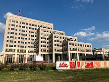
As of 2020, three Fortune 500 companies were based in the city: health insurance company Anthem Inc. (33);[145] pharmaceutical company Eli Lilly (123);[146] and Simon Property Group (496), the largest real estate investment trust in the U.S.[147] Columbus, Indiana-based Cummins (128) opened its Global Distribution Headquarters in downtown Indianapolis in 2017.[148][149] The city is home to three Fortune 1000 companies: hydrocarbon manufacturer Calumet Specialty Products Partners (604); automotive transmission manufacturer Allison Transmission (890); and retailer Finish Line (972). Other companies based in the Indianapolis metropolitan area include: real estate investment trust Duke Realty;[150] media conglomerate Emmis Communications;[151] retailer Lids;[152] financial services holding company OneAmerica;[153] airline holding company Republic Airways;[154] contract research corporation Envigo; and fast food chains Noble Roman's and Steak 'n Shake.
Like many Midwestern cities, recent deindustrialization trends have had a significant impact on the local economy. Once home to 60 automakers, Indianapolis rivaled Detroit as a center of automobile manufacturing in the early 20th century.[56] Between 1990 and 2012, approximately 26,900 manufacturing jobs were lost in the city, including the automotive plant closures of Chrysler, Ford, and General Motors.[155] In 2016, Carrier Corporation announced the closure of its Indianapolis plant, moving 1,400 manufacturing jobs to Mexico.[156] Since 1915, Rolls-Royce North America has had operations in Indianapolis.[157] It is the third largest manufacturing employer and thirteenth largest employer overall in the city, with a workforce of 4,200 in aircraft engine development and manufacturing.[158]
Biotechnology, life sciences, and healthcare are major sectors of Indianapolis's economy. As of 2016, Eli Lilly and Company was the largest private employer in the city, with more than 11,000 workers.[159] Other notable life sciences employers include Corteva, Covance, and Roche Diagnostics.[160] A 2014 report by the Battelle Memorial Institute and Biotechnology Industry Organization indicated that the Indianapolis–Carmel–Anderson MSA was the only U.S. metropolitan area to have specialized employment concentrations in all five bioscience sectors evaluated in the study: agricultural feedstock and chemicals; bioscience-related distribution; drugs and pharmaceuticals; medical devices and equipment; and research, testing, and medical laboratories.[161] The regional healthcare providers of Community Health Network, Eskenazi Health, Franciscan Health, Indiana University Health, and St. Vincent Health have a combined workforce of 43,700.[162]
The city's central location and extensive highway and rail infrastructure have positioned Indianapolis as an important logistics center, home to 1,500 distribution firms employing some 100,000 workers.[163][164][165] As home to the second largest FedEx Express hub in the world, Indianapolis International Airport ranks as the sixth busiest U.S. airport in terms of air cargo transport, handling over 1 million tons and employing 6,600 in 2015.[166][167] Indianapolis is a hub for CSX Transportation, home to its division headquarters, an intermodal terminal, and classification yard (in the suburb of Avon).[168] Amtrak's Beech Grove Shops, in the enclave of Beech Grove, serve as its primary heavy maintenance and overhaul facility, while the Indianapolis Distribution Center is the company's largest material and supply terminal.[169][170]
The hospitality industry is an increasingly vital sector to the Indianapolis economy. According to Visit Indy, 28.8 million visitors generated $5.4 billion in 2017, the seventh straight year of record growth.[171] Indianapolis has long been a sports tourism destination, but has more recently relied on conventions.[172] The Indiana Convention Center (ICC) and Lucas Oil Stadium are considered mega convention center facilities, with a combined 750,000 square feet (70,000 m2) of exhibition space.[173] ICC is connected to 12 hotels and 4,700 hotel rooms, the most of any U.S. convention center.[174] Since 2003, Indianapolis has hosted Gen Con, one of the largest gaming conventions in North America.[175]
According to real estate tracking firm CBRE Group, Indianapolis ranks among the fastest high-tech job growth areas in the U.S.[176][177] The metropolitan area is home to 28,500 information technology-related jobs at such companies as Angie's List, Appirio, Formstack, Genesys, Hubstaff,[178] Infosys,[179] Ingram Micro, and Salesforce Marketing Cloud.[180][181]
Major shopping malls in the city include Castleton Square, Circle Centre, The Fashion Mall at Keystone, Glendale Town Center, Lafayette Square, and Washington Square.
Culture[]
Visual arts[]

Founded in 1883, the Indianapolis Museum of Art (IMA) is the ninth oldest[182][note 1] and eighth largest encyclopedic art museum in the U.S.[184][note 2] The permanent collection has over 54,000 works, including African, American, Asian, and European pieces.[185] In addition to its collections, the Newfields campus consists of The Virginia B. Fairbanks Art & Nature Park: 100 Acres; Oldfields, a restored house museum and estate once owned by Josiah K. Lilly, Jr.; and restored gardens and grounds originally designed by Percival Gallagher of the Olmsted Brothers firm.[186] The IMA also owns the Miller House, a Mid-century modern home designed by Eero Saarinen in Columbus, Indiana.[187] The museum's holdings demonstrate the institution's emphasis on the connections among art, design, and the natural environment.[183]
The Indianapolis Art Center, in Broad Ripple Village, was founded in 1934 by the Works Project Administration. The center opened at its Michael Graves-designed building in 1996, including three public art galleries, 11 studios, a library, and auditorium. Opened in 2005, the center's ARTSPARK sculpture garden covers 12.5 acres (5.1 ha) along the White River.[188] Eiteljorg Museum of American Indians and Western Art opened in 1989 at White River State Park as the only Native American art museum in the Midwest.[189] IUPUI contains the Herron School of Art and Design. Established in 1902, the school's first core faculty included Impressionist painters of the Hoosier Group: T. C. Steele, J. Ottis Adams, William Forsyth, Richard Gruelle, and Otto Stark. The university's public art collection is extensive, with more than 30 works. Other public works can be found in the Eskenazi Health Art Collection and the Indiana Statehouse Public Art Collection.
Performing arts[]


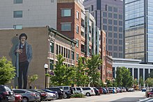
Most of Indianapolis's notable performing arts venues are in the Mass Ave cultural district and other locations in the downtown area. The Indiana Theatre opened as a movie palace on Washington Street in 1927 and houses the Indiana Repertory Theatre, a regional repertory theatre. Located on Monument Circle since 1916, the 1,786-seat Hilbert Circle Theatre is the home of the Indianapolis Symphony Orchestra (ISO). Founded in 1930, the ISO performed 180 concerts to over 275,000 guests during the 2015–2016 season, generating a record $8.5 million in ticket sales.[191] The Indianapolis Opera, founded in 1975, maintains a collaborative relationship with the ISO. The nonprofit Phoenix Theatre, which opened a new Cultural Centre in 2018, focuses on contemporary theatrical productions.[192]
In 1927, Madam Walker Legacy Center opened in the heart of the city's African-American neighborhood on Indiana Avenue.[193] The theater is named for Sarah Breedlove, or Madam C. J. Walker, an African American entrepreneur, philanthropist, and activist who began her beauty empire in Indianapolis. Indiana Avenue was home to a notable jazz scene from the 1920s through the 1960s, producing greats such as David Baker, Slide Hampton, Freddie Hubbard, J. J. Johnson, James Spaulding, and the Montgomery Brothers (Buddy, Monk, and Wes).[194] Wes Montgomery is considered one of the most influential jazz guitarists of all time,[194][195] and is credited with popularizing the "Naptown Sound."[196]
Mass Ave is home to the Old National Centre and the Athenæum (Das Deutsche Haus). Old National Centre at the Murat Shrine is the oldest stage house in Indianapolis, opened in 1909.[197] The building is a prime example of Moorish Revival architecture and features a 2,600-seat performing arts theatre, 1,800-seat concert hall, and 600-seat multi-functional room, hosting approximately 300 public and private events throughout the year.[197] The Athenæum, houses the American Cabaret Theater and Young Actors Theater.
Other notable venues include the Indianapolis Artsgarden, a performing arts center suspended over the intersection of Washington and Illinois streets, Clowes Memorial Hall on the Butler University campus, Melody Inn in Butler-Tarkington, Rivoli Theater, The Vogue in Broad Ripple, and The Emerson Theater in Little Flower.
Indianapolis is home to Bands of America (BOA), a nationwide organization of high school marching, concert, and jazz bands, and the headquarters for Drum Corps International (DCI), a professional drum and bugle corps association.[198] Annual music events include the International Violin Competition of Indianapolis, Midwest Music Summit, and Indy Jazz Fest. The Heartland Film Festival, Indianapolis International Film Festival, Indianapolis Jewish Film Festival, Indianapolis Theatre Fringe Festival, and the Indianapolis Alternative Media Festival are annual events held in the city.
Literature[]
Indianapolis was at the center of the Golden Age of Indiana Literature from 1870 to 1920.[199] Several notable poets and writers based in the city achieved national prominence and critical acclaim during this period, including James Whitcomb Riley, Booth Tarkington, and Meredith Nicholson.[19] In A History of Indiana Literature, Arthur W. Shumaker remarked on the era's influence: "It was the age of famous men and their famous books. In it Indiana, and particularly Indianapolis, became a literary center which in many ways rivaled the East."[200] A 1947 study found that Indiana authors ranked second to New York in the number of bestsellers produced in the previous 40 years.[199] Located in Lockerbie Square, the James Whitcomb Riley Museum Home has been a National Historic Landmark since 1962.
Perhaps the city's most acclaimed twentieth century writer was Kurt Vonnegut, known for his darkly satirical and controversial bestselling novel Slaughterhouse-Five.[201] The Kurt Vonnegut Museum and Library opened in 2010 downtown.[202] Vonnegut became known for including at least one character in his novels from Indianapolis.[203] Upon returning to the city in 1986, Vonnegut acknowledged the influence the city had on his writings:
All my jokes are Indianapolis. All my attitudes are Indianapolis. My adenoids are Indianapolis. If I ever severed myself from Indianapolis, I would be out of business. What people like about me is Indianapolis.[203][202]
A key figure of the Black Arts Movement, Indianapolis resident Mari Evans was among the most influential of the twentieth century's black poets.[204] Indianapolis is home to bestselling young adult fiction writer John Green, known for his critically acclaimed 2012 novel The Fault in Our Stars, set in the city.[205]
Attractions and events[]


The Children's Museum of Indianapolis is the largest of its kind in the world, offering 433,000 square feet (40,227.02 m2) of exhibit space.[206] The museum holds a collection of over 120,000 artifacts, including the Broad Ripple Park Carousel, a National Historic Landmark.[207] Because of its leadership and innovations, the museum is a world leader in its field.[208] Child and Parents magazine have both ranked the museum as the best children's museum in the U.S.[209] The museum is one of the city's most popular attractions, with 1.2 million visitors in 2014.[210]
The Indianapolis Zoo is home to nearly 1,400 animals of 214 species and 31,000 plants, including many threatened and endangered species.[211][212] The zoo is a leader in animal conservation and research, recognized for its biennial Indianapolis Prize designation. It is the only American zoo accredited as a zoo, aquarium, and zoological garden by the Association of Zoos and Aquariums.[213] It is the largest privately funded zoo in the U.S. and one of the city's most visited attractions, with 1.2 million guests in 2014.[214][210]
The Indianapolis Motor Speedway Museum exhibits an extensive collection of auto racing memorabilia showcasing various motorsports and automotive history.[215][216] The museum is the permanent home of the Borg-Warner Trophy, presented to Indianapolis 500 winners.[25] Daily grounds and track tours are also based at the museum.[216] The NCAA Hall of Champions opened in 2000 at White River State Park housing collegiate athletic artifacts and interactive exhibits covering all 23 NCAA-sanctioned sports.[217][218]
Indianapolis is home to several centers commemorating Indiana history. These include the Indiana Historical Society, Indiana State Library and Historical Bureau, Indiana State Museum, and Indiana Medical History Museum. Indiana Landmarks, the largest private statewide historic preservation organization in the U.S., is also in the city.[219] The Benjamin Harrison Presidential Site, in the Old Northside Historic District, is open for daily tours and includes archives and memorabilia from the 23rd President of the United States. President Harrison is buried about 3 miles (4.8 km) north of the site at Crown Hill Cemetery, listed on the National Register of Historic Places. Other notable graves include three U.S. Vice Presidents and notorious American gangster, John Dillinger.
Two museums and several memorials in the city commemorate armed forces or conflict, including the Colonel Eli Lilly Civil War Museum at the Soldiers' and Sailors' Monument and Indiana World War Memorial Military Museum at the Indiana World War Memorial Plaza. Outside of Washington, D.C., Indianapolis contains the largest collection of monuments dedicated to veterans and war casualties in the nation.[26][27] Other notable sites are the Crown Hill National Cemetery, Indiana 9/11 Memorial, Medal of Honor Memorial, and the USS Indianapolis National Memorial.
Nearly 1.5 miles (2.4 km) of the former Indiana Central Canal—now known as the Canal Walk—link several downtown museums, memorials, and public art pieces. Flanked by walking and bicycling paths, the Canal Walk also offers gondola rides, pedal boat, kayak, and surrey rentals. The Indiana Central Canal has been recognized by the American Water Works Association as an American Water Landmark since 1971.[220]
Indianapolis is home to dozens of annual festivals and events showcasing local culture. The "Month of May" (a series of celebrations leading to the Indianapolis 500) is perhaps the largest annual celebration in the city, with the 500 Festival Parade regularly drawing 300,000 spectators.[221] Other notable events include Indiana Black Expo, Indiana State Fair, Indy Pride Festival, and Historic Irvington Halloween Festival.
Cuisine[]

Indianapolis has an emerging food scene as well as established eateries.[222] Founded in 1821 as the city's public market, the Indianapolis City Market has served the community from its current building since 1886. Prior to World War II, the City Market and neighboring Tomlinson Hall (since demolished) were home to meat and vegetable vendors. As consumer habits evolved and residents moved from the central city, the City Market transitioned from a traditional marketplace to a food court, a function it retains today.[223]

Situated in the Corn Belt, Indianapolis has maintained close ties to farming and food production. Urban agriculture in the city dates to the 1930s, when non-profit organization Flanner House began teaching Black arrivals how to farm on vacant lots during the Great Migration. Within a few years, more than 200 families were tending 600 garden plots on nearly 100 acres (40 ha) of urban land on the city's near north side.[224] Urban agriculture has made a comeback in recent years in an effort to alleviate food deserts.[225] According to the city's Office of Sustainability, there were 129 community farms and gardens in 2020.[226] As of 2020, several farmers' markets have been established throughout Indianapolis.[227]
Distinctive local dishes include pork tenderloin sandwiches[228] and sugar cream pie, the latter being the unofficial state pie of Indiana.[229] The beef Manhattan, invented in Indianapolis, can also be found on restaurant menus throughout the city and region.[230]
Opened in 1902, St. Elmo Steak House is well known for its signature shrimp cocktail, named by the Travel Channel as the "world's spiciest food". In 2012, it was recognized by the James Beard Foundation as one of "America's Classics".[231] The Slippery Noodle Inn, a blues bar and restaurant, is the oldest continuously operating tavern in Indiana, having opened in 1850.[232] The Jazz Kitchen, opened in 1994, was recognized in 2011 by OpenTable as one of the "top 50 late night dining hotspots" in the U.S.[233]
In 2016, Condé Nast Traveler named Indianapolis the "most underrated food city in the U.S.," while ranking Milktooth as one of the best restaurants in the world.[234][235] Food & Wine called Indianapolis the "rising star of the Midwest," recognizing Milktooth, Rook, Amelia's, and Bluebeard, all in Fletcher Place.[236][237] Several Indianapolis chefs and restaurateurs have been semifinalists in the James Beard Foundation Awards in recent years.[238][239] Microbreweries are quickly becoming a staple in the city, increasing fivefold since 2009.[240] There are now about 50 craft brewers in Indianapolis, with Sun King Brewing being the largest.[241]
For some time, Indianapolis was known as the "100 Percent American City" for its racial and ethnic homogeneity.[242] Historically, these factors, as well as low taxes and wages, provided chain restaurants a relatively stable market to test dining preferences before expanding nationwide. As a result, the Indianapolis metropolitan area had the highest concentration of chain restaurants per capita of any market in the U.S. in 2008, with one chain restaurant for every 1,459 people—44% higher than the national average.[243] In recent years, immigrants have opened some 800 ethnic restaurants.[242]
Sports[]


Two major league sports teams are based in Indianapolis: the Indianapolis Colts of the National Football League (NFL) and the Indiana Pacers of the National Basketball Association (NBA).
Originally the Baltimore Colts, the franchise has been based in Indianapolis since relocating in 1984. The Colts' tenure in Indianapolis has produced 11 division championships, two conference championships, and two Super Bowl appearances. Quarterback Peyton Manning led the team to win Super Bowl XLI in the 2006 NFL season. Lucas Oil Stadium replaced the team's first home, the RCA Dome, in 2008.
Founded in 1967, the Indiana Pacers began in the American Basketball Association (ABA), joining the NBA when the leagues merged in 1976. Prior to joining the NBA, the Pacers won three division titles and three championships (1970, 1972, 1973). Since the merger, the Pacers have won one conference title and six division titles, most recently in 2014.
Founded in 2000, the Indiana Fever of the Women's National Basketball Association (WNBA) have won three conference titles and one championship in 2012. The Fever and Pacers share Bankers Life Fieldhouse, which replaced Market Square Arena in 1999. The Indianapolis Indians of the Triple-A East are the second-oldest minor league franchise in American professional baseball, having been established in 1902.[244] The Indians have won 25 division titles, 14 league titles, and seven championships, most recently in 2000. Since 1996, the team has played at Victory Field, which replaced Bush Stadium. Of the 160 teams comprising Minor League Baseball, the Indians had the highest attendance during the 2016 season.[245] Established in 2013, Indy Eleven of the United Soccer League (USL) plays at IU Michael A. Carroll Track & Soccer Stadium. Indy Fuel of the ECHL was founded in 2014 and plays at Indiana Farmers Coliseum.
Butler University and IUPUI are NCAA Division I schools based in the city. The Butler Bulldogs compete in the Big East Conference, except for Butler Bulldogs football, which plays in the Pioneer Football League FCS. The Butler Bulldogs men's basketball team were runners-up in the 2010 and 2011 NCAA Men's Division I Basketball Championship Games. The IUPUI Jaguars compete in the Horizon League.
Traditionally, Indianapolis's Hinkle Fieldhouse was the hub for Hoosier Hysteria, a general excitement for the game of basketball throughout the state, specifically the Indiana High School Boys Basketball Tournament.[246] Hinkle, a National Historic Landmark, was opened in 1928 as the world's largest basketball arena, with seating for 15,000.[247] It is regarded as "Indiana's Basketball Cathedral".[248] Perhaps the most notable game was the 1954 state championship, which inspired the critically acclaimed 1986 film, Hoosiers.[249]
Indianapolis has been called the "Amateur Sports Capital of the World".[42][250] The National Collegiate Athletic Association (NCAA), the main governing body for U.S. collegiate sports, and the National Federation of State High School Associations are based in Indianapolis. The city is home to three NCAA athletic conferences: the Horizon League (Division I); the Great Lakes Valley Conference (Division II); and the Heartland Collegiate Athletic Conference (Division III). Indianapolis is also home to three national sport governing bodies, as recognized by the United States Olympic Committee: USA Gymnastics; USA Diving; and USA Track & Field.[251]
Indianapolis hosts numerous sporting events annually, including the Circle City Classic (1983–present), NFL Scouting Combine (1987–present), and Big Ten Football Championship Game (2011–present). Indianapolis is tied with New York City for having hosted the second most NCAA Men's Division I Basketball Championships (1980, 1991, 1997, 2000, 2006, 2010, 2015, and 2021).[252] The city will host the men's Final Four next in 2026.[253] The city has also hosted three NCAA Women's Division I Basketball Championships (2005, 2011, and 2016). Notable past events include the NBA All-Star Game (1985), Pan American Games X (1987), US Open Series Indianapolis Tennis Championships (1988–2009), World Artistic Gymnastics Championships (1991), WrestleMania VIII (1992), World Rowing Championships (1994), World Police and Fire Games (2001), FIBA Basketball World Cup (2002), and Super Bowl XLVI (2012).
Indianapolis is home to the OneAmerica 500 Festival Mini-Marathon, the largest half marathon and seventh largest running event in the U.S.[254] The mini-marathon is held the first weekend of May as part of the 500 Festival, leading up to the Indianapolis 500. As of 2013, it had sold out for 12 consecutive years, with 35,000 participants.[255] Held in autumn, the Monumental Marathon is also among the largest in the U.S., with nearly 14,000 entrants in 2015.[256]
Motorsports[]
Indianapolis is a major center for motorsports. Two auto racing sanctioning bodies are headquartered in the city (INDYCAR and United States Auto Club) along with more than 500 motorsports companies and racing teams, employing some 10,000 people in the region.[257] Indianapolis is a metonym for auto racing, having inspired the name "Indy car," used for both the competition and type of car used in it.[258]
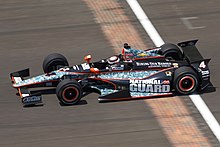
Since 1911, Indianapolis Motor Speedway (IMS) (in the enclave of Speedway) has been the site of the Indianapolis 500, an open-wheel automobile race held annually on Memorial Day weekend. Considered part of the Triple Crown of Motorsport, the Indianapolis 500 is the world's largest single-day sporting event, hosting more than 257,000 permanent seats.[25] Since 1994, IMS has hosted one of NASCAR's highest attended events, the NASCAR Cup Series Brickyard 400.[259] IMS has also hosted the NASCAR Xfinity Series Pennzoil 150 since 2012 and the IndyCar Series Grand Prix of Indianapolis since 2014. From 2000 to 2007, the circuit hosted Formula One at the facility's road course.
Lucas Oil Raceway, in nearby Brownsburg, is home to the National Hot Rod Association (NHRA) U.S. Nationals, the most prestigious drag racing event in the world, held annually each Labor Day weekend.[260]
Parks and recreation[]

Indy Parks and Recreation maintains 211 parks covering 11,254 acres (4,554 ha), 127 playgrounds, 155 sports fields, 135 miles (217 km) of trails, 23 recreation and nature centers, 23 spraygrounds, 20 aquatic centers, 12 golf courses,[261] and four dog parks.[c] The department also provides 2,400 programs and classes annually.[262]
Military Park was established as the city's first state-owned park in 1852. Garfield Park was the city's first municipally-owned public park, opening in 1876 as Southern Park.[263][264] By the 20th century, the city enlisted landscape architect George Kessler to conceive a framework for Indianapolis's modern parks system.[265] Kessler's 1909 Indianapolis Park and Boulevard Plan linked notable parks, such as Brookside, Ellenberger, and Garfield parks, with a system of parkways following the city's waterways.[266] In 2003, the system's 3,474 acres (1,406 ha) were added to the National Register of Historic Places.[267] Eagle Creek Park is the largest and most visited park in the city and ranks among the largest municipal parks in the U.S., covering 4,766 acres (1,929 ha).[268] Fishing, sailing, kayaking, canoeing, and swimming are popular activities at Eagle Creek Reservoir.
Two of Indiana's 25 state parks, Fort Harrison in Lawrence and White River in Indianapolis, are located in Marion County. Fort Harrison is managed by the Indiana Department of Natural Resources. White River is owned and operated by the White River State Park Development Commission, a quasi-governmental agency.[269] Encompassing 250 acres (100 ha), White River is the city's major urban park, home to the Indianapolis Zoo, White River Gardens, and several museums.[211] Indianapolis lies about 50 miles (80 km) north of two state forests, Morgan–Monroe and Yellowwood, and one national forest, Hoosier. Crown Hill Cemetery, the third largest private cemetery in the U.S., covers 555 acres (225 ha) on the city's north side and is home to more than 250 species of trees and shrubs comprising one of the largest old-growth forests in the Midwest.[270][271]
Some recreational trails and greenways in the city include Fall Creek Greenway, Pleasant Run Greenway, and the Monon Trail.[272] The Monon is a popular rail trail and part of the United States Bicycle Route System, drawing some 1.3 million people annually.[273][274] The privately managed Indianapolis Cultural Trail provides 8 miles (13 km) of separated bike and pedestrian corridors linking Indianapolis cultural districts with surrounding urban neighborhoods.[275]
According to the Trust for Public Land's 2017 ParkScore Index, Indianapolis tied for last with respect to public park accessibility of the 100 largest U.S. cities evaluated. Some 68% of residents are underserved. The city's large land area and low public funding contributed to the ranking.[276]
Government and politics[]


Indianapolis has a consolidated city-county government, a status it has held since 1970 under Indiana Code's Unigov provision. Many functions of the city and county governments are consolidated, though some remain separate.[3] The city has a strong mayor–council form of government.
The executive branch is headed by an elected mayor, who serves as the chief executive of both the city and Marion County. Joe Hogsett, a Democrat, is the 49th mayor of Indianapolis. The mayor appoints deputy mayors, department heads, and members of various boards and commissions. City-County Council is the legislative body and consists of 25 members, all of whom represent geographic districts. The council has the exclusive power to adopt budgets, levy taxes, and make appropriations. It can also enact, repeal, or amend ordinances, and make appointments to certain boards and commissions. According to Moody's, the city maintains a Aaa bond credit rating and an annual budget of $1.1 billion.[277][278] The judicial branch consists of a circuit court, a superior court with four divisions and 32 judges, and several small claims courts located in various townships.[3] The three branches, along with most local government departments, are based in the City-County Building.
As the state capital, Indianapolis is the seat of Indiana's state government. The city has hosted the capital since its move from Corydon in 1825. The Indiana Statehouse houses the executive, legislative, and judicial branches of state government, including the offices of the Governor of Indiana and Lieutenant Governor of Indiana, the Indiana General Assembly, and the Indiana Supreme Court. Most state departments and agencies are in Indiana Government Centers North and South. The Indiana Governor's Residence is on Meridian Street in the Butler–Tarkington neighborhood, about 5 miles (8.0 km) north of downtown.
Most of Indianapolis is within Indiana's 7th congressional district, represented by Democrat André Carson, while the northern fifth is part of Indiana's 5th congressional district, represented by Republican Victoria Spartz. Federal field offices are in the Birch Bayh Federal Building and United States Courthouse (which houses the United States District Court for the Southern District of Indiana) and the Minton-Capehart Federal Building, both downtown. The Defense Finance and Accounting Service, an agency of the U.S. Department of Defense, is headquartered in nearby Lawrence.
Until fairly recently, Indianapolis was considered one of the most conservative major cities in the U.S.[68] Republicans held the mayor's office for 32 years (1967–1999), and controlled the City-County Council from its inception in 1970 to 2003.[68] In the 2000 United States presidential election, Marion County voters narrowly selected George W. Bush over Al Gore by a margin of 1.3%, but voted in favor of John Kerry by a margin of 1.9% in the 2004 United States presidential election. Presidential election results have increasingly favored Democrats, with Marion County voters selecting Joe Biden over Donald Trump in the 2020 United States presidential election, 63.3–34.3%.[279] Incumbent mayor Democrat Joe Hogsett faced Republican State Senator Jim Merritt and Libertarian Doug McNaughton in the 2019 Indianapolis mayoral election. Hogsett was elected to a second term, with 72% of the vote.[280] The 2019 City-County Council elections expanded Democratic control of the council, flipping six seats to hold a 20–5 supermajority over Republicans.[281] Indianapolis is regarded as politically moderate.[282]
Recent political issues of local concern have included cutting the city's structural deficit, planning and construction of a new criminal justice center, homelessness, streetlights, and improved mass transit and transportation infrastructure.[283][278]
Public safety[]
Police and law enforcement[]

Indianapolis Metropolitan Police Department (IMPD) is the primary law enforcement agency for the city of Indianapolis. IMPD's jurisdiction covers Marion County, with the exceptions of Beech Grove, Lawrence, Southport, Speedway, and the Indianapolis International Airport, which is served by the Indianapolis Airport Authority Police Department.[284] IMPD was established in 2007 through a merger between the Indianapolis Police Department and the Marion County Sheriff's Office Law Enforcement Division.[285] The Marion County Sheriff's Office manages Marion County Jails I and II. IMPD operates six precincts with 1,640 sworn police personnel and 200 civilian employees.[3]
According to the FBI's 2017 Uniform Crime Report, Indianapolis recorded 1,333.96 violent crimes per 100,000 people. Violent crimes include murder and non-negligent manslaughter, rape, robbery, and aggravated assault. In that same report, Indianapolis recorded 4,411.87 property crimes per 100,000 people. Property crimes include burglary, larceny-theft, and motor vehicle theft.
Until 2019, annual criminal homicide numbers had grown each year since 2011, reaching record highs from 2015 to 2018.[286] With 144 criminal homicides, 2015 surpassed 1998 as the year with the most murder investigations in the city. With 159 criminal homicides, 2018 stands as the most violent year on record in the city.[286] FBI data showed a 7 percent increase in violent crimes committed in Indianapolis, outpacing the rest of the state and country.[287] Law enforcement has blamed increased violence on a combination of root causes, including poverty, substance abuse, mental illness, and availability of firearms.[288]
Fire department[]
Indianapolis Fire Department (IFD) provides fire protection services as the primary emergency response agency for 278 square miles (720 km2) of Marion County. IFD provides automatic and mutual aid to the excluded municipalities of Beech Grove, Lawrence, and Speedway, as well as Decatur, Pike, and Wayne townships which have retained their own fire departments. The fire district comprises seven geographic battalions with 43 fire stations.[289] Some 1,200 firefighters respond to more than 161,000 incidents annually.[290]
Emergency medical services[]
Indianapolis Emergency Medical Services is the largest provider of pre-hospital medical care in the city, with 357 emergency medical technicians and full-time paramedics responding to nearly 120,000 emergency dispatch calls annually.[291] The agency's coverage area excludes Decatur, Pike, and Wayne townships, and the town of Speedway.
Education[]
Primary and secondary education[]
Nine K–12 public school districts serve Indianapolis residents, the largest being Indianapolis Public Schools (IPS). The other eight public school districts are Franklin Township Community School Corporation, Metropolitan School District of Decatur Township, Metropolitan School District of Lawrence Township, Metropolitan School District of Pike Township, Metropolitan School District of Warren Township, Metropolitan School District of Washington Township, Metropolitan School District of Wayne Township, and Perry Township Schools. Two state-supported residential schools located in the city include the Indiana School for the Blind and Visually Impaired and Indiana School for the Deaf.
IPS has an annual enrollment of about 32,000 students attending 59 schools.[292][293] In 2015, IPS began contracting with charter organizations and nonprofit school managers to operate failing district schools as innovation schools.[294] About 37% of IPS students are enrolled in 20 innovation schools, which are run independently but accountable to the Board of School Commissioners, with the remaining 63% of students attending 39 neighborhood or magnet schools.[292][295] About 18,000 students are enrolled in tuition-free Mayor-Sponsored Charter Schools (MSCS), as authorized by the Indianapolis Mayor's Office of Education Innovation and Indianapolis Charter School Board.[296]
There are dozens of private, parochial, and independent charter schools operating throughout the city. Catholic and Christian primary and secondary schools are most prevalent.[297][298]
Higher education[]

Indiana University – Purdue University Indianapolis (IUPUI) was founded in 1969 after the branch campuses of Indiana University and Purdue University merged.[299] IUPUI is classified as an urban research university, containing 17 schools and enrolling about 30,000 students.[300][299] Notable schools include the Herron School of Art and Design, Robert H. McKinney School of Law, School of Dentistry, and the Indiana University School of Medicine, among the largest medical schools in the U.S.[301][302] Public satellite campuses include Ball State University's R. Wayne Estopinal College of Architecture and Planning, Ivy Tech Community College of Indiana, and Vincennes University.
Private universities include Butler University, Marian University, Martin University, and the University of Indianapolis. Crossroads Bible College and Indiana Bible College are small Christian colleges based in the city. Private satellite campuses include Grace College, Indiana Institute of Technology, and Indiana Wesleyan University.
Libraries[]
Founded in 1873, the Indianapolis Public Library includes Central Library and 24 branches throughout Marion County. Central Library houses a number of special collections, including the Center for Black Literature & Culture, the Chris Gonzalez LGBT Collection, and the Nina Mason Pulliam Indianapolis Special Collections Room.[303] The public library serves about 280,000 cardholders with a circulation of nearly 10 million materials annually.[304]
Media[]

Indianapolis is served by various print media. Founded in 1903, The Indianapolis Star is the city's daily morning newspaper. The Star is owned by Gannett Company, with a daily circulation of 127,064.[305] The Indianapolis News was the city's daily evening newspaper and oldest print media, published from 1869 to 1999. Notable weeklies include NUVO, an alternative weekly newspaper, the Indianapolis Recorder, a weekly newspaper serving the local African American community, the Indianapolis Business Journal, reporting on local real estate, and the Southside Times. Indianapolis Monthly is the city's monthly lifestyle publication.
Broadcast television network affiliates include WTTV 4 (CBS), WRTV 6 (ABC), WISH-TV 8 (The CW), WTHR-TV 13 (NBC), WDNI-CD 19 (Telemundo), WFYI-TV 20 (PBS), WNDY-TV 23 (MyNetworkTV), WUDZ-LD 28 (Buzzr), WSDI-LD 30 (FNX), WHMB-TV 40 (Family), WCLJ-TV 42 (Bounce TV), WBXI-CD 47 (Start TV), WXIN-TV 59 (Fox), WIPX-TV 63 (Ion) and WDTI 69 (Daystar). In 2019, the Indianapolis metropolitan area was the 25th largest television market in the U.S.[306]
The majority of commercial radio stations in the city are owned by Cumulus Media, Emmis Communications, iHeartMedia, and Urban One. Popular nationally syndicated radio program The Bob & Tom Show has been based at Indianapolis radio station WFBQ since 1983.[307] In 2019, the Indianapolis metropolitan area was the 39th largest radio market in the U.S.[308]
Indianapolis natives Jane Pauley and David Letterman launched their broadcasting careers in local media, Pauley with WISH-TV and Letterman with WTHR-TV, respectively.[309][310] Motion pictures at least partially filmed in the city include Speedway (1929), To Please a Lady (1950), Winning (1969), Hoosiers (1986), Eight Men Out (1988), and Going All the Way (1997). Television series set in Indianapolis have included One Day at a Time; Good Morning, Miss Bliss; Men Behaving Badly; Close to Home; the second season of anthology drama American Crime;[311] and the web television limited series, Self Made.[312] Television series shot on location in the city include Cops and HGTV's Good Bones.[313] NBC's Parks and Recreation occasionally filmed in the city, including the eponymous episode "Indianapolis."[314][315]
Transportation[]


Indianapolis's transportation infrastructure comprises a complex network that includes a local public bus system, several private intercity bus providers, Amtrak passenger rail service via the Cardinal, 282 miles (454 km) of freight rail lines, an Interstate Highway System, two airports, a heliport, bikeshare system, 115 miles (185 km) of bike lanes,[226] and 110 miles (177 km) of trails and greenways.[272][226] The city has also become known for its prevalence of electric scooters.[316]
According to the 2016 American Community Survey, 83.7% of working residents in the city commuted by driving alone, 8.4% carpooled, 1.5% used public transportation, and 1.8% walked. About 1.5% used all other forms of transportation, including taxicab, motorcycle, and bicycle. About 3.1% of working city residents worked at home.[317] In 2015, 10.5 percent of Indianapolis households lacked a car, which decreased to 8.7 percent in 2016, the same as the national average in that year. Indianapolis averaged 1.63 cars per household in 2016, compared to a national average of 1.8.[318]
Four Interstates intersect the city: Interstate 65, Interstate 69, Interstate 70, and Interstate 74. Two auxiliary Interstate Highways are in the metropolitan area: a beltway (Interstate 465) and connector (Interstate 865). A $3 billion expansion project to extend Interstate 69 from Evansville to Indianapolis is in progress.[319] The Indiana Department of Transportation manages all Interstates, U.S. Highways, and Indiana State Roads within the city. The city's Department of Public Works manages about 8,175 miles (13,156 km) of street, in addition to 540 bridges, alleys, sidewalks, and curbs.[272][320]
Reliance on the automobile has affected the city's development patterns, with Walk Score ranking Indianapolis as one of the least walkable large cities in the U.S.[321] The city has enhanced bicycle and pedestrian infrastructure in recent years, with some 115 miles (185 km) of on-street bike lanes and 110 miles (180 km) of trails and greenways.[322][226] Indianapolis is designated a "Bronze Level" Bicycle Friendly Community by the League of American Bicyclists.[323] The Indianapolis Cultural Trail and BCycle launched Indiana Pacers Bikeshare in April 2014 as the city's bicycle-sharing system, consisting of 525 bicycles at 50 stations.[324] Lyft and Uber as well as taxicabs are available.[325] After negotiations with city officials, Bird and Lime electric scooter-sharing launched in September 2018.[326]
Indianapolis International Airport (IND) sits on 7,700 acres (3,116 ha) approximately 7 miles (11 km) southwest of downtown Indianapolis. IND is the busiest airport in the state, serving more than 9.4 million passengers annually.[327] Completed in 2008, the Colonel H. Weir Cook Terminal contains two concourses and 40 gates, connecting to 51 nonstop domestic and international destinations and averaging 145 daily departures.[328] As home to the second largest FedEx Express hub in the world, IND ranks among the ten busiest U.S. airports in terms of air cargo throughput.[166][329] The Indianapolis Airport Authority is a municipal corporation that oversees operations at five additional airports in the region, two of which are in Indianapolis: Eagle Creek Airpark (EYE), a relief airport for IND, and the Indianapolis Downtown Heliport (8A4).[330]
The Indianapolis Public Transportation Corporation, branded as IndyGo, operates the city's public bus system. In 2016, the Julia M. Carson Transit Center opened, the downtown hub for 27 of its 31 bus routes and operating 9.2 million passenger trips.[331][272] In 2017, City-County Council approved a voter referendum increasing Marion County's income tax to help fund IndyGo's first major system expansion since its founding in 1975. The Marion County Transit Plan outlines proposed system improvements, including three bus rapid transit (BRT) lines, new buses, sidewalks, and bus shelters, extended hours and weekend schedules, and a 70% increase in service hours on all existing local routes.[332][333][334] Phase I of IndyGo's Red Line, the first of the three planned BRT lines, began service on September 1, 2019.[335] The Central Indiana Regional Transportation Authority (CIRTA) is a quasi-governmental agency that organizes regional car and vanpools and operates three public workforce connectors from Indianapolis to employment centers in Plainfield and Whitestown.
Amtrak provides intercity rail service to Indianapolis via Union Station, serving about 30,000 passengers in 2015.[170] The Cardinal makes three weekly trips between New York City and Chicago. Several private intercity bus service providers stop in the city. Greyhound Lines operates a bus terminal at Union Station and stop at Indianapolis International Airport's Ground Transportation Center.[336] Barons Bus Lines, Burlington Trailways, and Miller Transportation's Hoosier Ride also stop at Greyhound's Union Station bus terminal.[337] Megabus stops at the corner of North Alabama Street and East Market Street near the Indianapolis City Market.[338] GO Express Travel manages two shuttle services: GO Green Express between downtown Indianapolis and the Indianapolis International Airport and Campus Commute between IUPUI and Indiana University Bloomington.[339][340] OurBus began daily service between Indianapolis and Chicago, with stops in Zionsville and Lafayette, filling a gap left after Amtrak's Hoosier State was discontinued in July 2019.[341]
Healthcare[]

Health & Hospital Corporation of Marion County, a municipal corporation, was formed in 1951 to manage the city's public health facilities and programs, including the Marion County Public Health Department and Eskenazi Health.[343] Eskenazi Health operates 11 primary care centers across the city, including its flagship medical center the Sidney & Lois Eskenazi Hospital. The hospital includes an Adult Level I Trauma Center, 315 beds, and 275 exam rooms, annually serving about 1 million outpatients.[344] The Veterans Health Administration's Richard L. Roudebush VA Medical Center is Indiana's tertiary referral hospital for former armed services personnel, treating more than 60,000 veterans annually.[345] The Indiana Family and Social Services Administration oversees the NeuroDiagnostic Institute, a 159-bed psychiatric hospital which replaced Larue D. Carter Memorial Hospital in 2019.[346]
Indiana University Health, a nonprofit hospital network, operates three teaching hospitals in Indianapolis: University Hospital, Methodist Hospital, and Riley Hospital for Children. The medical centers are anchored by the Indiana University School of Medicine's principal research and education campus, the largest allopathic medical school in the U.S.[301][302] Riley Hospital for Children is among the nation's foremost pediatric health centers, recognized in all ten specialties by U.S. News and World Report.[347] The 430-bed facility also contains Indiana's only Pediatric Level I Trauma Center.[348] In 2020, IU Health detailed plans to consolidate University and Methodist hospitals and replace Methodist with a new $1.6 billion medical center, to open in 2026.[349]
Other private and nonprofit healthcare networks with a presence in the city include Ascension (St. Vincent Indianapolis Hospital); Franciscan Health (Franciscan Health Indianapolis); and Community Health Network (Community Hospital East, Community Hospital North, and Community Hospital South).
Utilities[]

Electricity is provided by AES Indiana (formerly Indianapolis Power & Light), a subsidiary of AES Corporation.[350] Citizens Energy Group, the only public charitable trust formed to operate utilities in the U.S., provides residents with natural gas, water, wastewater, and thermal services.[351][352] Covanta Energy operates a waste-to-energy plant in the city, processing solid waste for steam production.[351][353] Steam is sold to Citizens' Perry K. Generating Station for the downtown Indianapolis district heating system, the second largest in the U.S.[354] Indianapolis's water is supplied through four surface water treatment plants, drawing from the White River, Fall Creek, and Eagle Creek; and four pumping stations, providing water supply from groundwater aquifers. Additional water supply is ensured by three reservoirs in the region.[220] A fourth reservoir near the northern suburb of Fishers will be completed in 2020.[355]
Eleven solid waste districts are managed by one of three garbage collection providers: the city's Department of Public Works Solid Waste Division, Republic Services, and Waste Management.[356][357] Residential curbside recycling is a subscription service provided by Republic Services and Ray's Trash Service.[358] Recycling drop-off sites located throughout the city are provided free of charge by the Department of Public Works Solid Waste Division.[359]
Notable people[]
International relations[]
Sister cities[]
Indianapolis has seven sister cities and two friendship cities as designated by Sister Cities International.[360] The sister-city relationship with Scarborough, Ontario, Canada lasted from 1996 to 1998, ending when Scarborough was amalgamated into Toronto.[361]
Charter sister cities
 Taipei, Taiwan (1978)
 Cologne, North Rhine-Westphalia, Germany (1988)
 Monza, Lombardy, Italy (1993)
 Piran, Slovenia (2001)
 Campinas, São Paulo, Brazil (2009)
 Northamptonshire, England, United Kingdom (2009)
 Onitsha, Nigeria (2017)
Friendship cities
 Hangzhou, Zhejiang, China (2009)
 Hyderabad, Telangana, India (2010)
Consulates[]
As of 2018, Indianapolis contains ten foreign consulates, serving Denmark, France, Germany, Italy, Japan, Mexico, Portugal, Romania, Slovakia, and Switzerland.[362]
See also[]
- Eleven Park – Proposed soccer stadium in Indianapolis, Indiana
- Indianapolis Catacombs
Notes[]
- ^ Mean monthly maxima and minima (i.e. the expected highest and lowest temperature readings at any point during the year or given month) calculated based on data at said location from 1991 to 2020.
- ^ Official records for Indianapolis kept at downtown from February 1871 to December 1942, and at Indianapolis Int'l since January 1943. For more information, see Threadex
- ^ Information provided by the 2020 Indy Parks Guide brochure.
- ^ The nine oldest museums in the U.S. are: Peabody Essex Museum, 1799; Wadsworth Atheneum, 1842; Metropolitan Museum of Art, 1870; Museum of Fine Arts, Boston, 1870; Philadelphia Museum of Art, 1876; Columbus Museum of Art, Ohio, 1878; Art Institute of Chicago, 1879; Cincinnati Art Museum, 1881; Portland Museum of Art, 1882; Indianapolis Museum of Art, 1883.[183]
- ^ At 669,484 square feet (62,197.1 m2), the IMA is eighth largest in the U.S. in Main Museum Building space among the 130 respondents in the Association of Art Museum Directors 2010 Statistical Survey.[184]
References[]
- ^ Jump up to: a b Bodenhamer, David J., and Robert G. Barrows, eds. (1994). The Encyclopedia of Indianapolis. Bloomington and Indianapolis: Indiana University Press. pp. 1266–1267. ISBN 0-253-31222-1.CS1 maint: multiple names: authors list (link) CS1 maint: extra text: authors list (link)
- ^ Jump up to: a b c d Bodenhamer, David; Barrows, Robert, eds. (1994). The Encyclopedia of Indianapolis. Bloomington & Indianapolis: Indiana University Press. pp. 1479–80.
- ^ Jump up to: a b c d e "Unigov Handbook: A Citizen's Guide to Local Government" (PDF). League of Women Voters of Indianapolis. Archived from the original (PDF) on March 13, 2017. Retrieved March 12, 2017.
- ^ "2019 U.S. Gazetteer Files". United States Census Bureau. Retrieved July 16, 2020.
- ^ Jump up to: a b "Indianapolis". Geographic Names Information System. United States Geological Survey. Retrieved April 10, 2021.
- ^ Jump up to: a b c "QuickFacts: Indianapolis city (balance), Indiana". United States Census Bureau. Retrieved August 20, 2021.
- ^ "2020 Population and Housing State Data". United States Census Bureau. Retrieved August 22, 2021.
- ^ "Definition of Indianapolitan". Merriam-Webster Dictionary. Retrieved August 1, 2016.
- ^ "U.S. Census website". United States Census Bureau. Retrieved January 31, 2008.
- ^ Jones, Daniel (2003) [1917]. Peter Roach; James Hartmann; Jane Setter (eds.). English Pronouncing Dictionary. Cambridge: Cambridge University Press. ISBN 3-12-539683-2.
- ^ "Indianapolis". Merriam-Webster Dictionary.; "Indianapolis". Dictionary.com Unabridged. Random House.
- ^ "QuickFacts: Marion County, Indiana". United States Census Bureau. Retrieved August 20, 2021.
- ^ Jump up to: a b "Cumulative Estimates of Resident Population Change and Rankings: April 1, 2010 to July 1, 2018 – United States – Metropolitan Statistical Area; and for Puerto Rico 2018 Population Estimates". U.S. Census Bureau. July 2019. Retrieved November 13, 2019.
- ^ Jump up to: a b "U.S. Census website". U.S. Census Bureau. July 2019. Retrieved November 13, 2019.
- ^ James R. Jones III, PhD.; Amy L. Johnson (2016). "Early Peoples of Indiana" (PDF). Indiana Department of Natural Resources Division of Historic Preservation and Archaeology. Retrieved August 11, 2020.
- ^ Jump up to: a b Bodenhamer, David; Robert Graham Barrows; David Gordon Vanderstel (1994). The Encyclopedia of Indianapolis. Indiana University Press. ISBN 0-253-31222-1. p. 1042
- ^ Bodenhamer, David; Barrows, Robert, eds. (1994). The Encyclopedia of Indianapolis. Bloomington & Indianapolis: Indiana University Press. p. 190.
- ^ Jump up to: a b "Metro Indianapolis Export Plan" (PDF). Indy Chamber. Archived from the original (PDF) on October 22, 2016. Retrieved August 16, 2016.
- ^ Jump up to: a b "Capital at the Crossroads of America–Indianapolis: A Discover Our Shared Heritage Travel Itinerary". National Park Service (U.S. Dept. of the Interior). Retrieved March 24, 2016.
- ^ Jump up to: a b "Gross domestic product (GDP) by metropolitan area". U.S. Bureau of Economic Analysis (BEA). Retrieved July 13, 2017.
- ^ Rick Mattoon; Norman Wang (2014). "Industry clusters and economic development in the Seventh District's largest cities" (PDF). Economic Perspectives. pp. 56–58. Retrieved August 16, 2016.
- ^ Jump up to: a b c Ted Greene and Jon Sweeney (January 20, 2012). Naptown to Super City (television broadcast). WFYI.
- ^ Clark, Andrew (May 21, 2018). "Fortune 500 list: Indiana RV manufacturer makes it for the first time". The Indianapolis Star. Retrieved August 2, 2019.
- ^ Quinn, Samm (January 2, 2020). "Children's museum reports record attendance in 2019". Indianapolis Business Journal. Retrieved August 12, 2020.
- ^ Jump up to: a b c "The Borg-Warner Trophy" (PDF). BorgWarner Inc. Archived from the original (PDF) on April 28, 2016. Retrieved April 27, 2016.
- ^ Jump up to: a b Mitchell, Dawn (May 25, 2015). "Monumental Indianapolis: Touring Indianapolis memorials". The Indianapolis Star. Retrieved March 25, 2016.
- ^ Jump up to: a b "Message from the Executive Director". Indiana War Memorial. Retrieved March 25, 2016.
- ^ An earlier use of the name dates to the 1760s when it referenced a tract of land under the control of the Commonwealth of Virginia, but the area's name was discarded when it became a part of that state. See Hodgin, Cyrus (1903). "The Naming of Indiana" (pdf transcription). Papers of the Wayne County, Indiana, Historical Society. Wayne County, Indiana, Historical Society. 1 (1): 3–11. Retrieved January 23, 2014.
- ^ "Judge Jeremiah Sullivan House". National Park Service (U.S. Dept. of the Interior). Retrieved August 21, 2017.
- ^ A plaque at the City-County Building commissioned by the Society of Indiana Pioneers in 1962 lists these as considered names: "In an act of January 6, 1821, the Indiana General Assembly, then meeting at Corydon, named the new capital of the state 'Indianapolis'. Jeremiah Sullivan, later an eminent Hoosier jurist, acting in cooperation with Samuel Merrill and the approval of Governor Jonathan Jennings, proposed Indianapolis as the name which was chosen in preference to Tecumseh, Suwarrow, and Concord."
- ^ A. C. Howard (1857). A. C. Howard's Directory for the City of Indianapolis: Containing a Correct List of Citizens' Names, Their Residence and Place of Business, with a Historical Sketch of Indianapolis from its Earliest History to the Present Day. Indianapolis: A. C. Howard. p. 3. See also Hester Ann Hale (1987). Indianapolis, the First Century. Indianapolis: Marion County Historical Society. p. 9.
- ^ Brown, p. 1; Centennial History of Indianapolis, p. 26; and Howard, p. 2.
- ^ James H. Madison (2014). Hoosiers: A New History of Indiana. Bloomington and Indianapolis: Indiana University Press and the Indiana Historical Society Press. p. 123. ISBN 978-0-253-01308-8.
- ^ Baer, p. 10 and 58.
- ^ Brown, p. 2; Centennial History of Indianapolis, p. 6; and Hale, p. 8.
- ^ Hale, p. 9.
- ^ Hyman, p. 10, and William A. Browne Jr. (Summer 2013). "The Ralston Plan: Naming the Streets of Indianapolis". Traces of Indiana and Midwestern History. Indianapolis: Indiana Historical Society. 25 (3): 8–9. Accessed March 25, 2016.
- ^ Brown, pp. 8, 46 and 49; Centennial History of Indianapolis, p. 30; Esarey, v. 3, pp. 42–43 and 201–2; and David J. Bodenhamer and Robert G. Barrows, eds. (1994). The Encyclopedia of Indianapolis. Bloomington and Indianapolis: Indiana University Press. pp. 1479–80. ISBN 0-253-31222-1.CS1 maint: extra text: authors list (link)
- ^ Bodenhamer and Barrows, eds., p. 967; Hale, p. 13; Howard, p. 26; and W. R. Holloway (1870). Indianapolis: A Historical and Statistical Sketch of the Railroad City, A Chronicle of its Social, Municipal, Commercial and Manufacturing Progress with Full Statistical Tables. Indianapolis: Indianapolis Journal.
- ^ Baer, p. 11, and Hyman, p. 34.
- ^ Jump up to: a b Bodenhamer, David; Barrows, Robert, eds. (1994). The Encyclopedia of Indianapolis. Bloomington & Indianapolis: Indiana University Press. pp. 395–396.
- ^ Jump up to: a b c d e f g "Indianapolis". Encyclopædia Britannica. Retrieved June 13, 2016.
- ^ "Indianapolis Union Railroad Station". Discover Our Shared Heritage Travel Itinerary. Washington, D.C.: National Park Service. Retrieved August 11, 2015.
- ^ Holliday, p. 24; Dunn, Greater Indianapolis, v. I, p. 217; and Leary, pp. 94–98.
- ^ John D. Barnhart (September 1961). "The Impact of the Civil War on Indiana". Indiana Magazine of History. Bloomington: Indiana University. 57 (3): 186. Retrieved October 15, 2015.
- ^ Joseph A. Parsons, Jr. (March 1958). "Indiana and the Call for Volunteers, April, 1861". Indiana Magazine of History. Bloomington: Indiana University. 54 (1): 5–7. Retrieved October 20, 2015.
- ^ Emma Lou Thornbrough (1995). Indiana in the Civil War Era, 1850–1880. History of Indiana. III. Indianapolis: Indiana Historical Society. p. 124. ISBN 0-87195-050-2.
- ^ Leary, p. 99.
- ^ Jump up to: a b Bodenhamer and Barrows, eds., p. 443.
- ^ Leary, pp. 99, 113–14, and Bodenhamer and Barrows, eds., pp. 441, 443.
- ^ Thornbrough, p. 202; Bodenhamer and Barrows, eds., p. 1121; and Kenneth M. Stampp (1949). Indiana Politics During the Civil War. Indiana Historical Collections. 31. Indianapolis: Indiana Historical Bureau. pp. 199–201. OCLC 952264.
- ^ Barnhart, pp. 212–13, and John Holliday (1911). Indianapolis and the Civil War. E. J. Hecker. pp. 58–59.
- ^ Dunn, v. I, p. 237.
- ^ Bodenhamer, David; Barrows, Robert, eds. (1994). The Encyclopedia of Indianapolis. Bloomington & Indianapolis: Indiana University Press. p. 1483.
- ^ Bodenhamer, David; Barrows, Robert, eds. (1994). The Encyclopedia of Indianapolis. Bloomington & Indianapolis: Indiana University Press. p. 23.
- ^ Jump up to: a b "Retro Indy: City came close to being "Motor City"". The Indianapolis Star. April 24, 2016. Retrieved April 27, 2016.
- ^ Dunn, Jacob Piatt (1919). Indiana and Indianans. Volume III. Chicago & New York: American Historical Society. p. 1230.
|volume=has extra text (help) - ^ James Philip Fadely (Winter 2006). "The Veteran and the Memorial: George J. Gangsdale and the Soldiers and Sailors Monument". Traces of Indiana and Midwestern History. Indianapolis: Indiana Historical Society. 18 (1): 33–35. Accessed March 26, 2016.
- ^ "Community Profiles: Indianapolis, Indiana". The Great Flood of 1913, 100 Years Later. Silver Jackets. 2013. Retrieved July 29, 2013.
- ^ Trudy E. Bell (Spring 2006). "Forgotten Waters: Indiana's Great Easter Flood of 1913". Traces of Indiana and Midwestern History. Indianapolis: Indiana Historical Society. 18 (2): 15.
- ^ Unconfirmed deaths numbered as many as twenty-five. See Bodenhamer and Barrows, p. 582.
- ^ Bodenhamer, David J., and Robert G. Barrows, eds. (1994). The Encyclopedia of Indianapolis. Bloomington and Indianapolis: Indiana University Press. pp. 581–582. ISBN 0-253-31222-1.CS1 maint: multiple names: authors list (link) CS1 maint: extra text: authors list (link)
- ^ "Indianapolis" (PDF). Archived from the original (PDF) on September 26, 2006. Retrieved November 8, 2011.
- ^ Morning Edition. "Robert Kennedy: Delivering News of King's Death". NPR. Retrieved July 1, 2010.
- ^ Higgins, Will (April 2, 2015). "April 4, 1968: How RFK saved Indianapolis". The Indianapolis Star. Retrieved March 26, 2016.
- ^ "Top 100 American Speeches of the 20th Century". Retrieved August 1, 2016.
- ^ Cavazos, Shaina (August 17, 2016). "Racial Bias and the Crumbling of a City". The Atlantic. Retrieved September 22, 2016.
- ^ Jump up to: a b c Bradner, Eric (August 29, 2010). "Indiana Democrats, African-Americans saw diminishing returns in 'Unigov'". Evansville Courier & Press. Retrieved March 26, 2016.
- ^ Bodenhamer, David; Barrows, Robert, eds. (1994). The Encyclopedia of Indianapolis. Bloomington & Indianapolis: Indiana University Press. p. 1356.
- ^ "Table 19. Population of the 100 Largest Urban Places: 1960". U.S. Census Bureau. Retrieved April 27, 2016.
- ^ "Table 20. Population of the 100 Largest Urban Places: 1970". U.S. Census Bureau. Retrieved April 27, 2016.
- ^ Bodenhamer, David; Barrows, Robert, eds. (1994). The Encyclopedia of Indianapolis. Bloomington & Indianapolis: Indiana University Press. pp. 1350–1353.
- ^ Bodenhamer, David; Barrows, Robert, eds. (1994). The Encyclopedia of Indianapolis. Bloomington & Indianapolis: Indiana University Press. pp. 803–804.
- ^ Bodenhamer, David; Barrows, Robert, eds. (1994). The Encyclopedia of Indianapolis. Bloomington & Indianapolis: Indiana University Press. pp. 424–425.
- ^ "Indianapolis Cultural Trail History". Indianapolis Cultural Trail, Inc. Retrieved August 11, 2020.
- ^ "IND Airport". AirportService.com. Retrieved March 26, 2016.
- ^ "About Lucas Oil Stadium". Indiana Convention Center & Lucas Oil Stadium. Archived from the original on March 16, 2016. Retrieved March 26, 2016.
- ^ Sikich, Chris (April 19, 2014). "Convention City: Convention Center's growth vaults Indy to upper tier". The Indianapolis Star. Retrieved February 11, 2017.
- ^ Stall, Sam (July 11, 2015). "Go behind the scenes of Indy's $1.9B sewer overhaul". Indianapolis Business Journal. Retrieved April 25, 2016.
- ^ Hwang, Kellie (August 29, 2019). "Answers to all of your burning questions about the Red Line". The Indianapolis Star. Retrieved August 11, 2020.
- ^ Jump up to: a b c "Indiana InDepth Profile: Largest Cities and Towns in Indiana (35,000+)". Indiana Business Research Center, Indiana University, Kelley School of Business. Retrieved May 22, 2017.
- ^ Jump up to: a b c Bodenhamer, David; Barrows, Robert, eds. (1994). The Encyclopedia of Indianapolis. Bloomington & Indianapolis: Indiana University Press. p. 1338.
- ^ "Ecoregions of Indiana and Ohio" (PDF). U.S. Environmental Protection Agency. Retrieved June 13, 2016.[permanent dead link]
- ^ Bodenhamer, David; Barrows, Robert, eds. (1994). The Encyclopedia of Indianapolis. Bloomington & Indianapolis: Indiana University Press. p. 1426.
- ^ Bodenhamer, David J., and Robert G. Barrows, eds. (1994). The Encyclopedia of Indianapolis. Bloomington and Indianapolis: Indiana University Press. p. 132. ISBN 0-253-31222-1.CS1 maint: multiple names: authors list (link) CS1 maint: extra text: authors list (link)
- ^ William A. Browne Jr. (Summer 2013). "The Ralston Plan: Naming the Streets of Indianapolis". Traces of Indiana and Midwestern History. Indianapolis: Indiana Historical Society. 25 (3): 8 and 9.
- ^ Browne, p. 11 and 16.
- ^ Bodenhamer, David; Barrows, Robert, eds. (1994). The Encyclopedia of Indianapolis. Bloomington & Indianapolis: Indiana University Press. p. 1485.
- ^ "Indiana World War Memorial Plaza Historic District". U.S. Department of the Interior. Retrieved May 20, 2016.
- ^ Jump up to: a b Bodenhamer, David J., and Robert G. Barrows, eds. (1994). The Encyclopedia of Indianapolis. Bloomington and Indianapolis: Indiana University Press. pp. 762–763. ISBN 0-253-31222-1.CS1 maint: multiple names: authors list (link) CS1 maint: extra text: authors list (link)
- ^ Jump up to: a b Bodenhamer, David J., and Robert G. Barrows, eds. (1994). The Encyclopedia of Indianapolis. Bloomington and Indianapolis: Indiana University Press. p. 648. ISBN 0-253-31222-1.CS1 maint: multiple names: authors list (link) CS1 maint: extra text: authors list (link)
- ^ City of New York Board of Estimate and Apportionment (1916). Commission on Building Districts and Restrictions: Final Report. New York: M. B. Brown Printing & Binding Co. p. 62.
- ^ "City-County Building, Indianapolis". Emporis.com. Retrieved June 11, 2016.
- ^ Jump up to: a b Bodenhamer, David J., and Robert G. Barrows, eds. (1994). The Encyclopedia of Indianapolis. Bloomington and Indianapolis: Indiana University Press. pp. 28–37. ISBN 0-253-31222-1.CS1 maint: multiple names: authors list (link) CS1 maint: extra text: authors list (link)
- ^ "Tallest buildings in Indianapolis". Emporis.com. Retrieved June 11, 2016.
- ^ "Salesforce Tower, Indianapolis". Emporis.com. Retrieved September 4, 2017.
- ^ "2012 Census of Agriculture" (PDF). U.S. Department of Agriculture. Retrieved September 4, 2017.
- ^ Bodenhamer, David J., and Robert G. Barrows, eds. (1994). The Encyclopedia of Indianapolis. Bloomington and Indianapolis: Indiana University Press. pp. 243–244. ISBN 0-253-31222-1.CS1 maint: multiple names: authors list (link) CS1 maint: extra text: authors list (link)
- ^ "About the Data". Indy Vitals and The Polis Center at IUPUI. Retrieved June 26, 2016.
- ^ Jump up to: a b c d e Bodenhamer, David J., and Robert G. Barrows, eds. (1994). The Encyclopedia of Indianapolis. Bloomington and Indianapolis: Indiana University Press. pp. 132–39. ISBN 0-253-31222-1.CS1 maint: multiple names: authors list (link) CS1 maint: extra text: authors list (link)
- ^ Olson, Scott (November 15, 2013). "Study: Downtown can sustain huge apartment boom". Indianapolis Business Journal. Retrieved June 11, 2016.
- ^ Russell, John (February 25, 2015). "Report: Downtown apartment market booming, with more units on the way". The Indianapolis Star. Retrieved June 11, 2016.
- ^ Eason, Brian (August 18, 2015). "Council passes resolution seeking help for owners in gentrifying areas". The Indianapolis Star. Retrieved June 11, 2016.
- ^ Courage, Cara (August 21, 2015). "Why Indianapolis is a test case for a fairer form of gentrification". The Guardian. Retrieved June 11, 2016.
- ^ Larson, Annika (February 10, 2016). "The rent is too damn high!". NUVO. Archived from the original on February 12, 2016. Retrieved June 11, 2016.
- ^ Taylor, Emily (December 14, 2016). "Are Indy neighborhoods gentrifying?". NUVO. Retrieved December 20, 2016.
- ^ "High Income Urban Neighborhoods", higley1000.com, Higley 1000, archived from the original on September 14, 2017, retrieved September 17, 2017
- ^ Kottek, Marcus; Greiser, Jürgen; et al. (June 2006). "World Map of Köppen–Geiger Climate Classification" (PDF). Meteorologische Zeitschrift. E. Schweizerbart'sche Verlagsbuchhandlung. 15 (3): 261. doi:10.1127/0941-2948/2006/0130.
- ^ "USDA Plant Hardiness Zone Map". United States Department of Agriculture. Archived from the original on February 9, 2014. Retrieved January 16, 2016.
- ^ Jump up to: a b c d "NowData – NOAA Online Weather Data". National Oceanic and Atmospheric Administration. Retrieved May 29, 2021.
- ^ "Total Days With Thunderstorms at US Cities in Summer". Current Results. Retrieved June 11, 2016.
- ^ Jump up to: a b "Indianapolis Climatological Information". National Weather Service, Weather Forecast Office. Retrieved December 9, 2013.
- ^ "Average Weather for Indianapolis International Airport, IN — Temperature and Precipitation". The Weather Channel. Archived from the original on June 28, 2011. Retrieved June 28, 2010.
- ^ "Station: Indianapolis, TN". U.S. Climate Normals 2020: U.S. Monthly Climate Normals (1991-2020). National Oceanic and Atmospheric Administration. Retrieved May 29, 2021.
- ^ "WMO Climate Normals for INDIANAPOLIS/INT'L ARPT IN 1961–1990". National Oceanic and Atmospheric Administration. Retrieved July 25, 2020.
- ^ d.o.o, Yu Media Group. "Indianapolis, Indiana - Detailed climate information and monthly weather forecast". Weather Atlas. Retrieved June 27, 2019.
- ^ "Census of Population and Housing". Census.gov. Retrieved June 4, 2016.
- ^ Bureau, U.S. Census. "U.S. Census website". U.S. Census Bureau. Retrieved June 15, 2018.
- ^ "Indianapolis (city (balance)), Indiana". State & County QuickFacts. U.S. Census Bureau. Archived from the original on August 7, 2012.
- ^ Jump up to: a b "Race and Hispanic Origin for Selected Cities and Other Places: Earliest Census to 1990". U.S. Census Bureau. Archived from the original on August 12, 2012.
- ^ Jump up to: a b From 15% sample
- ^ Jump up to: a b "Indiana: 2010 – Population and Housing Unit Counts – 2010 Census of Population and Housing" (PDF). U.S. Census Bureau. September 2012. Retrieved February 18, 2019.
- ^ Bodenhamer, David; Barrows, Robert, eds. (1994). The Encyclopedia of Indianapolis. Bloomington & Indianapolis: Indiana University Press. p. 728.
- ^ "Historic church at heart of Unigov fight". The Journal Gazette. March 16, 2016. Retrieved July 13, 2017.
- ^ "Indianapolis, IN Metro Area". STATS Indiana. Retrieved November 13, 2019.
- ^ "U.S. Census website". U.S. Census Bureau. Retrieved November 13, 2019.
- ^ "QuickFacts". U.S. Census Bureau. Retrieved February 18, 2019.
- ^ "Indianapolis-Carmel, IN Metro Area". Indiana Business Research Center, Indiana University, Kelley School of Business. Retrieved May 22, 2017.
- ^ "Indianapolis-Carmel-Muncie, IN Combined Area". Indiana Business Research Center, Indiana University, Kelley School of Business. Retrieved May 22, 2017.
- ^ Jump up to: a b c d e f "Profile of General Population and Housing Characteristics: 2010 Demographic Profile Data for Indianapolis city (balance), Indiana". U.S. Census Bureau. Archived from the original on May 21, 2019. Retrieved November 20, 2013.
- ^ The U.S. Census for 2010 reports the female population for Indianapolis as 424,099 (323,845 were age 18 and over) and the male population as 396,346 (291,745 were age 18 and over). See "Profile of General Population and Housing Characteristics: 2010 Demographic Profile Data for Indianapolis city (balance), Indiana". U.S. Census Bureau. Archived from the original on May 21, 2019. Retrieved November 20, 2013.
- ^ Jump up to: a b "Selected Economic Characteristics: 2007–2011 American Community Survey". U.S. Census Bureau. Archived from the original on February 12, 2020. Retrieved November 21, 2013.
- ^ Leonhardt, David; Cain Miller, Claire (March 20, 2015). "The Metro Areas With the Largest, and Smallest, Gay Populations". The New York Times. Retrieved April 1, 2016.
- ^ Singer, Audrey (December 1, 2015). "Metropolitan immigrant gateways revisited, 2014" (PDF). Brookings Institution. Retrieved December 12, 2020.
- ^ Hussein, Fatima (March 18, 2017). "From Burmese to American: Profiles in assimilation". The Indianapolis Star. Indianapolis, Indiana: Gannett. Retrieved December 12, 2020.
- ^ "About Us". Chin Community of Indiana. 2017. Retrieved December 14, 2020.
- ^ Salaz, Susan; Raymer, Steve (December 12, 2020). "Welcome To Chindianapolis". Indianapolis Monthly. Indianapolis, Indiana: Emmis Publishing, L.P. Retrieved December 12, 2020.
- ^ Contreras, Natalie (April 13, 2021). "How Indiana's Burmese community is leading a movement for democracy". The Indianapolis Star. Indianapolis, Indiana: Gannett. Retrieved June 18, 2021.
- ^ Jump up to: a b c "Indianapolis, Indiana Religion". Sperling's Best Places. Retrieved March 25, 2016.
- ^ "American Values Atlas". Public Religion Research Institute. Retrieved March 25, 2016.
- ^ Barron, James (January 6, 2017). "Cardinal Tobin, New Newark Archbishop, Cites 'Chasm Between Life and Faith'". The New York Times. Retrieved January 6, 2017.
- ^ Klacik, Drew (September 2013). "Why Downtown Indianapolis Matters" (PDF). Indiana University Public Policy Institute. Archived from the original (PDF) on September 3, 2017. Retrieved July 21, 2017.
- ^ "The Indianapolis Metro Area" (PDF). Archived from the original (PDF) on July 1, 2010. Retrieved July 1, 2010.
- ^ "Economy at a Glance". U.S. Department of Labor Bureau of Labor Statistics. Retrieved August 18, 2018.
- ^ "Anthem". Fortune. Retrieved August 2, 2019.
- ^ "Eli Lilly". Fortune. Retrieved August 2, 2019.
- ^ "Simon Property Group". Fortune. Retrieved August 2, 2019.
- ^ Orr, Susan (January 5, 2017). "Cummins unveils downtown Indy office complex, recruiting tool". Indianapolis Business Journal. Retrieved January 23, 2017.
- ^ "Cummins". Fortune. Retrieved August 2, 2019.
- ^ Olson, Scott (April 19, 2018). "Duke Realty seeks to build headquarters at Keystone at the Crossing". Indianapolis Business Journal. Retrieved January 6, 2019.
- ^ Holleman, Joe (September 24, 2018). "Longtime Emmis radio exec John Beck buying Arizona stations". St. Louis Post-Dispatch. Retrieved January 6, 2019.
- ^ Newman, Jeff (April 30, 2019). "Lids Sports Group leaving Zionsville HQ for smaller office space". Indianapolis Business Journal. Retrieved August 23, 2019.
- ^ Andrews, Greg (September 21, 2018). "OneAmerica sailed through financial crisis but still learned lessons". Indianapolis Business Journal. Retrieved January 6, 2019.
- ^ Cook, Tony; Lange, Kaitlin (May 31, 2018). "Republic Airways opens pilot school, plans to add 600 jobs". The Indianapolis Star. Retrieved January 6, 2019.
- ^ "Indy FastTrack" (PDF). 2014. Archived from the original (PDF) on April 14, 2016. Retrieved March 30, 2016.
- ^ Schwartz, Nelson (March 19, 2016). "Carrier Workers See Costs, Not Benefits, of Global Trade". New York Times. Retrieved March 30, 2016.
- ^ Turner, Kris (October 8, 2015). "Rolls-Royce celebrates 100 years in Indy". The Indianapolis Star. Retrieved May 15, 2016.
- ^ "2014 Market Overview: Indianapolis & the CBD" (PDF). 2014. Retrieved May 15, 2016.
- ^ "Key Facts". Eli Lilly and Company. Archived from the original on October 19, 2016. Retrieved November 10, 2016.
- ^ "Largest Life Science Companies" (PDF). Indy Chamber. Archived from the original (PDF) on September 8, 2015. Retrieved January 17, 2016.
- ^ "Battelle/BIO State Bioscience Jobs, Investments and Innovation 2014" (PDF). Retrieved October 4, 2014.
- ^ "Schedule 12: Principal Employers Current Year and Ten Years Ago" (PDF). December 31, 2014. Archived from the original (PDF) on October 10, 2015. Retrieved September 20, 2015.
- ^ "Transportation" (PDF). Indy Chamber. Archived from the original (PDF) on October 22, 2016. Retrieved June 12, 2016.
- ^ "Logistics". Indy Chamber. Retrieved June 12, 2016.
- ^ "Logistics Industry" (PDF). Indy Chamber. Archived from the original (PDF) on September 8, 2015. Retrieved January 17, 2016.
- ^ Jump up to: a b "Qualifying Cargo Airports, Rank Order, and Percent Change from 2013" (PDF). Federal Aviation Administration. Retrieved February 6, 2016.
- ^ "Largest Logistics & Distribution Companies" (PDF). Indy Chamber. Archived from the original (PDF) on September 8, 2015. Retrieved January 17, 2016.
- ^ "CSX in Indiana". CSX Transportation. Retrieved June 16, 2016.
- ^ "Beech Grove shops". Amtrak. Retrieved September 4, 2016.
- ^ Jump up to: a b "Amtrak Fact Sheet, Fiscal Year 2015, State of Indiana" (PDF). Amtrak. Archived from the original (PDF) on August 20, 2016. Retrieved September 29, 2016.
- ^ Shuey, Mickey (January 23, 2019). "Visit Indy reports seventh straight year of rising visitor spending". Indianapolis Business Journal. Retrieved January 27, 2019.
- ^ Schoettle, Anthony (September 25, 2015). "Expand the Indiana Convention Center again?". Indianapolis Business Journal. Retrieved June 30, 2016.
- ^ "350 Big Changes at Nation's Biggest Convention Centers" (PDF). Trade Show Executive. Archived from the original (PDF) on October 22, 2016. Retrieved July 29, 2016.
- ^ "Connected Hotels in Indianapolis". Visit Indy. Retrieved March 31, 2016.
- ^ "Gen Con LLC – Gen Con Attributes Record-Breaking 2014 Numbers to Growing Partnership between Gamers and Indianapolis Community". gencon.com. Archived from the original on August 20, 2014. Retrieved August 20, 2014.
- ^ Council, Jared (November 4, 2016). "Report: Indy ranks fifth in tech-job growth". Indianapolis Business Journal. Retrieved April 20, 2017.
- ^ Spivack, Miranda (January 17, 2017). "How Indianapolis, Long Known as a Manufacturing Center, Is Luring Tech Talent". The New York Times. Retrieved April 20, 2017.
- ^ Bahr, Sarah (May 12, 2020). "Working From Home When Your Boss is Watching". Indianapolis Monthly. Retrieved June 19, 2020.
- ^ "Infosys Picks Indiana for new U.S. Education Center, an additional 1,000 New Jobs" (Press release). Indianapolis, Indiana: Indianapolis Airport Authority. April 26, 2018. Retrieved October 4, 2018.
- ^ "Digital Technology". Indy Chamber. Archived from the original on September 19, 2015. Retrieved January 17, 2016.
- ^ "Largest IT Companies" (PDF). Indy Chamber. Archived from the original (PDF) on September 21, 2015. Retrieved January 17, 2016.
- ^ "Indianapolis Museum of Art Receives Nation's Highest Award for Community Service". ArtDaily. October 9, 2009. Retrieved March 26, 2011.
- ^ Jump up to: a b Anne P. Robinson; S.L. Berry (2008). Every Way Possible: 125 Years of the Indianapolis Museum of Art. Indianapolis Museum of Art. ISBN 978-0-936260-85-3.
- ^ Jump up to: a b AAMD Statistical Survey 2010. New York: Association of Art Museum Directors. 2010.
- ^ Yancey, Kitty B. (May 22, 2009). "Summer travel '09: Freebies across the USA". USA Today.
- ^ Brooks, Bradley C. (2004). Oldfields. Indianapolis Museum of Art.
- ^ Richardson, Tim (November 2010). "Modern Arcadia". House & Garden: 193–196.
- ^ "About". Indianapolis Art Center. Archived from the original on January 31, 2016. Retrieved April 3, 2016.
- ^ "About the Museum". Eiteljorg Museum of American Indians and Western Art. Retrieved April 3, 2016.
- ^ Miller, Paige Putnam (June 4, 1990). "National Historic Landmark Nomination: Madam C.J. Walker Building". National Park Service.
- ^ "2015 – 2016 Annual Report of the Indiana Symphony Society, Inc" (PDF). Indianapolis Symphony Orchestra.
- ^ Erdody, Lindsey (June 1, 2018). "Phoenix Theatre founder leaving after 35 years as main artistic force". Indianapolis Business Journal. Retrieved June 19, 2020.
- ^ Bodenhamer, David; Barrows, Robert, eds. (1994). The Encyclopedia of Indianapolis. Bloomington & Indianapolis: Indiana University Press. p. 730.
- ^ Jump up to: a b Bodenhamer, David; Barrows, Robert, eds. (1994). The Encyclopedia of Indianapolis. Bloomington & Indianapolis: Indiana University Press. pp. 840–843.
- ^ Tom Moon (Music Reviewer) (May 25, 2015). Review: 'In The Beginning,' Wes Montgomery (Radio). National Public Radio (NPR) All Things Considered. Retrieved October 15, 2017.
He was one of the most influential guitarists of all time.
- ^ Terri Procopio (August 30, 2016). "Wes Montgomery and the Indy Jazz Fest". Pattern. Archived from the original on October 16, 2017. Retrieved October 16, 2017.
- ^ Jump up to: a b "Old National Centre". Live Nation Worldwide, Inc. Retrieved April 4, 2016.
- ^ "Indianapolis: The Center for the Music Arts?". Halftime Magazine. Retrieved April 4, 2016.
- ^ Jump up to: a b "The Golden Age: Indiana Literature (1880–1920)". Indiana Historical Society. Archived from the original on June 29, 2016. Retrieved April 4, 2016.
- ^ "Founding of the Club". The Indianapolis Literary Club. Retrieved April 4, 2016.
- ^ "And so it goes: Kurt Vonnegut (1922–2007)". Kitsap Sun. April 10, 2014. Retrieved September 12, 2020.
- ^ Jump up to: a b Graves Fitzsimmons, Emma (November 19, 2010). "Kurt Vonnegut Memorial Library Opens in Indianapolis". The New York Times. Retrieved April 4, 2016.
- ^ Jump up to: a b "Kurt Vonnegut". Indiana Historical Society. Archived from the original on November 16, 2013. Retrieved April 4, 2016.
- ^ Chen, Wei-Huan (October 8, 2015). "Indiana poet Mari Evans receives lifetime achievement award". The Indianapolis Star. Retrieved September 12, 2020.
- ^ Lindquist, David (July 16, 2015). "Indianapolis shows local love to author John Green". The Indianapolis Star. Retrieved April 4, 2016.
- ^ "About Children's Museums". Association of Children's Museums. Archived from the original on June 13, 2017. Retrieved July 26, 2017.
- ^ Eileen Ogintz (July 13, 2011). "Delving into the world's largest children's museum". NBC News. Retrieved September 6, 2011.
- ^ Sandler, p. 186
- ^ "The 10 best children's Museums". Parents magazine. Retrieved October 20, 2010.
- ^ Jump up to: a b "2016 Book of Lists". Indianapolis Business Journal. p. 176. Retrieved May 12, 2016.
- ^ Jump up to: a b "History of the Zoo". Indianapolis Zoological Society. Retrieved May 17, 2016.
- ^ "2015 Indianapolis Zoo Annual Report" (PDF). Indianapolis Zoological Society. Archived from the original (PDF) on October 18, 2016. Retrieved October 17, 2016.
- ^ Mejia Lutz, Elena (July 24, 2017). "Indianapolis Zoo named one of '10 best zoos in U.S.' and out-of-towners agree". The Indianapolis Star. Retrieved July 26, 2017.
- ^ "Annual Reports". Indianapolis Zoological Society. Archived from the original on October 18, 2016. Retrieved October 17, 2016.
- ^ "Indianapolis Motor Speedway—Indianapolis: A Discover Our Shared Heritage Travel Itinerary". Indianapolis Motor Speedway. Retrieved April 27, 2016.
- ^ Jump up to: a b "Indianapolis Motor Speedway Museum". Indianapolis Motor Speedway. Retrieved April 27, 2016.
- ^ "History at White River State Park". White River State Park. Archived from the original on April 22, 2016. Retrieved April 27, 2016.
- ^ "NCAA Hall of Champions – About Us". NCAA. Archived from the original on March 29, 2016. Retrieved April 27, 2016.
- ^ Bodenhamer, David; Barrows, Robert, eds. (1994). The Encyclopedia of Indianapolis. Bloomington & Indianapolis: Indiana University Press. p. 685.
- ^ Jump up to: a b "Supply and Sources". Citizens Energy Group. Retrieved November 27, 2019.
- ^ 500 Festival. "Parade history". Retrieved March 25, 2016.
- ^ Haas, Matt (February 16, 2016). "How Every City Became Brooklyn". Bon Appétite. Retrieved September 22, 2016.
- ^ Bodenhamer, David; Barrows, Robert, eds. (1994). The Encyclopedia of Indianapolis. Bloomington & Indianapolis: Indiana University Press. p. 432.
- ^ Perry Abello, Oscar (August 4, 2020). "Generations of Black Leaders Watching Over This Indianapolis Neighborhood". Next City. Retrieved August 11, 2020.
- ^ Hopkins, Emily (September 4, 2018). "Indianapolis food deserts could be alleviated by farm-to-table trend". The Indianapolis Star. Retrieved December 23, 2018.
- ^ Jump up to: a b c d "Thrive Indianapolis Annual Report 2020" (PDF). City of Indianapolis Office of Sustainability. Retrieved April 22, 2021.
- ^ Rebecca Simpson Holloway. "Farmers' Market Locations in the Indy Area 2020". Indy with Kids. Retrieved August 11, 2020.
- ^ Pang, Kevin (April 3, 2014). "Breaded Pork Tenderloin sandwiches: An Indiana institution". Chicago Tribune. Retrieved March 10, 2018.
- ^ "Indiana State Pie". State of Indiana. Retrieved March 10, 2018.
- ^ Stuttgen, J.R. (2007). Cafe Indiana: A Guide to Indiana's Down-Home Cafes. University of Wisconsin Press. p. 178. ISBN 978-0-299-22493-6. Retrieved November 7, 2015.
- ^ JBF Editors. "2012 James Beard Foundation Award Winners" (PDF). James Beard Foundation. Retrieved September 22, 2016.
- ^ Bodenhamer, David; Barrows, Robert, eds. (1994). The Encyclopedia of Indianapolis. Bloomington & Indianapolis: Indiana University Press. p. 1266.
- ^ PRNewswire. "OpenTable Diners Reveal Top 50 Late Night Dining Hotspots" (PDF). OpenTable, Inc. Archived from the original (PDF) on September 23, 2016. Retrieved September 22, 2016.
- ^ Biro, Liz (September 21, 2016). "Milktooth is on a best restaurants in the world list". The Indianapolis Star. Retrieved September 22, 2016.
- ^ Carter, Allison (May 23, 2016). "Indy called 'most underrated food city in the U.S.' by Condé Nast Traveler". The Indianapolis Star. Retrieved September 22, 2016.
- ^ Quigley, Annie (April 12, 2016). "Rising Star of the Midwest: Indianapolis". Food & Wine. Retrieved September 22, 2016.
- ^ Carter, Allison (April 13, 2016). "4 Indy restaurants recognized by 'Food & Wine'". The Indianapolis Star. Retrieved September 22, 2016.
- ^ Biro, Liz (March 15, 2016). "No James Beard Awards for Indy chefs – but why?". The Indianapolis Star. Retrieved September 22, 2016.
- ^ "Three from Indianapolis named James Beard semifinalists". Indianapolis Business Journal. February 27, 2019. Retrieved February 28, 2019.
- ^ Olson, Scott (May 3, 2016). "More filling: Craft brew craze adds body to real estate market". Indianapolis Business Journal. Retrieved September 22, 2016.
- ^ Olson, Scott (January 16, 2013). "Sun King brewery lands tax breaks for expansion". Indianapolis Business Journal. Retrieved September 22, 2016.
- ^ Jump up to: a b Edge, John (February 22, 2011). "In Indianapolis, the World Comes to Eat". The New York Times. Retrieved September 22, 2016.
- ^ Cohen, Deborah (August 2008). "Chain Reaction". Indianapolis Monthly. pp. 89–99.
- ^ Bodenhamer, David; Barrows, Robert, eds. (1994). The Encyclopedia of Indianapolis. Bloomington & Indianapolis: Indiana University Press. p. 786.
- ^ "Indianapolis Indians lead MiLB in 2016 attendance". The Indianapolis Star. September 6, 2016. Retrieved September 9, 2016.
- ^ Beck, Bill (December 12, 2015). "BICENTENNIAL: Architects, designers, engineers, builders leave imprint on region". Indianapolis Business Journal. Retrieved July 4, 2016.
- ^ Keefer, Zak (March 16, 2014). "History of our Hysteria: How Indiana fell in love with basketball". The Indianapolis Star. Retrieved July 4, 2016.
- ^ Cohen, Kelly. "Indiana's hallowed hardwoods". ESPN. Retrieved April 22, 2021.
- ^ Branch, John (March 16, 2010). "It's the Bricks That Make Butler Basketball Special". The New York Times. Retrieved July 4, 2016.
- ^ "About Indianapolis, Sports and Recreation". Greater Indianapolis Chamber of Commerce. June 11, 2008. Archived from the original on May 16, 2008. Retrieved June 11, 2008.
- ^ "USOC: About – National Governing Bodies". United States Olympic Committee. 2014. Archived from the original on October 22, 2016. Retrieved September 10, 2016.
- ^ "History of the NCAA Tournament Final Four in Indianapolis". HERO Sports News. Archived from the original on September 2, 2016. Retrieved June 30, 2016.
- ^ Alesia, Mark (November 14, 2014). "Indy awarded men's Final Four in 2021". The Indianapolis Star. Retrieved June 30, 2016.
- ^ "Largest Races". Running USA. Archived from the original on May 4, 2012. Retrieved May 6, 2012.
- ^ "OneAmerica 500 Festival Mini-Marathon Sells Out for 12th Consecutive Year". 500Festival.com. April 1, 2013. Archived from the original on March 15, 2014. Retrieved July 7, 2013.
- ^ Scott, Jim (November 7, 2015). "Monumental Marathon sets new records". WXIN Fox 59. Retrieved July 3, 2016.
- ^ "Motorsports Industry" (PDF). Indy Chamber. Archived from the original (PDF) on September 8, 2015. Retrieved January 17, 2016.
- ^ "Indy car". Oxford English Dictionary. November 2010. Retrieved December 6, 2010.
- ^ Gabovitch, Max (July 2, 2016). "IMS hoping momentum from May, Tony Stewart's retirement stoke Brickyard 400". Indianapolis Business Journal. Retrieved July 6, 2016.
- ^ Hembree, Mike (September 3, 2015). "Drag racing stars are made at NHRA U.S. Nationals". USA Today. Retrieved May 23, 2016.
- ^ "Indianapolis Municipal Golf Courses". Indianapolis Business Journal. March 13, 2020. Retrieved June 13, 2021.
- ^ "Indy Parks Programs and Classes". City of Indianapolis. Retrieved September 13, 2020.
- ^ Bodenhamer, David J., and Robert G. Barrows, eds. (1994). The Encyclopedia of Indianapolis. Bloomington and Indianapolis: Indiana University Press. p. 608. ISBN 0-253-31222-1.CS1 maint: multiple names: authors list (link) CS1 maint: extra text: authors list (link)
- ^ Bodenhamer, David J., and Robert G. Barrows, eds. (1994). The Encyclopedia of Indianapolis. Bloomington and Indianapolis: Indiana University Press. p. 1008. ISBN 0-253-31222-1.CS1 maint: multiple names: authors list (link) CS1 maint: extra text: authors list (link)
- ^ Bodenhamer, David J., and Robert G. Barrows, eds. (1994). The Encyclopedia of Indianapolis. Bloomington and Indianapolis: Indiana University Press. p. 867. ISBN 0-253-31222-1.CS1 maint: multiple names: authors list (link) CS1 maint: extra text: authors list (link)
- ^ Bodenhamer, David J., and Robert G. Barrows, eds. (1994). The Encyclopedia of Indianapolis. Bloomington and Indianapolis: Indiana University Press. pp. 868–869. ISBN 0-253-31222-1.CS1 maint: multiple names: authors list (link) CS1 maint: extra text: authors list (link)
- ^ "Indianapolis Park and Boulevard System". U.S. Department of the Interior. Retrieved May 20, 2016.
- ^ Eason, Brian (June 18, 2016). "Indy's struggling parks: 'We have work to do'". The Indianapolis Star. Retrieved July 31, 2019.
- ^ "White River State Park Development Commission". Downtown Indy Inc. Retrieved October 4, 2018.
- ^ Bodenhamer, David J., and Robert G. Barrows, eds. (1994). The Encyclopedia of Indianapolis. Bloomington and Indianapolis: Indiana University Press. pp. 484–85. ISBN 0-253-31222-1.CS1 maint: multiple names: authors list (link) CS1 maint: extra text: authors list (link)
- ^ Tuohy, John (September 29, 2016). "500-year-old tree at risk in Crown Hill cemetery fight". The Indianapolis Star. Retrieved April 15, 2017.
- ^ Jump up to: a b c d "Indy Move Transportation Integration Plan" (PDF). Metropolitan Development Commission of Marion County, Indiana. Retrieved November 26, 2019.
- ^ "Indiana's Monon Trail". Rails-To-Trails Conservancy. March 1, 2009. Retrieved November 18, 2015.
- ^ "Indy Greenways 2014–2024 Master Plan" (PDF). City of Indianapolis Department of Metropolitan Development. May 2014. p. 36. Retrieved January 6, 2018.
- ^ "Trail Facts". Indianapolis Cultural Trail Inc. Retrieved September 13, 2020.
- ^ "Indianapolis, IN" (PDF). 2017 ParkScore Index. Trust for Public Land. Archived from the original (PDF) on October 22, 2016. Retrieved May 25, 2017.
- ^ Colombo, Hayleigh (August 13, 2018). "Hogsett's plan to issue debt for road, bridge repairs draws some concern". Indianapolis Business Journal. Retrieved August 14, 2018.
- ^ Jump up to: a b Briggs, James (August 14, 2017). "Mayor Joe Hogsett says he'll introduce Indianapolis' first 'honestly balanced budget' in a decade". The Indianapolis Star. Retrieved August 14, 2017.
- ^ "Dave Leip's Atlas of U.S. Presidential Elections". uselectionatlas.org.
- ^ "Marion County Election Results for November 5, 2019". The Indianapolis Star. November 5, 2019. Retrieved June 19, 2020.
- ^ "'Worst day': Republicans say failed Merritt campaign handed election to Hogsett, Democrats". The Indianapolis Star. December 1, 2019. Retrieved June 19, 2020.
- ^ "Chart of the Week: The most liberal and conservative big cities". Pew Research Center. Retrieved May 20, 2016.
- ^ Colombo, Hayleigh (August 12, 2017). "Frugal Hogsett aims to slash city's deficit". Indianapolis Business Journal. Retrieved August 14, 2017.
- ^ "2009 Annual Report" (PDF). Indianapolis Metropolitan Police Department. Retrieved April 27, 2016.
- ^ Murray, Jon (October 7, 2013). "Audit will tackle $9M question: Did Indianapolis police merger save any money?". The Indianapolis Star. Retrieved July 23, 2018.
- ^ Jump up to: a b Mack, Justin (January 10, 2020). "Indianapolis homicides down for the first time in years. Here's why no one is celebrating". The Indianapolis Star. Retrieved June 19, 2020.
- ^ Mack, Justin (December 31, 2017). "Woman killed in New Year's Eve shooting". The Indianapolis Star. Retrieved February 2, 2018.
- ^ Hays, Holly; Mack, Justin; Ryckaert, Vic (December 22, 2016). "Latest killing makes 2016 deadliest year in city's history". The Indianapolis Star. Retrieved January 11, 2017.
- ^ "Fire Department Battalions". City of Indianapolis and Marion County. Retrieved August 19, 2020.
- ^ "Fire Department Annual Reports & Statistics". City of Indianapolis and Marion County. Retrieved August 19, 2020.
- ^ "Annual Report 2019" (PDF). Indianapolis Emergency Medical Services. Retrieved August 19, 2020.[permanent dead link]
- ^ Jump up to: a b Weddle, Eric (October 29, 2020). "More IPS Students Attend Innovation Schools As District Enrollment Dips During Pandemic". WFYI. Indianapolis, Indiana: Metropolitan Indianapolis Pubilc Media, Inc. Retrieved December 12, 2020.
- ^ "Indianapolis Public Schools (5385)". Indiana Department of Education. Retrieved December 12, 2020.
- ^ Colombo, Hayleigh (March 4, 2015). "IPS chooses struggling School 103 as Phalen 'innovation' school". Chalkbeat Indiana. Chalkbeat. Retrieved December 12, 2020.
- ^ Peers McCoy, Dylan; Wang, Stephanie (February 7, 2019). "How Lewis Ferebee forged peace with charter competitors to reshape Indianapolis schools". Chalkbeat Indiana. Chalkbeat. Retrieved December 12, 2020.
- ^ "The Office of Education Innovation". City of Indianapolis. Retrieved December 12, 2020.
- ^ "Largest Private Primary Schools". Indianapolis Business Journal. May 27, 2021. Retrieved June 13, 2021.
- ^ "Largest Private Secondary Schools". Indianapolis Business Journal. May 26, 2021. Retrieved June 13, 2021.
- ^ Jump up to: a b "Indiana University–Purdue University Indianapolis". U.S. News & World Report. Retrieved May 24, 2018.
- ^ "The Carnegie Classification of Institutions". 2019. Retrieved December 13, 2020.
- ^ Jump up to: a b "Indiana University School of Medicine Fact Sheet" (PDF).
- ^ Jump up to: a b "Table B-1.2: Total Enrollment by U.S. Medical School and Sex, 2013–2014 through 2017–2018" (PDF). Association of American Medical Colleges. Retrieved January 30, 2018.
- ^ "Central Library". Indianapolis Public Library. Retrieved March 31, 2020.
- ^ "2019 Annual Report" (PDF). Indianapolis Public Library. Retrieved August 7, 2020.
- ^ "2015 Annual Report" (PDF). Gannett Company. Archived from the original (PDF) on April 15, 2017. Retrieved November 15, 2016.
- ^ "Local Television Market Universe Estimates" (PDF). Nielson. Retrieved May 11, 2020.
- ^ Lindquist, David (September 24, 2020). "'Bob & Tom Show' will return to late night television". The Indianapolis Star. Retrieved December 13, 2020.
- ^ "Radio Market Survey Population, Rankings & Information" (PDF). Nielson. Retrieved May 11, 2020.
- ^ Bodenhamer, David; Barrows, Robert, eds. (1994). The Encyclopedia of Indianapolis. Bloomington & Indianapolis: Indiana University Press. p. 22.
- ^ Allan, Marc; Comiskey, Daniel; Wren, Adam (April 25, 2015). "Goodbye, David Letterman: An Oral History". Indianapolis Monthly. Indianapolis: Emmis Communications. Retrieved October 10, 2016.
- ^ Keveney, Bill (January 4, 2016). "American Crime tackles rape in Season 2". USA Today. Retrieved November 16, 2016.
- ^ Lindquist, David (February 23, 2020). "Madam CJ Walker Netflix series: 4 Indianapolis residents you'll meet". The Indianapolis Star. Retrieved May 5, 2020.
- ^ Fernandez, Megan (March 30, 2016). "First Impressions of Good Bones on HGTV". Indianapolis Monthly. Indianapolis: Emmis Communications. Retrieved November 15, 2016.
- ^ "Parks and Rec shot at Indiana Statehouse airs Thursday". wthr.com. February 24, 2011. Retrieved May 19, 2020.[permanent dead link]
- ^ Hayden, Maureen (January 14, 2013). "'Parks and Rec' episode shot in Indianapolis airs on Thursday". The Herald Bulletin. Retrieved May 19, 2020.
- ^ May, Ethan (July 2, 2019). "Scooters in Indianapolis: How they have changed the city". The Indianapolis Star. Retrieved June 11, 2019.
- ^ "Means of Transportation to Work by Age". Census Reporter. Retrieved July 22, 2018.
- ^ "Car Ownership in U.S. Cities Data and Map". Governing. Retrieved May 4, 2018.
- ^ Lange, Kaitlin (February 13, 2017). "I-69 completion date pushed back". The Indianapolis Star. Retrieved September 3, 2017.
- ^ Tuohy, John (February 15, 2018). "More than potholes: Indianapolis' streets are headed for catastrophe". The Indianapolis Star. Retrieved July 21, 2018.
- ^ "Living in Indianapolis". Walk Score. Retrieved February 7, 2016.
- ^ Tuohy, John (April 15, 2015). "Indy inhospitable to bikers, survey says". The Indianapolis Star. Retrieved April 1, 2016.
- ^ "Current Bicycle Friendly Communities as of Fall 2019" (PDF). League of American Bicyclists. Retrieved December 2, 2019.
- ^ Hwang, Kellie (September 5, 2019). "Ready to ride: Nearly 300 more Pacers Bikeshare bikes are available to rent". The Indianapolis Star. Retrieved September 12, 2019.
- ^ Haneline, Amy; Tuohy, John (March 15, 2018). "Uber, Lyft, Yellow Cab: We compare ride services". The Indianapolis Star. Retrieved August 21, 2019.
- ^ May, Ethan (August 28, 2018). "Here's when the electric scooters will return to Indianapolis streets". The Indianapolis Star. Retrieved October 17, 2018.
- ^ "Airline Activity Report December 2017" (PDF). www.ind.com/about/investors-financials-reports/airline-activity-reports?year=2017. Indianapolis Airport Authority. Retrieved December 2, 2018.
- ^ "Indy Airport Sets New Record in Nonstop Destinations". Indianapolis Airport Authority. January 9, 2018. Retrieved March 11, 2018.
- ^ "CY 2015 All-Cargo Landed Weights, Rank Order" (PDF). Federal Aviation Administration. 2016. Retrieved July 22, 2018.
- ^ "Indiana State Aviation System Plan" (PDF). Indiana Department of Transportation. Retrieved April 1, 2016.
- ^ Tuohy, John (June 27, 2016). "IndyGo transit center passes rush-hour test". The Indianapolis Star. Retrieved July 1, 2016.
- ^ "The Marion County Transit Plan" (PDF). Indy Connect. Archived from the original (PDF) on July 23, 2018. Retrieved July 22, 2018.
- ^ Tuohy, John (April 23, 2015). "Indy's rapid transit plan moving fast". The Indianapolis Star. Retrieved February 7, 2016.
- ^ Briggs, James (February 27, 2017). "Indy council approves transit tax". The Indianapolis Star. Retrieved March 4, 2017.
- ^ Gibson, London (September 2, 2019). "Hit-and-run, scraping noises and a surprise unloading: Your Red Line questions answered after Day 1". The Indianapolis Star. Retrieved September 4, 2019.
- ^ "Bus stations in Indianapolis, IN | Greyhound". Greyhound. Retrieved August 8, 2019.
- ^ "Bus Stop Locations: Indiana | Trailways". Trailways Transportation System. Retrieved August 8, 2019.
- ^ "Travel to Indianapolis | megabus". megabus. Archived from the original on August 8, 2019. Retrieved August 8, 2019.
- ^ "Downtown Indy Express Shuttle Service | GO Express Travel". GO Express Travel. Archived from the original on August 8, 2019. Retrieved August 8, 2019.
- ^ "Pickup Locations — Campus Commute | GO Express Travel". Campus Commute. Retrieved August 8, 2019.
- ^ Hwang, Kellie (June 13, 2019). "The Hoosier State train is going away on July 1. Here's what it means for Indianapolis". The Indianapolis Star. Retrieved August 27, 2019.
- ^ "Indiana University Health Prepares For $1B Consolidation". Associated Press. April 16, 2018. Retrieved November 2, 2018.
- ^ "About Us". Health and Hospital Corporation of Marion County. Retrieved November 7, 2017.
- ^ "Eskenazi Health". Health and Hospital Corporation of Marion County. Retrieved November 7, 2017.
- ^ "About the Richard L. Roudebush VAMC, Indianapolis, Indiana". U.S. Department of Veterans Affairs. Retrieved September 29, 2016.
- ^ Sheridan, Jill (March 15, 2019). "NeuroDiagnostic Institute Opens, First New Psychiatric Hospital In Decades". WFYI. Retrieved June 13, 2021.
- ^ "Riley Hospital for Children at IU Health". U.S. News and World Report. Retrieved June 13, 2021.
- ^ "Facts & Figures". Indiana University Health. Archived from the original on February 7, 2016. Retrieved February 6, 2016.
- ^ Russell, John (August 5, 2020). "IU Health to add eight blocks to downtown campus, build new $1.6B hospital". Indianapolis Business Journal. Retrieved August 16, 2020.
- ^ "Our Company". AES Indiana. Retrieved February 26, 2021.
- ^ Jump up to: a b "Divisions of the Trust". Citizens Energy Group. Retrieved May 13, 2016.
- ^ "Case study: Indianapolis". Environmental Defense Fund. Retrieved March 27, 2017.
- ^ "Covanta Indianapolis". Covanta Ltd. Retrieved May 13, 2016.
- ^ "History". Citizens Energy Group. Retrieved April 4, 2016.
- ^ Russel, John (November 15, 2019). "Indianapolis' next reservoir 'an insurance policy' for dry periods". Indianapolis Business Journal. Retrieved November 27, 2019.
- ^ "Solid Waste Districts". City of Indianapolis and Marion County. Retrieved May 28, 2020.
- ^ Schoettle, Anthony (May 22, 2020). "Sheltering at home has produced loads more residential trash". Indianapolis Business Journal. Retrieved May 28, 2020.
- ^ "Find Your Recycling Pickup Day". City of Indianapolis and Marion County. Retrieved May 28, 2020.
- ^ "Find a Recycling Drop-Off Location". City of Indianapolis and Marion County. Retrieved September 15, 2020.
- ^ "2018 Annual Impact Report and 2019 Membership Directory" (PDF). Sister Cities International. June 2019. p. 52. Retrieved April 16, 2021.
- ^ Bateman, Chris (October 1, 2016). "Historicist: The Indianapolis-Scarborough Peace Games". Torontoist. Retrieved June 29, 2018.
- ^ "Consulates in Indianapolis, United States". Retrieved February 21, 2018.
Further reading[]
- Bodenhamer, David; Barrows, Robert; Vanderstel, David (November 1, 1994). The Encyclopedia of Indianapolis. Bloomington, Indiana: Indiana University Press. ISBN 978-0253312228. Archived from the original on May 29, 2020. Retrieved September 13, 2020.
- Cavazos, Shaina (August 17, 2016). "Racial Bias and the Crumbling of a City". The Atlantic. Washington, D.C.: Atlantic Monthly Group.
- Cavazos, Shaina (July 5, 2016). "The End of Busing in Indianapolis". The Atlantic. Washington, D.C.: Atlantic Monthly Group.
- Eisenberg Sasso, Sandy (September 13, 2002). Urban Tapestry: Indianapolis Stories. Bloomington, Indiana: Indiana University Press. ISBN 978-0253215444.
- Gadski, Mary Ellen (1993). Indianapolis Architecture: Transformations Since 1975. Indianapolis, Indiana: Indiana Architectural Foundation. ISBN 978-0963630018.
- Levathes, Louise (August 1987). "Indianapolis: City on the Rebound". National Geographic. Vol. 172 no. 2. Washington, D.C.: National Geographic Society. pp. 230–259.
- Owen, Carroll; Willbern, York (1985). Governing Metropolitan Indianapolis: The Politics of Unigov. Berkeley, California: University of California Press. ISBN 9780520051478.
- Poletika, Nicole (March 29, 2019). "The Undemocratic Making of Indianapolis". Belt. Cleveland, Ohio: Belt Publishing.
External links[]
 Definitions from Wiktionary
 Media from Wikimedia Commons
 Quotations from Wikiquote
 Travel guide from Wikivoyage
 Data from Wikidata
- Official website
- Indianapolis Chamber of Commerce
- Digital Indy from the Indianapolis Public Library Digital Collections
- Indianapolis Sanborn Map and Baist Atlas Collection from the University Library at IUPUI
| show Articles relating to Indianapolis and Marion County |
|---|


| show Authority control |
|---|
- Indianapolis
- 1821 establishments in Indiana
- Cities in Indiana
- Cities in Marion County, Indiana
- Consolidated city-counties in the United States
- County seats in Indiana
- Indianapolis metropolitan area
- National Road
- Planned capitals
- Planned cities in the United States
- Populated places established in 1821