Inya (Sea of Okhotsk)
| Inya | |
|---|---|
 Inya basin | |
 Mouth location in the Far Eastern Federal District, Russia | |
| Location | |
| Country | Khabarovsk Krai, Russia |
| Physical characteristics | |
| Source | |
| • location | lake |
| • coordinates | 61°38′34″N 145°49′21″E / 61.64278°N 145.82250°E |
| • elevation | 953 m (3,127 ft) |
| Mouth | Sea of Okhotsk |
• location | By |
• coordinates | 59°22′11″N 144°54′42″E / 59.36972°N 144.91167°E |
• elevation | 0 m (0 ft) |
| Length | 330 km (210 mi) |
| Basin size | 19,700 km2 (7,600 sq mi) |
| Discharge | |
| • average | 236 m3/s (8,300 cu ft/s) |

The Inya (Russian: Иня) is a river in Khabarovsk Krai, Russian Far East. It has a drainage basin of 19,700 square kilometres (7,600 sq mi) and a length of 330 km (210 mi).[1][2] The river is a tourist destination for rafting and kayaking.
The basin of the Inya is a spawning ground for salmon. Other fish species are also abundant in its waters, as well as crab fisheries near the mouth.[3]
Course[]
The Inya river has its source at an elevation of 953 m (3,127 ft) in the (Хэл-Дэги) lake, part of a lake system of the eastern end of the Suntar-Khayata range.[1][3]
The Inya flows roughly southwards across mountainous terrain with waterfalls and rapids in an area of mountain tundra. The on the left side of its valley separates it from the Taui (Kava) basin in the east. In its last stretch the river expands and fans out in many arms through a widening floodplain. Finally it flows into the Sea of Okhotsk by the settlement. There are no other inhabited places near the river.[4][5]
The main tributary of the Inya is the 210 kilometres (130 mi) long that joins it in its middle course from the right. The river freezes before mid October and stays frozen until mid May.
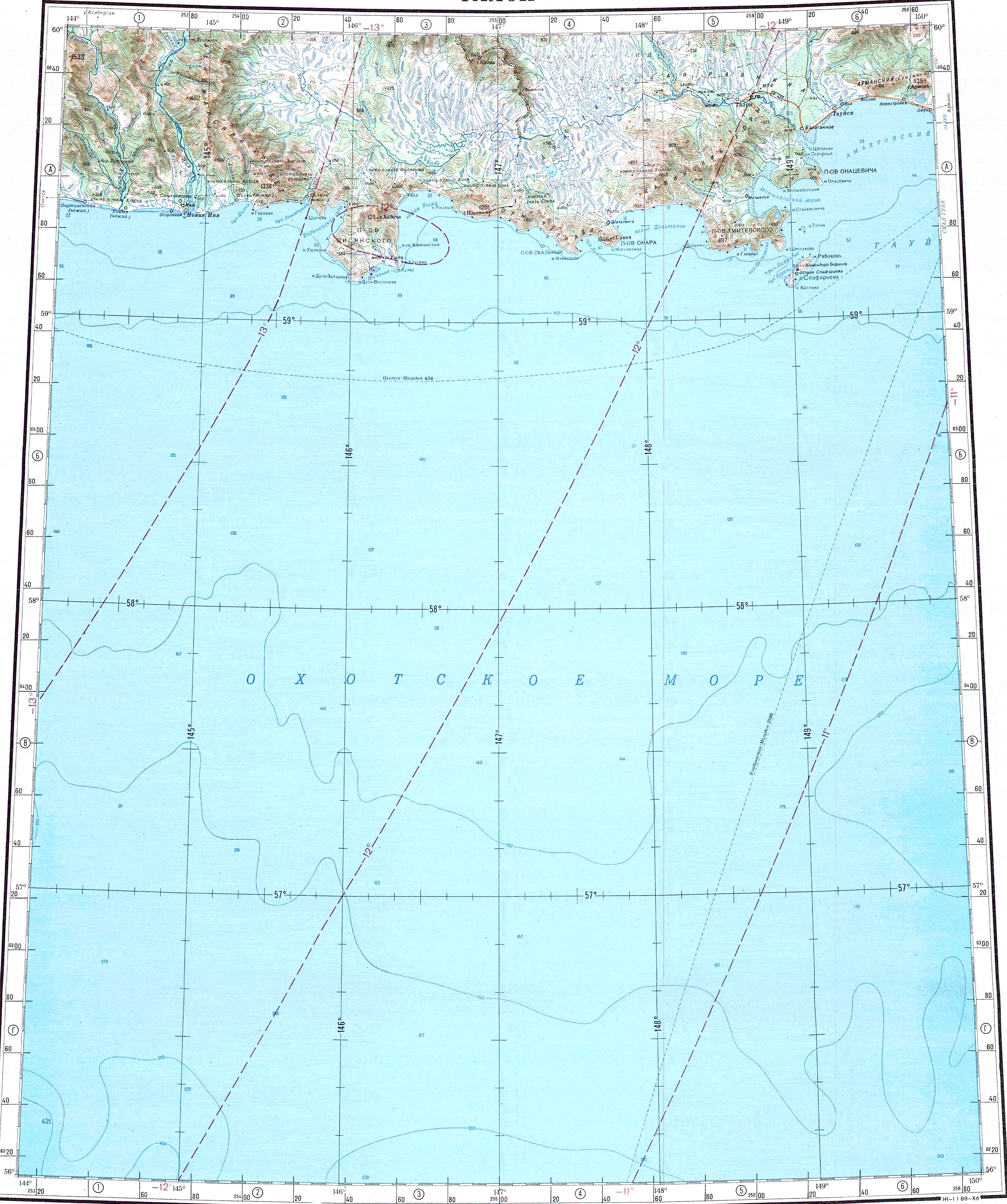
 ONC map showing the northern shore of the Sea of Okhotsk. |
See also[]
References[]
- ^ a b Река Иня in the State Water Register of Russia (Russian)
- ^ 1,000,000 scale Operational Navigation Chart; Sheet D-8
- ^ a b Inya - Water of Russia
- ^ Google Earth
- ^ "O-55 Chart (in Russian)". Retrieved 14 September 2021.
External links[]
This article related to a river in Russia is a stub. You can help Wikipedia by . |
- Rivers of Khabarovsk Krai
- Drainage basins of the Sea of Okhotsk
- Russia river stubs