Taui
| Taui Kava | |
|---|---|
 Taui river basin | |
 Mouth location in Magadan Oblast, Russia | |
| Location | |
| Country | Magadan Oblast, Russia |
| Physical characteristics | |
| Source | |
| • location | Confluence of the Rasava and Lozovaya in Khabarovsk Krai |
| • coordinates | 59°52′59″N 145°39′10″E / 59.88306°N 145.65278°E |
| • elevation | 125 m (410 ft) |
| Mouth | Sea of Okhotsk |
• location | Taui Bay |
• coordinates | 59°37′59″N 149°05′47″E / 59.63306°N 149.09639°E |
• elevation | 0 m (0 ft) |
| Length | 378 km (235 mi) |
| Basin size | 25,900 km2 (10,000 sq mi) |
| Discharge | |
| • average | 347 m3/s (12,300 cu ft/s) |

The Taui (Russian: Тауй), also known as Kava (Russian: Кава) part of its course, is a river in Khabarovsk Krai and Magadan Oblast, Russian Far East. It has a drainage basin of 25,900 square kilometres (10,000 sq mi).[1][2]
The river is a spawning ground for salmon. Its last stretch is navigable.[3]
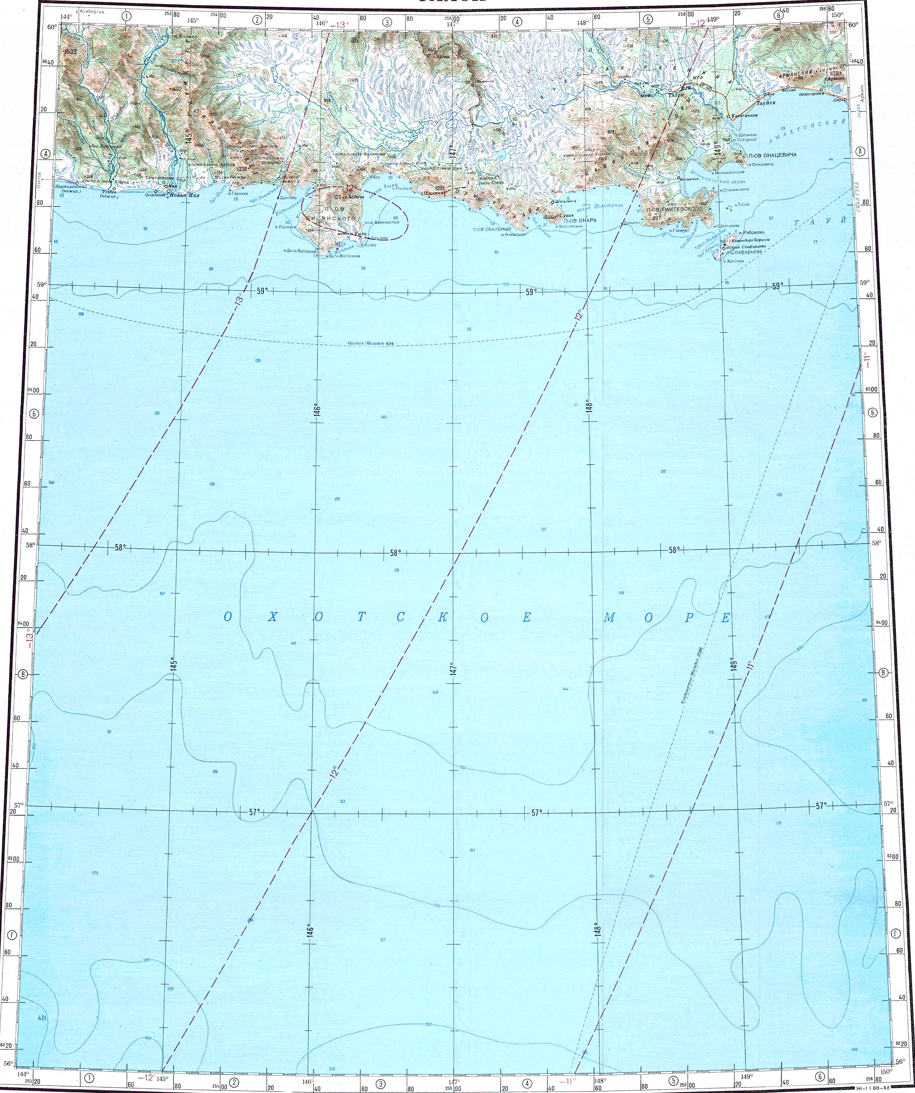
Course[]
The Taui river, as the Kava, is formed at the confluence of rivers Rasava and Lozovaya at an elevation of 125 m (410 ft) in the Upper Kolyma Highlands.[4][3]
The Taui flows first southeastwards and then roughly eastwards. In its last stretch it enters a wide floodplain among wetlands. Finally it flows into the Amakhton Bay, part of the Taui Bay of the Sea of Okhotsk. Its mouth lies west of the Arman lagoon and just southwest of the mouth of the Yana.[5] The river freezes before mid October and stays frozen until mid May.[3]
The separates the Taui basin from the Inya basin to the west. The main tributary of the Taui is the 228 kilometres (142 mi) long (Чёломджа) that joins it in its lower course from the left.[4]
See also[]
References[]
- ^ Река Тауй (в верховье Кава) in the State Water Register of Russia (Russian)
- ^ 1,000,000 scale Operational Navigation Chart; Sheet D-8
- ^ a b c Taui - Water of Russia
- ^ a b "O-55 Chart (in Russian)". Retrieved 9 September 2021.
- ^ Google Earth
External links[]
This article related to a river in Russia is a stub. You can help Wikipedia by . |
- Rivers of Magadan Oblast
- Drainage basins of the Sea of Okhotsk
- Russia river stubs