Jagodnjak
Jagodnjak
| |
|---|---|
| Municipality of Jagodnjak Općina Jagodnjak Општина Јагодњак | |
        Villages of the Jagodnjak Municipality | |
 Flag | |
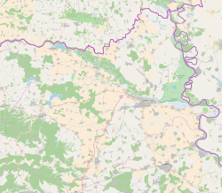 Jagodnjak Location of Jagodnjak in Croatia | |
| Coordinates: 45°42′N 18°35′E / 45.700°N 18.583°E | |
| Country | |
| Region | Baranja (Podunavlje) |
| County | |
| Government | |
| • Municipal mayor | Anđelko Balaban (HNS–LD) |
| Area | |
| • Total | 116.99 km2 (45.17 sq mi) |
| Population (2011) | |
| • Total | 2,040 |
| • Density | 17/km2 (45/sq mi) |
| Time zone | UTC+1 (CET) |
| • Summer (DST) | UTC+2 (CEST) |
| Postal codes | 31323 Bolman 31324 Jagodnjak |
| Area code(s) | +031 |
| Official languages | Croatian, Serbian[3] |
| Website | www |


Jagodnjak ((Croatian and Serbian pronunciation: [jâɡodɲaːk]) Serbian Cyrillic: Јагодњак, Hungarian: Kácsfalu, German: Katschfeld) is a village and a municipality in the Osijek-Baranja County, Croatia. Landscape of the Jagodnjak Municipality is marked by the Drava river with surrounding wetland forest and by Pannonian Basin plains with agricultural fields of corn, wheat, common sunflower and sugar beet.
Jagodnjak is underdeveloped municipality which is statistically classified as the First Category Area of Special State Concern by the Government of Croatia.[4]
Name[]
Jagodnjak name is derived from the Slavic word "jagoda" ("strawberry" in English), "jagodnjak" = "strawberry bed(s)/plot(s)/patch(es)/garden". In other languages, the village in German is known as Katschfeld and in Hungarian as Kácsfalu and is written as Јагодњак in Serbian Cyrillic.[5]
Geography[]
The municipality of Jagodnjak includes the following settlements:
- Bolman
- Jagodnjak
- Majške Međe
- Novi Bolman
History[]
The first historical Municipality of Jagodnjak was established before the World War II during the epoch of the Kingdom of Yugoslavia.[6] At that time municipality was part of the Danube Banovina and it did not include villages of Bolman, Novi Bolman and Majške Međe which were separate unit called the Municipality of Bolman.[6]
During the final stage of the World War II in March 1945 the village of Bolman was the spot of the Battle of Bolman in which Yugoslav Partisans (primarily multi-ethnic units from Vojvodina) and Red Army fought against Nazis.[7] The monument to the battle was constructed in 1951 and in 1971 it was protected as a registered cultural heritage site.[8] After the integration of the region under the central government rule in the late 1990s the monument to the battle was devastated in 1999 and 2000.[7] The municipality initiated reconstruction efforts in 2002 and the work was not completed until 2013 when the Ministry of Culture of the Republic of Croatia provided funds for this purpose.[8] The monument is allegedly target of intentional desecration with illegal waste disposal.[8]
Modern day Municipality of Jagodnjak was established in 1998 with the support of the United Nations representatives in the final stage of the UNTAES transitional administration over the region of Eastern Slavonia, Baranja and Western Syrmia.[6] It was created in order to ensure adequate Serb local self-government through the creation of municipalities in Eastern Slavonia in which the group constitute ethnic majority.[6] Today Jagodnjak is only municipality in Croatian part of Baranya with an ethnic Serb majority. Together with other municipalities with Serb majority in Eastern Croatia it constitutes the Joint Council of Municipalities.
Demographics[]
Population[]
There are 2,537 inhabitants in the municipality (2001 census), including: [1]
- Serbs (64.72%)
- Croats (26.65%)
- Hungarians (2.88%)
- Romani (1.18%)
Before World War II there was a substantial Danube Swabian minority here but they were all expelled by the Communist regime of Josip Broz Tito after 1945.
Languages[]
Due to the local minority population, the Jagodnjak municipality prescribe the use of not only Croatian as the official language, but the Serbian language and Serbian Cyrillic alphabet as well.[5][9]
Religion[]
Politics[]
Joint Council of Municipalities[]
The Municipality of Jagodnjak is one of seven Serb majority member municipalities within the Joint Council of Municipalities, inter-municipal sui generis organization of ethnic Serb community in eastern Croatia established on the basis of Erdut Agreement. As Serb community constitute majority of the population of the municipality it is represented by 2 delegated Councillors at the Assembly of the Joint Council of Municipalities, double the number of Councilors to the number from Serb minority municipalities in Eastern Croatia.[10]
Notable natives and residents[]
See also[]
- Osijek-Baranja County
- Baranja
- Joint Council of Municipalities
- Church of St Nicholas, Jagodnjak
- List of Croatian municipalities with minority languages in official use
References[]
This article may be expanded with text translated from the corresponding article in Croatian. (October 2012) Click [show] for important translation instructions.
|
- ^ Government of Croatia (October 2013). "Peto izvješće Republike Hrvatske o primjeni Europske povelje o regionalnim ili manjinskim jezicima" (PDF) (in Croatian). Council of Europe. p. 36. Retrieved 30 November 2016.
- ^ "Općine na područjima posebne državne skrbi Republike Hrvatske" (PDF). Croatian Chamber of Economy. Retrieved 15 April 2020.
- ^ Četvrto izvješće Republike Hrvatske o primjeni Europske povelje o regionalnim ili manjinskim jezicima, Zagreb, 2009
- ^ Lovrinčević, Željko; Davor, Mikulić; Budak, Jelena (June 2004). "AREAS OF SPECIAL STATE CONCERN IN CROATIA- REGIONAL DEVELOPMENT DIFFERENCES AND THE DEMOGRAPHIC AND EDUCATIONAL CHARACTERISTICS". Ekonomski pregled, Vol.55 No.5-6. Archived from the original on 18 August 2018. Retrieved 25 August 2018.
- ^ a b "Archived copy" (PDF). Archived from the original (PDF) on 2013-10-29. Retrieved 2013-03-08.
{{cite web}}: CS1 maint: archived copy as title (link) - ^ a b c d Jovan S. Nedić. "20 godina Općine Jagodnjak". Novosti (Croatia). Retrieved 5 May 2019.
- ^ a b Jovan Nedić. "Bolmanska živa rana". Novosti (Croatia). Retrieved 5 May 2019.
- ^ a b c Jovan Nedić. "Pod spomenikom - smetlište". Novosti (Croatia). Retrieved 5 May 2019.
- ^ Izvješće o provođenju ustavnog zakona o pravima nacionalnih manjina i o utošku sredstava osiguranih u državnom proračunu Republike Hrvatske za 2008. godinu za potrebe nacionalnih manjina, Zagreb, 2009.
- ^ "Konstituisan 6. saziv Zajedničkog veća opština l" (in Serbian). Zagreb: Privrednik. 1 August 2017.
External links[]
| Wikimedia Commons has media related to Jagodnjak. |
- Official website (in Croatian)
Places adjacent to Jagodnjak | ||||||||||||||||
|---|---|---|---|---|---|---|---|---|---|---|---|---|---|---|---|---|
| ||||||||||||||||
Subdivisions of Osijek-Baranja County | ||
|---|---|---|
| Cities and towns |  | |
| Municipalities |
| |

- Populated places in Osijek-Baranja County
- Municipalities of Croatia
- Baranya (region)
- Joint Council of Municipalities
- Serb communities in Croatia