Podrinje, Croatia
Podrinje
| |
|---|---|
Village (Selo) | |
 | |
 | |
 Podrinje | |
| Coordinates: 45°23′N 18°42′E / 45.383°N 18.700°E | |
| Country | |
| Region | Slavonia (Podunavlje) |
| County | |
| Municipality | Markušica |
| Government | |
| • Body | Local Committee |
| Population (2011)[2] | |
| • Total | 224 |
| Time zone | UTC+1 (CET) |
| • Summer (DST) | UTC+2 (CEST) |
| Official languages | Croatian, Serbian[1] |

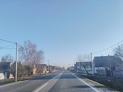
Podrinje (Serbian Cyrillic: Подриње)[3] is a village in Croatia, located in the municipality of Markušica. It is connected by the D518 highway.
According to the 1991 census, the village was inhabited by a majority of Serbs (94.33%), and minority of Croats (3%).[4]
References[]
- ^ Jump up to: a b Government of Croatia (October 2013). "Peto izvješće Republike Hrvatske o primjeni Europske povelje o regionalnim ili manjinskim jezicima" (PDF) (in Croatian). Council of Europe. p. 36. Retrieved 30 November 2016.
- ^ "Population by Age and Sex, by Settlements, 2011 Census: Podrinje". Census of Population, Households and Dwellings 2011. Zagreb: Croatian Bureau of Statistics. December 2012.
- ^ "Minority names in Croatia-Registar Geografskih Imena Nacionalnih Manjina Republike Hrvatske" (PDF). Archived from the original (PDF) on 2013-10-29. Retrieved 2013-03-08.
- ^ "попис становништва 1991" (PDF). Савезни завод за статистику и евиденцију ФНРЈ и СФРЈ. Cite journal requires
|journal=(help)
| show Markušica Municipality |
|---|


| Authority control |
|
|---|
This Vukovar-Syrmia County geography article is a stub. You can help Wikipedia by . |
Categories:
- Populated places in Vukovar-Syrmia County
- Populated places in Syrmia
- Joint Council of Municipalities
- Serb communities in Croatia
- Vukovar-Srijem County geography stubs