Jenštejn
Jenštejn | |
|---|---|
 Ruins of Jenštejn Castle | |
 Flag  Coat of arms | |
 Jenštejn Location in the Czech Republic | |
| Coordinates: 50°9′10″N 14°36′43″E / 50.15278°N 14.61194°ECoordinates: 50°9′10″N 14°36′43″E / 50.15278°N 14.61194°E | |
| Country | |
| Region | Central Bohemian |
| District | Prague-East |
| First mentioned | 1368 |
| Area | |
| • Total | 5.09 km2 (1.97 sq mi) |
| Elevation | 232 m (761 ft) |
| Population (2021-01-01)[1] | |
| • Total | 1,405 |
| • Density | 280/km2 (710/sq mi) |
| Time zone | UTC+1 (CET) |
| • Summer (DST) | UTC+2 (CEST) |
| Postal codes | 250 73, 250 91 |
| Website | www |

Jenštejn (German: Jenstein) is a municipality and village in Prague-East District in the Central Bohemian Region of the Czech Republic. It has about 1,400 inhabitants.
It lies about 16 km north-east from Prague downtown and 7 km south-west of Brandýs nad Labem-Stará Boleslav.
Administrative parts[]
Village of Dehtáry is an administrative part of Jenštejn.
Sights[]
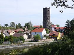
Jenštejn is known for ruins of Jenštejn Castle.
References[]
External links[]
| Wikimedia Commons has media related to Jenštejn. |
| show Authority control |
|---|
Categories:
- Populated places in Prague-East District
- Villages in Prague-East District
- Prague-East geography stubs