Jirny
Jirny | |
|---|---|
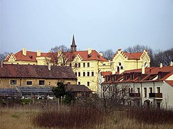 Jirny Castle | |
 Flag  Coat of arms | |
 Jirny Location in the Czech Republic | |
| Coordinates: 50°6′57″N 14°41′57″E / 50.11583°N 14.69917°ECoordinates: 50°6′57″N 14°41′57″E / 50.11583°N 14.69917°E | |
| Country | |
| Region | Central Bohemian |
| District | Prague-East |
| First mentioned | 1350 |
| Area | |
| • Total | 8.26 km2 (3.19 sq mi) |
| Elevation | 250 m (820 ft) |
| Population (2021-01-01)[1] | |
| • Total | 2,950 |
| • Density | 360/km2 (920/sq mi) |
| Time zone | UTC+1 (CET) |
| • Summer (DST) | UTC+2 (CEST) |
| Postal code | 250 90 |
| Website | www |

Jirny is a municipality and village in Prague-East District in the Central Bohemian Region of the Czech Republic. It has about 3,000 inhabitants. It lies on the D11 motorway, about 22 km (14 mi) kilometres east of Prague's centre and 9 km (6 mi) kilometres south of Brandýs nad Labem-Stará Boleslav.
Administrative parts[]
The village of Nové Jirny is an administrative part of Jirny.
References[]
| Wikimedia Commons has media related to Jirny. |
| Authority control: National libraries |
|---|
Categories:
- Populated places in Prague-East District
- Villages in Prague-East District
- Prague-East geography stubs