Johnson County, Texas
Johnson County | |
|---|---|
U.S. county | |
 The Johnson County Courthouse in 2009 | |
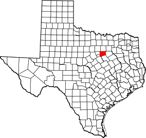 Location within the U.S. state of Texas | |
 Texas's location within the U.S. | |
| Coordinates: 32°23′N 97°22′W / 32.38°N 97.36°W | |
| Country | |
| State | |
| Founded | 1854 |
| Seat | Cleburne |
| Largest city | Burleson |
| Area | |
| • Total | 734 sq mi (1,900 km2) |
| • Land | 725 sq mi (1,880 km2) |
| • Water | 9.8 sq mi (25 km2) 1.3%% |
| Population (2010) | |
| • Total | 150,934 |
| • Density | 208/sq mi (80/km2) |
| Time zone | UTC−6 (Central) |
| • Summer (DST) | UTC−5 (CDT) |
| Congressional district | 25th |
| Website | www |

Johnson County is a county located in the U.S. state of Texas. As of the 2010 census, its population was 150,934.[1] Its county seat is Cleburne.[2] Johnson County is named for Middleton Johnson, a Texas Ranger, soldier, and politician.
Johnson County is included in the Dallas–Fort Worth–Arlington metropolitan statistical area.
History[]
The first settler of Johnson County was Henry Briden, who built a log cabin on the Nolan River in 1849.[3] His log cabin still exists, and can be seen along State Highway 174 in Rio Vista, Texas. The first county seat was Wardville, now located under the waters of Lake Pat Cleburne. In 1856, Buchanan became the county seat. Johnson County was divided in 1866, with the western half becoming Hood County. Camp Henderson became the new county seat and was renamed Cleburne in honor of Confederate General Patrick Cleburne.
Geography[]
According to the U.S. Census Bureau, the county has a total area of 734 square miles (1,900 km2), of which 725 square miles (1,880 km2) are land and 9.8 square miles (25 km2) (1.3%) are covered by water.[4]
Major highways[]
 I-35W
I-35W I-35 BL
 U.S. Highway 67
 U.S. Highway 287
 U.S. Highway 377
 State Highway 81
 State Highway 171
 State Highway 174
Adjacent counties[]
- Tarrant County (north)
- Dallas County (northeast)
- Ellis County (east)
- Hill County (south)
- Bosque County (southwest)
- Somervell County (southwest)
- Hood County (west)
- Parker County (northwest)
Demographics[]
| Historical population | |||
|---|---|---|---|
| Census | Pop. | %± | |
| 1860 | 4,305 | — | |
| 1870 | 4,923 | 14.4% | |
| 1880 | 17,911 | 263.8% | |
| 1890 | 22,313 | 24.6% | |
| 1900 | 33,819 | 51.6% | |
| 1910 | 34,460 | 1.9% | |
| 1920 | 37,286 | 8.2% | |
| 1930 | 33,317 | −10.6% | |
| 1940 | 30,384 | −8.8% | |
| 1950 | 31,390 | 3.3% | |
| 1960 | 34,720 | 10.6% | |
| 1970 | 45,769 | 31.8% | |
| 1980 | 67,649 | 47.8% | |
| 1990 | 97,165 | 43.6% | |
| 2000 | 126,811 | 30.5% | |
| 2010 | 150,934 | 19.0% | |
| 2019 (est.) | 175,817 | [5] | 16.5% |
| U.S. Decennial Census[6] 1850–2010[7] 2010–2019[1] | |||
As of the census[8] of 2000, 126,811 people, 43,636 households, and 34,428 families resided in the county. The population density was 174 people per square mile (67/km2). The 46,269 housing units averaged 63 per square mile (24/km2). The racial makeup of the county was 90.01% White, 2.50% African American, 0.64% Native American, 0.52% Asian, 0.18% Pacific Islander, 4.52% from other races, and 1.63% from two or more races. About 12.12% of the population was Hispanic or Latino of any race.
Of the 43,636 households, 39.50% had children under the age of 18 living with them, 64.70% were married couples living together, 10.00% had a female householder with no husband present, and 21.10% were not families. About 17.30% of the households were made up of individuals, and 6.90% had someone living alone who was 65 years of age or older. The average household size was 2.85 and the average family size was 3.20. As of the 2010 census, about 3.6 same-sex couples occurred per 1,000 households in the county.[9]
In the county, the age distribution was 28.80% under the age of 18, 8.80% from 18 to 24, 30.20% from 25 to 44, 22.30% from 45 to 64, and 10.00% who were 65 years of age or older. The median age was 34 years. For every 100 females, there were 99.70 males. For every 100 females age 18 and over, there were 97.10 males.
The median income for a household in the county was $44,621, and for a family was $49,963. Males had a median income of $36,718 versus $25,149 for females. The per capita income for the county was $18,400. About 6.90% of families and 8.80% of the population were below the poverty line, including 10.60% of those under age 18 and 10.90% of those age 65 or over.
Education[]
Southwestern Adventist University, a private liberal arts university in Keene, is currently the only four-year institution of higher learning in Johnson County. Southwestern is affiliated with the Seventh-day Adventist Church and has existed since 1893. Hill College a college in Hillsboro, a town in neighboring Hill County also provides tertiary education, with a campus in Cleburne since 1971.
Media[]
Johnson County is part of the Dallas/Fort Worth television media market in north-central Texas. Local news media outlets are: KDFW-TV, KXAS-TV, WFAA-TV, KTVT-TV, KERA-TV, KTXA-TV, KDFI-TV, KDAF-TV, KFWD-TV, and KDTX-TV. KCLE is the local radio station, which offers local news in addition to its country-music format. The local newspapers are the Cleburne Times-Review, and .
Cities (multiple counties)[]
- Burleson (small part in Tarrant County)
- Cresson (partly in Hood and Parker counties)
- Crowley (mostly in Tarrant County)
- Mansfield (mostly in Tarrant County and a small part in Ellis County)
Cities[]
Towns[]
- Cross Timber
- Venus (small part in Ellis County)
Unincorporated communities[]
Politics[]
See also[]
- Johnson County Courthouse
- List of museums in North Texas
- National Register of Historic Places listings in Johnson County, Texas
- Recorded Texas Historic Landmarks in Johnson County
- DeWayne Burns, state representative from Johnson and Bosque counties, effective 2015
References[]
- ^ Jump up to: a b "State & County QuickFacts". United States Census Bureau. Archived from the original on October 18, 2011. Retrieved December 18, 2013.
- ^ "Find a County". National Association of Counties. Archived from the original on 2011-05-31. Retrieved 2011-06-07.
- ^ Elam, Richard. "Johnson County". Handbook of Texas Online. Texas State Historical Association. Retrieved 30 December 2020.
- ^ "2010 Census Gazetteer Files". United States Census Bureau. August 22, 2012. Archived from the original on April 19, 2015. Retrieved May 2, 2015.
- ^ "Population and Housing Unit Estimates". United States Census Bureau. May 24, 2020. Retrieved May 27, 2020.
- ^ "U.S. Decennial Census". United States Census Bureau. Retrieved May 2, 2015.
- ^ "Texas Almanac: Population History of Counties from 1850–2010" (PDF). Texas Almanac. Archived (PDF) from the original on February 26, 2015. Retrieved May 2, 2015.
- ^ "U.S. Census website". United States Census Bureau. Retrieved 2011-05-14.
- ^ Leonhardt, David; Quealy, Kevin (June 26, 2015), "Where Same-Sex Couples Live", The New York Times, archived from the original on June 29, 2015, retrieved July 6, 2015
- ^ Leip, David. "Dave Leip's Atlas of U.S. Presidential Elections". uselectionatlas.org. Archived from the original on 23 March 2018. Retrieved 7 May 2018.
External links[]
![]() Media related to Johnson County, Texas at Wikimedia Commons
Media related to Johnson County, Texas at Wikimedia Commons
- Official Johnson County, Texas website
- Johnson County in Handbook of Texas Online at the University of Texas
| show Places adjacent to Johnson County, Texas |
|---|
| show Municipalities and communities of Johnson County, Texas, United States |
|---|


| show Authority control |
|---|
- Texas counties
- Johnson County, Texas
- Dallas–Fort Worth metroplex
- 1854 establishments in Texas
- Populated places established in 1854