San Jacinto County, Texas
San Jacinto County | |
|---|---|
U.S. county | |
 The San Jacinto County Courthouse in Coldspring | |
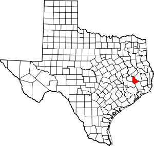 Location within the U.S. state of Texas | |
 Texas's location within the U.S. | |
| Coordinates: 30°35′N 95°10′W / 30.58°N 95.16°W | |
| Country | |
| State | |
| Founded | 1870 |
| Named for | Battle of San Jacinto |
| Seat | Coldspring |
| Largest city | Shepherd |
| Area | |
| • Total | 628 sq mi (1,630 km2) |
| • Land | 569 sq mi (1,470 km2) |
| • Water | 59 sq mi (150 km2) 9.3%% |
| Population (2010) | |
| • Total | 26,384 |
| • Density | 46/sq mi (18/km2) |
| Time zone | UTC−6 (Central) |
| • Summer (DST) | UTC−5 (CDT) |
| Congressional district | 8th |
| Website | www |

San Jacinto County (/ˌsæn dʒəˈsɪntoʊ/ SAN jə-SIN-toh) is a county in the U.S. state of Texas. As of the 2010 census, its population was 26,384.[1] Its county seat is Coldspring.[2] The county's name comes from the Battle of San Jacinto which secured Texas' independence from Mexico and established a republic in 1836.


Geography[]
According to the U.S. Census Bureau, the county has a total area of 628 square miles (1,630 km2), of which 569 square miles (1,470 km2) are land and 59 square miles (150 km2) (9.3%) are covered by water.[3]
Major highways[]
 U.S. Highway 59
 Interstate 69 is currently under construction and will follow the current route of U.S. 59 in most places.
 U.S. Highway 190
 State Highway 150
 State Highway 156
The TTC-69 component (recommended preferred) of the once-planned Trans-Texas Corridor went through San Jacinto County.[4]
Adjacent counties[]
- Trinity County (north)
- Polk County (east)
- Liberty County (southeast)
- Montgomery County (southwest)
- Walker County (west)
National protected area[]
- Sam Houston National Forest (part)
Demographics[]
| Historical population | |||
|---|---|---|---|
| Census | Pop. | %± | |
| 1880 | 6,186 | — | |
| 1890 | 7,360 | 19.0% | |
| 1900 | 10,277 | 39.6% | |
| 1910 | 9,542 | −7.2% | |
| 1920 | 9,867 | 3.4% | |
| 1930 | 9,711 | −1.6% | |
| 1940 | 9,056 | −6.7% | |
| 1950 | 7,172 | −20.8% | |
| 1960 | 6,153 | −14.2% | |
| 1970 | 6,702 | 8.9% | |
| 1980 | 11,434 | 70.6% | |
| 1990 | 16,372 | 43.2% | |
| 2000 | 22,246 | 35.9% | |
| 2010 | 26,384 | 18.6% | |
| 2019 (est.) | 28,859 | [5] | 9.4% |
| U.S. Decennial Census[6] 1850–2010[7] 2010–2014[1] | |||
As of the census[8] of 2000, there were 22,246 people, 8,651 households, and 6,401 families residing in the county. The population density was 39 people per square mile (15/km2). There were 11,520 housing units at an average density of 20 per square mile (8/km2). The racial makeup of the county was 83.64% White, 12.64% Black or African American, 0.46% Native American, 0.28% Asian, 0.07% Pacific Islander, 1.63% from other races, and 1.28% from two or more races. 4.87% of the population were Hispanic or Latino of any race.
There were 8,651 households, out of which 30.00% had children under the age of 18 living with them, 60.20% were married couples living together, 9.70% had a female householder with no husband present, and 26.00% were non-families. 22.60% of all households were made up of individuals, and 10.10% had someone living alone who was 65 years of age or older. The average household size was 2.55 and the average family size was 2.98.
In the county, the population was spread out, with 25.20% under the age of 18, 7.40% from 18 to 24, 24.90% from 25 to 44, 26.60% from 45 to 64, and 15.90% who were 65 years of age or older. The median age was 40 years. For every 100 females there were 100.50 males. For every 100 females age 18 and over, there were 97.40 males.
The median income for a household in the county was $32,220, and the median income for a family was $37,781. Males had a median income of $34,614 versus $22,313 for females. The per capita income for the county was $16,144. About 15.10% of families and 18.80% of the population were below the poverty line, including 22.80% of those under age 18 and 17.60% of those age 65 or over.
Politics[]
United States Congress[]
| Senators | Name | Party | First Elected | Level | |
|---|---|---|---|---|---|
| Senate Class 1 | Ted Cruz | Republican | 2012 | Junior Senator | |
| Senate Class 2 | John Cornyn | Republican | 2002 | Senior Senator | |
| Representatives | Name | Party | First Elected | Area(s) of San Jacinto County Represented | |
| District 8 | Kevin Brady | Republican | 1996 | Entire county | |
Texas Legislature[]
Texas Senate[]
District 3: Robert Nichols (R)- first elected in 2006.
Texas House of Representatives[]
District 18: Ernest Bailes (R) - first elected in 2016
Education[]
School districts include
- Coldspring-Oakhurst Consolidated Independent School District
- Shepherd Independent School District
- Cleveland Independent School District (partial)
- Willis Independent School District (partial)
Areas of San Jacinto County in Coldspring-Oakhurst CISD and Shepherd ISD are assigned to Angelina College. Areas in Cleveland ISD and Willis ISD are assigned to Lone Star College.[10]
Communities[]
Cities[]
- Coldspring (county seat)
- Point Blank
- Shepherd
Census-designated places[]
See also[]
- List of museums in the Texas Gulf Coast
- National Register of Historic Places listings in San Jacinto County, Texas
- Recorded Texas Historic Landmarks in San Jacinto County
- Pine Island (Lake Livingston)
References[]
- ^ Jump up to: a b "State & County QuickFacts". United States Census Bureau. Retrieved December 24, 2013.
- ^ "Find a County". National Association of Counties. Retrieved 2011-06-07.
- ^ "2010 Census Gazetteer Files". United States Census Bureau. August 22, 2012. Retrieved May 10, 2015.
- ^ TxDoT, TTC Section N, Detailed Map 2, 2008-01-24 Archived 2008-02-02 at the Wayback Machine
- ^ "Population and Housing Unit Estimates". United States Census Bureau. May 24, 2020. Retrieved May 27, 2020.
- ^ "U.S. Decennial Census". United States Census Bureau. Retrieved May 10, 2015.
- ^ "Texas Almanac: Population History of Counties from 1850–2010" (PDF). Texas Almanac. Retrieved May 10, 2015.
- ^ "U.S. Census website". United States Census Bureau. Retrieved 2011-05-14.
- ^ Leip, David. "Dave Leip's Atlas of U.S. Presidential Elections". uselectionatlas.org. Retrieved 2018-07-30.
- ^ Texas Education Code, Sec. 130.165. ANGELINA COUNTY JUNIOR COLLEGE DISTRICT SERVICE AREA..
External links[]
- San Jacinto County government's website
- San Jacinto County from the Handbook of Texas Online
- San Jacinto, TXGenWeb Focuses on genealogical research in San Jacinto County.
| show Places adjacent to San Jacinto County, Texas |
|---|
| show Municipalities and communities of San Jacinto County, Texas, United States |
|---|


| show Authority control |
|---|
- Texas counties
- San Jacinto County, Texas
- 1870 establishments in Texas
- Populated places established in 1870