Gaines County, Texas
Gaines County | |
|---|---|
U.S. county | |
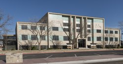 The Gaines County Courthouse in Seminole | |
 Location within the U.S. state of Texas | |
 Texas's location within the U.S. | |
| Coordinates: 32°44′N 102°38′W / 32.74°N 102.64°WCoordinates: 32°44′N 102°38′W / 32.74°N 102.64°W | |
| Country | |
| State | |
| Founded | 1905 |
| Seat | Seminole |
| Largest city | Seminole |
| Area | |
| • Total | 1,503 sq mi (3,890 km2) |
| • Land | 1,502 sq mi (3,890 km2) |
| • Water | 0.5 sq mi (1 km2) 0.03%% |
| Population | |
| • Estimate (2017) | 20,638 |
| • Density | 13.7/sq mi (5.3/km2) |
| Time zone | UTC−6 (Central) |
| • Summer (DST) | UTC−5 (CDT) |
| Congressional district | 19th |
| Website | www |

Gaines County is a county in the U.S. state of Texas. As of the 2010 census, its population was 17,526.[1] The county seat is Seminole.[2]
History[]
The county is named for James Gaines,[3] a merchant who signed the Texas Declaration of Independence and was born in Culpeper County, Virginia in 1779. During the 19th century, the land had been occupied solely by Comanche and Mexican Comancheros, traders who had a thriving business with the Plains Indians. In October 1875, Lt. Bullis, who commanded the 24th Infantry Regiment, encountered a large group of Indians at Cedar Lake. Lt. Bullis captured them for food, supplies, utensils, and buffalo hides. It was then that Col. Shafter established a camp at Cedar Lake and continued to scout the area as far south as the Pecos River. That November he came across a draw where he found a water development. He discovered over 70 wells that reached levels 4 to 15 feet deep. This area became a regular place to trade goods.
In 1887 the northern part of the county was occupied by the Mallet Ranch. The foreman, Dave Ernest sold the ranch to a merchant from San Antonio who used the land for driving cattle towards Kansas. On October 24, 1905, Gaines County became an organized county in Texas.[4] Land was donated by non-resident landowners which would become the town of Seminole, Texas, the county seat. In 1912 a small post office opened up east of Seminole that was named after a local ranch brand that would later become Loop, Texas. In 1917 the Santa Fe Railroad came through Blythe, Texas, but its name was changed to Seagraves, Texas after the company discovered they had a town by the same name already located on the line.
A great addition to Gaines County came in 1977 when a group of Mennonites arrived to start farming and ranching. In 2005 Gaines County became the number one oil producing, cotton producing, and peanut producing county in Texas.[5]
Geography[]
According to the U.S. Census Bureau, the county has a total area of 1,503 square miles (3,890 km2), of which 1,502 square miles (3,890 km2) is land and 0.5 square miles (1.3 km2) (0.03%) is water.[6]
Major highways[]
 U.S. Highway 62
 U.S. Highway 180
 U.S. Highway 385
 State Highway 83
 State Highway 115
 State Highway 214
Adjacent counties[]
- Yoakum County (north)
- Terry County (north)
- Dawson County (east)
- Martin County (southeast)
- Andrews County (south)
- Lea County, New Mexico (west)
Demographics[]
| Historical population | |||
|---|---|---|---|
| Census | Pop. | %± | |
| 1880 | 8 | — | |
| 1890 | 68 | 750.0% | |
| 1900 | 55 | −19.1% | |
| 1910 | 1,255 | 2,181.8% | |
| 1920 | 1,018 | −18.9% | |
| 1930 | 2,800 | 175.0% | |
| 1940 | 8,136 | 190.6% | |
| 1950 | 8,909 | 9.5% | |
| 1960 | 12,267 | 37.7% | |
| 1970 | 11,593 | −5.5% | |
| 1980 | 13,150 | 13.4% | |
| 1990 | 14,123 | 7.4% | |
| 2000 | 14,467 | 2.4% | |
| 2010 | 17,526 | 21.1% | |
| 2019 (est.) | 21,492 | [7] | 22.6% |
| U.S. Decennial Census[8] 1850–2010[9] 2010–2014[1] | |||
As of the census[10] of 2000, there were 14,467 people, 4,681 households, and 3,754 families residing in the county. The population density was 10 people per square mile (4/km2). There were 5,410 housing units at an average density of 4 per square mile (1/km2). The racial makeup of the county was 80.28% White, 2.28% Black or African American, 0.76% Native American, 0.15% Asian, 0.01% Pacific Islander, 14.17% from other races, and 2.35% from two or more races. 35.77% of the population were Hispanic or Latino of any race.
There were 4,681 households, out of which 45.30% had children under the age of 18 living with them, 67.70% were married couples living together, 8.80% had a female householder with no husband present, and 19.80% were non-families. 18.20% of all households were made up of individuals, and 8.60% had someone living alone who was 65 years of age or older. The average household size was 3.07 and the average family size was 3.53.
In the county, the population was spread out, with 35.00% under the age of 18, 9.50% from 18 to 24, 26.80% from 25 to 44, 18.40% from 45 to 64, and 10.30% who were 65 years of age or older. The median age was 30 years. For every 100 females there were 97.00 males. For every 100 females age 18 and over, there were 94.00 males.
The median income for a household in the county was $30,432, and the median income for a family was $34,046. Males had a median income of $29,580 versus $16,996 for females. The per capita income for the county was $13,088. About 17.30% of families and 21.70% of the population were below the poverty line, including 29.20% of those under age 18 and 15.70% of those age 65 or over.
Media[]
The county is served by a twice-a-week newspaper publication, the Seminole Sentinel, as well as local radio stations KIKZ (AM) and KSEM-FM.
Communities[]
Cities[]
Town[]
- Denver City (mostly in Yoakum County)
Census-designated place[]
Ghost town[]
Politics[]
Notable people[]
- Larry Gatlin, country music singer
- Tanya Tucker, country music singer
See also[]
- Recorded Texas Historic Landmarks in Gaines County
References[]
- ^ Jump up to: a b "State & County QuickFacts". United States Census Bureau. Archived from the original on July 28, 2011. Retrieved December 16, 2013.
- ^ "Find a County". National Association of Counties. Archived from the original on 2011-05-31. Retrieved 2011-06-07.
- ^ Gannett, Henry (1905). The Origin of Certain Place Names in the United States. Govt. Print. Off. pp. 133.
- ^ "Texas: Individual County Chronologies". Texas Atlas of Historical County Boundaries. The Newberry Library. 2008. Archived from the original on December 11, 2017. Retrieved May 23, 2015.
- ^ http://www.seminoletxchamber.org/?content_id=13
- ^ "2010 Census Gazetteer Files". United States Census Bureau. August 22, 2012. Retrieved April 27, 2015.
- ^ "Population and Housing Unit Estimates". United States Census Bureau. May 24, 2020. Retrieved May 27, 2020.
- ^ "U.S. Decennial Census". United States Census Bureau. Retrieved April 27, 2015.
- ^ "Texas Almanac: Population History of Counties from 1850–2010" (PDF). Texas Almanac. Retrieved April 27, 2015.
- ^ "U.S. Census website". United States Census Bureau. Retrieved 2011-05-14.
- ^ Leip, David. "Dave Leip's Atlas of U.S. Presidential Elections". uselectionatlas.org. Retrieved 2018-07-23.
External links[]
- Gaines County government's website
- Gaines County from the Handbook of Texas Online
- Inventory of county records, Gaines County courthouse, Seminole, Texas,[permanent dead link] hosted by the Portal to Texas History
- Gaines County Profile from the Texas Association of Counties
| show Places adjacent to Gaines County, Texas |
|---|
| show Municipalities and communities of Gaines County, Texas, United States |
|---|


| show Authority control |
|---|
- Texas counties
- Gaines County, Texas
- 1905 establishments in Texas
- Populated places established in 1905