Hall County, Texas
Hall County | |
|---|---|
U.S. county | |
 The Hall County Courthouse in Memphis | |
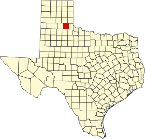 Location within the U.S. state of Texas | |
 Texas's location within the U.S. | |
| Coordinates: 34°31′N 100°41′W / 34.52°N 100.69°W | |
| Country | |
| State | |
| Founded | 1890 |
| Named for | Warren D. C. Hall |
| Seat | Memphis |
| Largest city | Memphis |
| Area | |
| • Total | 904 sq mi (2,340 km2) |
| • Land | 883 sq mi (2,290 km2) |
| • Water | 21 sq mi (50 km2) 2.3%% |
| Population (2010) | |
| • Total | 3,353 |
| • Density | 3.8/sq mi (1.5/km2) |
| Time zone | UTC−6 (Central) |
| • Summer (DST) | UTC−5 (CDT) |
| Congressional district | 13th |

Hall County is a county located in the U.S. state of Texas. As of the 2010 census, the population is 3,353.[1] Its county seat is Memphis.[2] The county was created in 1876 and later organized in 1890.[3] It is named for Warren D. C. Hall, a secretary of war for the Republic of Texas.[4]
Republican Drew Springer, Jr., a businessman from Muenster in Cooke County, has since January 2013 represented Hall County in the Texas House of Representatives. He succeeded Rick Hardcastle of Vernon, who retired after 14 years in the position.[5]
Geography[]
According to the U.S. Census Bureau, the county has a total area of 904 square miles (2,340 km2), of which 883 square miles (2,290 km2) are land and 21 square miles (54 km2) (3.8%) are covered by water.[6]
Major highways[]
 U.S. Highway 287
 State Highway 70
 State Highway 86
 State Highway 256
Adjacent counties[]
- Donley County (north)
- Collingsworth County (northeast)
- Childress County (east)
- Cottle County (southeast)
- Motley County (south)
- Briscoe County (west)
Demographics[]
| Historical population | |||
|---|---|---|---|
| Census | Pop. | %± | |
| 1880 | 36 | — | |
| 1890 | 703 | 1,852.8% | |
| 1900 | 1,660 | 136.1% | |
| 1910 | 8,279 | 398.7% | |
| 1920 | 11,137 | 34.5% | |
| 1930 | 16,966 | 52.3% | |
| 1940 | 12,117 | −28.6% | |
| 1950 | 10,930 | −9.8% | |
| 1960 | 7,322 | −33.0% | |
| 1970 | 6,015 | −17.9% | |
| 1980 | 5,594 | −7.0% | |
| 1990 | 3,905 | −30.2% | |
| 2000 | 3,782 | −3.1% | |
| 2010 | 3,353 | −11.3% | |
| 2019 (est.) | 2,964 | [7] | −11.6% |
| U.S. Decennial Census[8] 1850–2010[9] 2010–2014[1] | |||
As of the census[10] of 2000, 3,782 people, 1,548 households, and 1,013 families resided in the county. The population density was 4 people per square mile (2/km2). The 1,988 housing units averaged 2 per square mile (1/km2). The racial makeup of the county was 71.97% White, 8.22% Black or African American, 0.53% Native American, 0.16% Asian, 17.90% from other races, and 1.22% from two or more races. About 27.50% of the population was Hispanic or Latino of any race.
Of the 1,548 households, 28.20% had children under the age of 18 living with them, 53.70% were married couples living together, 9.00% had a female householder with no husband present, and 34.50% were not families; 32.40% of all households were made up of individuals, and 19.60% had someone living alone who was 65 years of age or older. The average household size was 2.42 and the average family size was 3.06.
In the county, the population was distributed as 27.20% under the age of 18, 6.80% from 18 to 24, 22.10% from 25 to 44, 22.40% from 45 to 64, and 21.50% who were 65 years of age or older. The median age was 40 years. For every 100 females, there were 91.70 males. For every 100 females age 18 and over, there were 86.50 males.
The median income for a household in the county was $23,016, and for a family was $27,325. Males had a median income of $22,167 versus $19,050 for females. The per capita income for the county was $13,210. About 21.60% of families and 26.30% of the population were below the poverty line, including 39.80% of those under age 18 and 16.30% of those age 65 or over.
Education[]
Hall County is served by these districts:
- Memphis Independent School District
- Turkey-Quitaque Independent School District
- Childress Independent School District (partial)
Communities[]
Cities[]
- Memphis (county seat)
- Turkey
Towns[]
- Estelline
- Lakeview
Ghost Towns[]
Notable people[]
- William Mac Thornberry, U.S. Representative
- Daniel I.J. Thornton, governor of Colorado
- Blues Boy Willie, blues musician
- Bob Wills, musician
At one time, the JA Ranch, founded by Charles Goodnight and John George Adair, which reached into six counties, held acreage in Hall County. Minnie Lou Bradley, matriarch of the Bradley 3 Ranch in nearby Childress County, claims a Hall County address.
Politics[]
See also[]
- List of museums in the Texas Panhandle
- National Register of Historic Places listings in Hall County, Texas
- Recorded Texas Historic Landmarks in Hall County
References[]
- ^ Jump up to: a b "State & County QuickFacts". United States Census Bureau. Archived from the original on October 18, 2011. Retrieved December 17, 2013.
- ^ "Find a County". National Association of Counties. Retrieved 2011-06-07.
- ^ "Texas: Individual County Chronologies". Texas Atlas of Historical County Boundaries. The Newberry Library. 2008. Retrieved May 24, 2015.
- ^ Gannett, Henry (1905). The Origin of Certain Place Names in the United States. Govt. Print. Off. pp. 147.
- ^ "State Rep. Springer announces district tour July 30". Lubbock Avalanche-Journal, July 16, 2013. Retrieved July 18, 2013.
- ^ "2010 Census Gazetteer Files". United States Census Bureau. August 22, 2012. Retrieved April 28, 2015.
- ^ "Population and Housing Unit Estimates". United States Census Bureau. May 24, 2020. Retrieved May 27, 2020.
- ^ "U.S. Decennial Census". United States Census Bureau. Retrieved April 28, 2015.
- ^ "Texas Almanac: Population History of Counties from 1850–2010" (PDF). Texas Almanac. Retrieved April 28, 2015.
- ^ "U.S. Census website". United States Census Bureau. Retrieved 2011-05-14.
- ^ Leip, David. "Dave Leip's Atlas of U.S. Presidential Elections". uselectionatlas.org. Retrieved 2018-07-25.
External links[]
- Hall County Memories
- Hall County from the Handbook of Texas Online
- Hall County Profile from the Texas Association of Counties
- Historic Hall County materials, hosted by the Portal to Texas History.
| show Places adjacent to Hall County, Texas |
|---|
| show Municipalities and communities of Hall County, Texas, United States |
|---|


Coordinates: 34°31′N 100°41′W / 34.52°N 100.69°W
| show Authority control |
|---|
- Texas counties
- Hall County, Texas
- 1890 establishments in Texas
- Populated places established in 1890
- Texas Panhandle