Kent County, Texas
Kent County | |
|---|---|
U.S. county | |
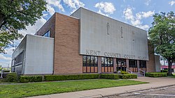 Kent County Courthouse in Jayton | |
 Location within the U.S. state of Texas | |
 Texas's location within the U.S. | |
| Coordinates: 33°11′N 100°46′W / 33.19°N 100.77°W | |
| Country | |
| State | |
| Founded | 1892 |
| Named for | Andrew Kent |
| Seat | Jayton |
| Largest city | Jayton |
| Area | |
| • Total | 903 sq mi (2,340 km2) |
| • Land | 903 sq mi (2,340 km2) |
| • Water | 0.4 sq mi (1 km2) 0.05%% |
| Population (2010) | |
| • Total | 808 |
| • Density | 0.9/sq mi (0.3/km2) |
| Time zone | UTC−6 (Central) |
| • Summer (DST) | UTC−5 (CDT) |
| Congressional district | 19th |
| Website | www |

Kent County is a county located in the U.S. state of Texas. As of the 2010 census, its population was 808,[1] making it the sixth-least populous county in Texas. Its county seat is Jayton.[2] The county was created in 1876 and later organized in 1892.[3] It is named for Andrew Kent, who died at the Battle of the Alamo. Kent County is a [4] prohibition or entirely dry county.
Republican Drew Springer, Jr., a businessman from Muenster in Cooke County, has since January 2013 represented Kent County in the Texas House of Representatives.[5]
History timeline[]
This section is in list format, but may read better as prose. (December 2013) |
- 8000 BC Paleo-Indians were the first inhabitants. Later Native American inhabitants included the Wanderers band of Comanche.[6]
- 1872 Ranald S. Mackenzie and his soldiers trounced the Comanches at Treasure Butte, southeast of Clairemont.[6]
- 1876 The Texas legislature formed Kent County from Young and Bexar districts. The new county is named after Alamo defender Andrew Kent.[6]
- 1888 Cattleman R. L. Rhomberg settled in the new county and named a settlement Clairemont for his daughter, Claire.[7]
- 1890 The county census recorded 324 residents.[6]
- 1891 A conflict arose between cattle ranchers and farmers who tried to fence their farms against cattle.[6]
- 1892 Kent County was organized, with Clairemont as the county seat.[8]
- 1900 The county population was 899.[6]
- 1909 The Stamford and Northeastern Railway built a line across the county's northeast corner. The railroad, which connected Stamford and Spur, later became part of the Wichita Valley Railroad. The Jayton community was founded.[9]
- 1930 The county's population peaked at 3,851.[6]
- 1946-1991 Oil was discovered in Kent County in 1946. By 1991, more than 448,448,000 barrels (71,297,500 m3) of oil have been produced in the county since 1946.[6]
Geography[]
According to the U.S. Census Bureau, the county has a total area of 903 square miles (2,340 km2), of which 903 square miles (2,340 km2) are land and 0.4 square miles (1.0 km2) (0.05%) is covered by water.[10]
Major highways[]
 U.S. Highway 380
 State Highway 70
 State Highway 208
Adjacent counties[]
- Dickens County (north)
- Stonewall County (east)
- Fisher County (southeast)
- Scurry County (south)
- Garza County (west)
- King County (northeast)
- Crosby County (northwest)
Demographics[]
| Historical population | |||
|---|---|---|---|
| Census | Pop. | %± | |
| 1880 | 92 | — | |
| 1890 | 324 | 252.2% | |
| 1900 | 899 | 177.5% | |
| 1910 | 2,655 | 195.3% | |
| 1920 | 3,335 | 25.6% | |
| 1930 | 3,851 | 15.5% | |
| 1940 | 3,413 | −11.4% | |
| 1950 | 2,249 | −34.1% | |
| 1960 | 1,727 | −23.2% | |
| 1970 | 1,434 | −17.0% | |
| 1980 | 1,145 | −20.2% | |
| 1990 | 1,010 | −11.8% | |
| 2000 | 859 | −15.0% | |
| 2010 | 808 | −5.9% | |
| 2019 (est.) | 762 | [11] | −5.7% |
| U.S. Decennial Census[12] 1850–2010[13] 2010–2014[1] | |||
As of the census[14] of 2000, 859 people, 353 households, and 247 families resided in the county. The population density was less than 1/km2 (1/sq mi). The 551 housing units averaged about 0.6 1 per square mile. The racial makeup of the county was 95.46% White, 0.23% Black or African American, 0.35% Native American, 3.73% from other races, and 0.23% from two or more races. About 9% of the population were Hispanic or Latino of any race.
Of the 353 households, 26.10% had children under the age of 18 living with them, 61.20% were married couples living together, 5.90% had a female householder with no husband present, and 30.00% were not families. About 28% of all households were made up of individuals, and 14.20% had someone living alone who was 65 years of age or older. The average household size was 2.33 and the average family size was 2.83.
In the county, the population was distributed as 20.60% under the age of 18, 5.40% from 18 to 24, 21.80% from 25 to 44, 26.80% from 45 to 64, and 25.50% who were 65 years of age or older. The median age was 47 years. For every 100 females, there were 91.70 males. For every 100 females age 18 and over, there were 91.60 males.
The median income for a household in the county was $30,433, and for a family was $35,568. Males had a median income of $23,875 versus $20,000 for females. The per capita income for the county was $17,626. About 9.20% of families and 10.40% of the population were below the poverty line, including 13.10% of those under age 18 and 6.10% of those age 65 or over.
Communities[]
City[]
- Jayton (county seat)
Census-designated place[]
Ghost town[]
Politics[]
See also[]
- Dry counties
- Double Mountain Fork Brazos River
- National Register of Historic Places listings in Kent County, Texas
- Recorded Texas Historic Landmarks in Kent County
References[]
- ^ Jump up to: a b "State & County QuickFacts". United States Census Bureau. Archived from the original on October 18, 2011. Retrieved December 18, 2013.
- ^ "Find a County". National Association of Counties. Archived from the original on 2011-05-31. Retrieved 2011-06-07.
- ^ "Texas: Individual County Chronologies". Texas Atlas of Historical County Boundaries. The Newberry Library. 2008. Retrieved May 24, 2015.
- ^ "Texas counties wet/dry status as of May 2020".
- ^ "State Rep. Springer announces district tour July 30". Lubbock Avalanche-Journal, July 16, 2013. Retrieved July 18, 2013.
- ^ Jump up to: a b c d e f g h Hunt, William R (2010-06-15). "Kent County, Texas". Handbook of Texas Online. Texas State Historical Association. Retrieved 16 December 2010.
- ^ Davis, Charles G (2010-06-12). "Clairmont". Handbook of Texas Online. Texas State Historical Association. Retrieved 16 December 2010.
- ^ "Clairemont, Texas". Texas Escapes. Texas Escapes - Blueprints For Travel, LLC. Retrieved 16 December 2010.
- ^ Davis, Charles G (2010-06-15). "Jayton, Texas". Handbook of Texas Online. Texas State Historical Association. Retrieved 16 December 2010.
- ^ "2010 Census Gazetteer Files". United States Census Bureau. August 22, 2012. Retrieved May 2, 2015.
- ^ "Population and Housing Unit Estimates". United States Census Bureau. May 24, 2020. Retrieved May 27, 2020.
- ^ "U.S. Decennial Census". United States Census Bureau. Retrieved May 2, 2015.
- ^ "Texas Almanac: Population History of Counties from 1850–2010" (PDF). Texas Almanac. Retrieved May 2, 2015.
- ^ "U.S. Census website". United States Census Bureau. Retrieved 2011-05-14.
- ^ Leip, David. "Dave Leip's Atlas of U.S. Presidential Elections". uselectionatlas.org. Retrieved 2018-07-26.
External links[]
- Kent County government’s website
- Kent County from the Handbook of Texas Online
- Kent County Profile from the Texas Association of Counties
| show Places adjacent to Kent County, Texas |
|---|
| show Municipalities and communities of Kent County, Texas, United States |
|---|


Coordinates: 33°11′N 100°46′W / 33.19°N 100.77°W
| show Authority control |
|---|
- Texas counties
- Kent County, Texas
- 1876 establishments in Texas
- Populated places established in 1876