Jose Abad Santos Avenue
 | ||||
|---|---|---|---|---|
| Olongapo–Gapan Road Gapan–San Fernando–Olongapo Road | ||||
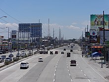
 Driving eastbound through San Fernando, Pampanga | ||||
| Route information | ||||
| Maintained by the Department of Public Works and Highways | ||||
| Length | 118 km (73 mi) | |||
| Component highways | ||||
| Major junctions | ||||
| East end | ||||
| ||||
| West end | ||||
| Location | ||||
| Provinces | Bataan, Nueva Ecija, Pampanga, Zambales | |||
| Major cities | Gapan, San Fernando, Olongapo | |||
| Towns | Dinalupihan, Lubao, Guagua, Bacolor, Mexico, Santa Ana, Arayat, Cabiao, San Isidro | |||
| Highway system | ||||
| ||||
The Jose Abad Santos Avenue (JASA), also known as Olongapo–Gapan Road and Gapan–San Fernando–Olongapo Road, is a two-to-thirteen-lane 118-kilometer (73 mi) major highway spanning the provinces of Bataan, Nueva Ecija, Pampanga, and Zambales in Central Luzon, Philippines. The highway is designated as National Route 3 (N3) of the Philippine highway network.[1]
Etymology[]

Jose Abad Santos Avenue was named in honor of José Abad Santos, Chief Justice of the Supreme Court of the Philippines, who was executed by the Japanese invading forces during World War II. Abad Santos was born in San Fernando, Pampanga, through which the road passes. The avenue was formerly called Olongapo–Gapan Road and Gapan–San Fernando–Olongapo Road. The name was changed in line with Republic Act No. 9477 signed by President Gloria Macapagal Arroyo on May 22, 2007. Nowadays, the avenue is commonly referred to by its acronym JASA, however, its old name is still used.[2]
History[]
Jose Abad Santos Avenue traces its roots to the pre-colonial period.[citation needed] The Kapampangan empire expanded their trades throughout Central Luzon, forcing them to create roads adjacent to the Pampanga River. Since Nueva Ecija, Bulacan, and Rizal (Metro Manila) are readily accessible because the road networks to that locations exist, the empire could not access the province of Zambales and Bataan. Through the years, they developed land tracks accessible by foot and small wagons pulled by horses.
When the Spanish colonials came in the Philippines, they developed the road built by the old empire. They widened the road, constructed wooden bridges, and connected it to the Olongapo, a very vital location which enabled them to easily access the Subic Bay, the site of their Naval Base.
When the Americans came, they paved the Olongapo Gapan Road and constructed concrete bridges, the longest is the one that traverses Great Pampanga River. These actions enabled them to connect their Air Field in Clark and their Naval Base in Subic Bay. Greater improvements on the road was made on this period.
When the World War II started, the Olongapo Gapan Road was crippled, halting the transportation throughout the entire span of the road. The Japanese bombed the road to stop the Americans and Filipino in the fortification of different bases which spans through the Central Luzon.
After the end of the War, the Philippine Government rehabilitated and repaired the whole road, paving all of the 118-kilometer-long highway. New bridges was constructed, shoulders were improved and added some facilities.
During the Mount Pinatubo eruption in 1991, some portions of a highway, especially its Bacolor and Magliman, San Fernando section, were buried in lahar and many bridges were destroyed. A year after the disaster, these sections were rehabilitated, which involved building new roads and bridges.
Today, Olongapo–Gapan Road, now called Jose Abad Santos Avenue and designated as National Route 3 of the Philippine highway network, is the most significant toll-free road that connects Nueva Ecija, Pampanga, Bataan, and Zambales.
Route description[]
The road passes to Gapan, San Isidro, and Cabiao in Nueva Ecija, Santa Ana, Arayat, Mexico, City of San Fernando, Bacolor, Guagua, and Lubao in Pampanga, Hermosa and Dinalupihan in Bataan, and finally to the city of Olongapo in Zambales.[3]
The highway also serves a major utility corridor, carrying various high voltage overhead power lines through densely populated areas where land and right of way acquisition for a normal power line is impractical. Notable power lines using the highway's right of way for most or part of their route are the Hermosa–Duhat–Balintawak transmission line from Hermosa Substation of National Grid Corporation of the Philippines (NGCP) to San Fernando Exit of North Luzon Expressway (NLEx) and Hermosa–Calaguiman line from NGCP Hermosa Substation in Hermosa to Layac Junction in Dinalupihan. The San Fernando segment of the Hermosa–Duhat–Balintawak line itself is undergoing relocation to alleviate heavy traffic along the avenue due to the presence of its electric poles standing on the highway itself, and to pave the way for the expansion of some segments of the avenue, particularly at Barangay Dolores.[4]
Gapan to San Fernando[]
The road starts on Pan-Philippine Highway (N1/AH26) in the city of Gapan in Nueva Ecija. It enters San Isidro where the road turns westward. A few meters is Cabiao where the road continues straightforward, again turning westward then eastward, entering Pampanga, and passes through Pampanga River. It then passes through residential areas and institutions within the municipalities of Arayat, Santa Ana, and Mexico before entering San Fernando. The SM City Pampanga and Robinson Starmills malls can be seen on a boundary between Mexico and City of San Fernando. It intersects with North Luzon Expressway after passing these two malls. It crosses MacArthur Highway through Dolores Flyover, continues on a straight route, with its city proper being visible from the highway, with another flyover named Lazatin Flyover through Lazatin Boulevard. A few meters past the flyover is San Fernando Central Transport Terminal. The city's welcome sign could be located on this portion and after it, the highway enters Bacolor.
Bacolor to Olongapo[]

Upon entering Bacolor, the road turns eastward and passes through the lahar-filled Pasig-Potrero River. It passes through Bacolor town proper, with its parish church being visible from the highway and a restaurant named Apag Marangle. It continues on a straight direction, intersects with Guagua-Santa Rita Provincial Road and San Antonio-Siran Road, turns westward, and enters Lubao after passing the second road mentioned before. It continues straightforward, passing through residential areas and establishments within the municipality and parallels the Lubao Old National Road. It then passes through Porac Gumain River, Barangays Sta. Cruz, Lourdes, San Isidro, and Prado Siongco before entering Bataan through the Pampanga Welcome marker. The Lubao Bypass Road parallels the highway starting on a said river until Barangay Lourdes in Lubao. The road continues straightforward and after a few meters, it enters Dinalupihan. The highway then passes through Layac Junction where it turns right. It will pass on various establishments and residential areas within the municipality. It turns westward and crosses below the Subic–Clark–Tarlac Expressway (SCTEX). It then parallels into it, continues on a straight direction, passes through barangays San Benito, Colo, Naparing, Happy Valley, and Roosevelt National Park Protected Area, and the eastern end of Subic Freeport Expressway. It enters Zambales a few meters after the said exit and continues on a zigzag pattern before passing through residential areas within Olongapo. The road then enters the city proper of Olongapo, where it is locally known as Rizal Avenue, and continues towards National Highway () at its terminus at the Ulo ng Apo Rotonda.
Intersections[]
Intersections are numbered by kilometer posts, with Rizal Park in Manila designated as kilometer zero.
| Province | City/Municipality | km | mi | Destinations | Notes |
|---|---|---|---|---|---|
| Nueva Ecija | Gapan | 90 | 56 | Eastern terminus | |
| San Isidro | San Isidro-Jaen Road | ||||
| Pampanga | Arayat | 87.9 | 54.6 | Mt. Arayat National Park Road | Serves Mt. Arayat National Park |
| 81.5 | 50.6 | Arayat–Magalang Road | |||
| Santa Ana | Baliwag–Candaba–Santa Ana Road | ||||
| Mexico | Bahay Pare–San Luis–Santo Domingo Road / Tulauc–Santo Domingo Road | Roundabout intersection | |||
| Mexico-Magalang Road | |||||
| San Fernando–Lagundi Road | |||||
| San Fernando | 65 | 40 | NLEX-San Fernando Exit, crosses above NLEX | ||
| Crossing motorists are carried by Dolores Flyover | |||||
| Lazatin Boulevard | Crossing motorists are carried by Lazatin Flyover | ||||
| Bacolor | Mega Dike Access Road | ||||
| Guagua | Guagua-Porac Road | ||||
| San Antonio–Floridablanca Road | |||||
| Lubao | San Fernando–Lubao Road | ||||
| Lubao Access Road | both terminus ends at Jose Abad Santos Avenue | ||||
| Bataan | Dinalupihan | 101 | 63 | Northern Terminus of N301 | |
| Olongapo | Ulo ng Apo roundabout. Western terminus. | ||||
| 1.000 mi = 1.609 km; 1.000 km = 0.621 mi | |||||
Landmarks[]
The Jose Abad Santos Avenue spans for about 118 kilometers, thus, many establishments and landmarks are built alongside the highway. This landmarks are malls, historical sites, government facilities, and many more other establishments. Two major shopping malls along the road are SM City Pampanga, the second largest mall in Northern and Central Luzon, and Robinsons Starmills Pampanga.
References[]
- ^ "Jose Abad Santos Avenue". ph.geoview.info. Retrieved 2017-07-19.
- ^ Republic Act No. 9477 (2007), AN ACT RENAMING THE GAPAN-SAN FERNANDO-OLONGAPO ROAD (GSO ROAD) AS JOSE ABAD SANTOS AVENUE (JASA), retrieved 2017-07-19
- ^ "Gapan-San Fernando-Olongapo Road: San Fernando". Caught (up) in traffic. 2012-01-18. Retrieved 2017-07-19.
- ^ Arcellaz, Princess Clea (1 August 2019). "NGCP starts 'relocation' of Jasa electric posts". Retrieved 18 December 2019.
- Roads in Pampanga
- Roads in Nueva Ecija
- Roads in Bataan
- Roads in Zambales