Philippine expressway network
| Philippine expressway network | |
|---|---|
  | |
 Map of expressways in Luzon, including under construction and planned expressways | |
| System information | |
| Maintained by private companies under concession from the Department of Public Works and Highways | |
| Length | 626 km[1] (389 mi) |
| Formed | 2014 |
| Highway names | |
| Expressways | Ex |
| System links | |
| |
The Philippine expressway network, also known as the High Standard Highway Network, is a controlled-access highway network managed by the Department of Public Works and Highways (DPWH) which consists of all expressways and regional high standard highways in the Philippines.[2]
High standard highways are defined as highways which provide a high level of traffic services by assuring high speed mobility and safe travel in order to vitally support socio-economic activities for sound socio-economic development of strategic regions and the country as a whole.[2] In the Philippines, controlled-access highways are known as expressways. They are multi-lane divided toll roads which are privately maintained under concession from the government. The regional high standard highways are partial controlled-access highways that function as supplementary to expressways.[2]
The Philippine expressway network spanned 420 kilometers (260 mi) in length in 2015 and was extended to 626 kilometers (389 mi) in 2020, and is to be extended to 995 kilometers (618 mi) beyond 2030 according to the master plan submitted by the Japan International Cooperation Agency in 2010.[1]
Overview[]
The Philippine highway network spans over 32,000 kilometers (20,000 mi) across all regions of the Philippines. These highways, however, are mostly single and dual carriageways with many U-turn lanes and intersections slowing down traffic. Coupled with the increase in the number of vehicles and the demand for limited-access highways, the Philippine government requested the government of Japan to conduct a master plan for the development of a high standard highway network in 2009 under the Philippine Medium-Term Public Investment Plan (2005–2010).[2] The plan calls for the promotion of national integrity by strengthening the Philippine Nautical Highway System linking roads and ferries, the decongestion of traffic in Metro Manila, and the improvement of accessibility to main tourist spots, among others.[2]
The Philippine expressway network master plan covers the development of high standard highways surrounding Metro Manila in Luzon, Metro Cebu in the Visayas, and the Metro Davao–General Santos area in Mindanao.[2]
Types[]
High standard highways in the Philippines are classified into two types: the arterial high standard highways or expressways, and regional high standard highways.[2]
Expressways (HSH-1)[]
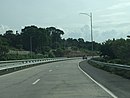
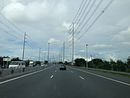
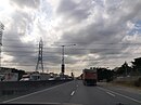
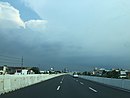
Arterial high standards highways (HSH-1) in the Philippines are known as expressways. They are highways with limited access, normally with interchanges and may include facilities for levying tolls for passage in an open or closed system.[3] Standard features of Philippine expressways include guard rails, rumble strips, signs and pavement markings, solid wall fence, speed radars, toll plaza, closed-circuit television and rest and service areas. The speed limit is 100 km/h for cars and jeepneys, 80 km/h for trucks and buses, and 60 km/h is the minimum for all classes of vehicles.

The first expressways in the Philippines are the North Luzon Expressway (NLEX) and the South Luzon Expressway (SLEX), both of which were built in the late 1960s.[4] The first elevated toll road in the Philippines is the Skyway, with its construction consisting of numerous sections called "stages". Its latest section, Stage 3, was completed in 2021.[5] The Southern Tagalog Arterial Road (STAR) Tollway, from Santo Tomas to Lipa in Batangas was opened in 2001 and was extended in 2008. The Subic–Clark–Tarlac Expressway (SCTEX), the longest tollway in the Philippines was opened in 2008, setting the stage for the development of the Tarlac–Pangasinan–La Union Expressway (TPLEX), which would extend beyond the SCTEX' northern terminus in Tarlac City. The TPLEX was opened in 2013. The Cavite–Laguna Expressway (CALAX), another expressway in Southern Luzon, was partially opened on October 30, 2019.[6] The Central Luzon Link Expressway (CLLEX) was partially opened on July 15, 2021.[7]
There are many under construction and proposed expressways in the Philippines. All the expressways in the Philippines are privately maintained under concession agreements either with the Department of Public Works and Highways or the Toll Regulatory Board through build–operate–transfer (BOT) arrangements. At present, there are 10 expressways in the Philippines that connect Metro Manila to northern and southern Luzon. Other expressways outside Luzon, such as the Cebu–Cordova Link Expressway, are under construction or in development.
Regional high standard highways (HSH-2)[]
Regional high standard highways in the Philippines are multi-lane arterial roads with bypass, grade separation and/or frontage road. They connect the expressways and are mostly partial controlled-access highways.[2] Their design speed is 80–100 km/h for inter-urban regional highways and 60 km/h for intra-urban highways.[2]
Numbering system[]
Under the implementation of a route numbering system commissioned by the Department of Public Works and Highways (DPWH) on 2014, expressways are signed with yellow pentagonal signs with black numerals. They are prefixed with the letter "E" for "Expressway" to distinguish them from national highways. Expressways numbers are assigned sequentially and continuously. [3]
Numbered routes[]
The Philippine expressway network is currently consisting of six discontinuous network of expressways, all of which are located in the island of Luzon.[8][9]
| Image | Route | From | To | Length | Toll roads | Areas served | Notes |
|---|---|---|---|---|---|---|---|

|
Quezon City | Rosario, La Union | 226 km (140 mi) | North Luzon Expressway Subic–Clark–Tarlac Expressway (Mabalacat–Tarlac City segment) Tarlac–Pangasinan–La Union Expressway |
Bulacan, La Union, northern Metro Manila, Nueva Ecija, Pampanga, Pangasinan, Tarlac | Includes the 3.36-kilometer (2.09 mi) NLEX Tabang Spur Road in Bulacan. | |

|
Makati | Batangas City | 123 km (76 mi) | South Luzon Expressway (Magallanes–Santo Tomas segment) Skyway[note 1] Southern Tagalog Arterial Road |
Batangas, Cavite, Laguna, Metro Manila | ||
|
Muntinlupa | 4 km (2.5 mi) | Muntinlupa–Cavite Expressway | Southern Metro Manila, Cavite | Spur of E2 | ||
| Taguig | Parañaque | 7.7 km (4.8 mi) | C-5 Southlink Expressway | Southern Metro Manila | Partially operational (Taguig to Pasay) | ||
| Quezon City | Taguig | 34 km (21 mi) | Southeast Metro Manila Expressway | Rizal, eastern Metro Manila | Under construction | ||
|
Parañaque | Kawit, Cavite | 14 km (8.7 mi) | Manila–Cavite Expressway | Cavite, southern Metro Manila | ||
 
|
Olongapo | Mabalacat | 59.3 km (36.8 mi) | Subic–Clark–Tarlac Expressway (Hermosa–Mabalacat segment)[note 2] Subic Freeport Expressway |
Bataan, Pampanga, Zambales | ||
|
Quezon City | Navotas | 24.85 km (15.44 mi) | NLEX Segment 8.2 (Construction pending) NLEX Mindanao Avenue Link NLEX Karuhatan Link NLEX Harbor Link |
Northern Metro Manila | Operational (Valenzuela to Navotas) | |
|
Parañaque | Taguig | 11.6 km (7.2 mi) | NAIA Expressway | Southern Metro Manila including Ninoy Aquino International Airport | ||
Unnumbered routes[]
| Image | From | To | Length | Toll roads | Areas served | Notes |
|---|---|---|---|---|---|---|

|
Kawit, Cavite | Biñan | 47 km (29 mi) | Cavite–Laguna Expressway | Cavite, Laguna | Operational (Biñan to Silang only) Under construction (Silang to Kawit) |
| Tarlac City | San Jose, Nueva Ecija | 66.4 km (41.3 mi) | Central Luzon Link Expressway | Tarlac, Nueva Ecija | Partially operational (Tarlac City to Aliaga) |
Tolls[]

Most of the expressways implement tolls, usually of the closed road and barrier toll systems. On expressways roads using closed road tolling, motorists first get a card or ticket at the entry point and surrender them upon exit. On expressways implementing barrier tolling, toll collection is done at toll plazas on a fixed rate. Some expressways employ a hybrid system that includes both, like the North Luzon Expressway, which uses both barrier ("open system") and closed road tolling.
Electronic toll collection (ETC) is first implemented on the Skyway and South Luzon Expressway, using transponder technology branded E-Pass. ETC systems are implemented by some toll road operators, with inter-running support on other connected expressways. Toll plazas or toll gates have ETC lanes on the leftmost lanes or on "mixed" lanes, that allow cash collection, or both. Latest ETC systems use radio frequency identification (RFID) technology over transponder technology for collection. Having differing ETC systems that are not supported on other roads, a plan for a unified ETC system are promoted for motorists' convenience.
As of July 2021, the toll rates by expressway are as follows:
| Name | Class 1 (Cars, Motorcycles, SUVs, Jeepneys) |
Class 2 (Buses, Light Trucks) |
Class 3 (Heavy Trucks) |
|---|---|---|---|
| Cavite–Laguna Expressway | ₱47.00 (Mamplasan–Santa Rosa) | ₱95.00 (Mamplasan–Santa Rosa) | ₱193.00 (Mamplasan–Santa Rosa) |
| C-5 Southlink Expressway | ₱22.00 | ₱44.00 | ₱66.00 |
| Manila–Cavite Expressway | ₱8.00 (Kabihasnan) ₱25.00 (Parañaque) ₱64.00 (Kawit) |
₱50.00 (Parañaque) ₱129.00 (Kawit) |
₱75.00 (Parañaque) ₱194.00 (Kawit) |
| Metro Manila Skyway | ₱164.00 (to & from Alabang/SLEx) ₱118.00 (to & from Sucat/Dr. A. Santos Ave.) ₱72.00 (to & from Bicutan/Doña Soledad) ₱105.00 (Buendia to Plaza Azul/Nagtahan) ₱129.00 (E. Rodriguez to NLEX Balintawak) ₱264.00 (Buendia to NLEX Balintawak) |
₱329.00 (to & from Alabang/SLEx) ₱237.00 (to & from Sucat/Dr. A. Santos Ave.) ₱145.00 (to & from Bicutan/Doña Soledad) ₱210.00 (Buendia to Plaza Azul/Nagtahan) ₱258.00 (E. Rodriguez to NLEX Balintawak) ₱528.00 (Buendia to NLEX Balintawak) |
₱493.00 (to & from Alabang/SLEx) ₱356.00 (to & from Sucat/Dr. A. Santos Ave.) ₱218.00 (to & from Bicutan/Doña Soledad) |
| Muntinlupa–Cavite Expressway | ₱17.00 | ₱35.00 | ₱52.00 |
| NAIA Expressway | ₱35.00 (Short Segment) ₱45.00 (Full Route) |
₱69.00 (Short Segment) ₱90.00 (Full Route) |
₱104.00 (Short Segment) ₱134.00 (Full Route) |
| North Luzon Expressway | ₱60.00 [Open System (Balintawak–Marilao)] ₱3.23/km [Closed System (Bocaue–Sta.Ines)] |
₱149.00 [Open System (Balintawak–Marilao)] ₱8.08/km [Closed System (Bocaue–Sta.Ines)] |
₱179.00 [Open System (Balintawak–Marilao)] ₱9.70/km [Closed System (Bocaue–Sta.Ines)] |
| South Luzon Expressway | ₱3.37/km | ₱6.74/km | ₱10.11/km |
| STAR Tollway | ₱1.016/km | ₱2.032/km | ₱3.048/km |
| Subic–Clark–Tarlac Expressway | ₱2.67/km | ₱5.35/km | ₱8.03/km |
| Subic Freeport Expressway | ₱27.00 | ₱67.00 | ₱80.00 |
| Tarlac–Pangasinan–La Union Expressway | ₱3.50/km | ₱8.70/km | ₱10.50/km |
Luzon Spine Expressway Network[]
A component of the expressway network or the High Standard Highway Network is the Luzon Spine Expressway Network (LSEN). It is a planned network of interconnected expressways within the island of Luzon. It is part of the Build! Build! Build! Infrastructure Plan of DuterteNomics.[10]
In addition to the following expressways:
- Central Luzon Link Expressway (CLLEX)
- Manila–Cavite Expressway (CAVITEX)
- Muntinlupa–Cavite Expressway (MCX)
- NAIA Expressway (NAIAX)
- NLEX Harbor Link
- North Luzon Expressway (NLEX)
- Metro Manila Skyway
- South Luzon Expressway (SLEX)
- Southern Tagalog Arterial Road (STAR Tollway)
- Subic Freeport Expressway
- Subic–Clark–Tarlac Expressway (SCTEX)
- Tarlac–Pangasinan–La Union Expressway (TPLEX)
New expressways will be built as well, such as:
- North Luzon East Expressway (NLEE)[11]
- NLEX–SLEX Connector Road[11]
- NLEX Harbor Link (segments 10.1)[11]
- Plaridel Bypass Road Phase II[11]
- SLEX Toll Road 4 and 5[12]
- Southeast Metro Manila Expressway[13][11]
- Tarlac–Pangasinan–La Union Expressway (TPLEX) extension[11]
Asian Highway Network[]
The Asian Highway 26 (![]() ) passes through three expressways in the Philippines:
) passes through three expressways in the Philippines:
 North Luzon Expressway from Guiguinto, Bulacan to Balintawak Interchange, Quezon City;
 South Luzon Expressway from Magallanes Interchange, Makati to Calamba, Laguna; and
- Skyway in Metro Manila.[note 1]
See also[]
- Philippine highway network
- List of expressways in the Philippines
- Transportation in the Philippines
- List of bridges in the Philippines
- Philippine Nautical Highway System
Notes[]
- ^ a b The extent of E2/AH26 in Skyway is unknown since the DPWH's GIS apps does not show any route designation for the tollway. Despite this, some E2/AH26 markers were seen between Buendia and Alabang until they were dismantled together with the center barriers in 2020.
- ^ This segment from Hermosa, Bataan to Mabalacat is currently numbered E1 according to the DPWH's GIS apps but their 2019 atlas, as well as older sources, shows that it is part of E4.
References[]
- ^ a b "Master Plan for High Standard Highways/Expressways for PPP". Department of Public Works and Highways. Retrieved May 15, 2017.
- ^ a b c d e f g h i "The Study of Masterplan on High Standard Highway Network Development in the Republic of the Philippines" (PDF). Japan International Cooperation Agency. July 2010. Retrieved May 15, 2017.
- ^ a b "Brief History of National Roads in the Philippines" (PDF). Department of Public Works and Highways. Retrieved May 15, 2017.
- ^ Abecilla, Victor (November 3, 2015). "Practical solutions to Metro Manila". The Standard. Retrieved January 17, 2016.
- ^ "Skyway Stage 3 to officially open on January 15". CNN Philippines. January 13, 2021.
- ^ Tuquero, Loreben (October 22, 2019). "Cavite-Laguna Expressway passable by October 30 – DPWH". Rappler. Retrieved October 23, 2019.
- ^ Aguilar, Krissy (July 15, 2021). "First 18 km of 30-km Central Luzon Link Expressway opens". Philippine Daily Inquirer. Retrieved July 15, 2021.
- ^ "2015 DPWH Road Data". Department of Public Works and Highways. Retrieved May 15, 2017.
- ^ "Road and Bridge Inventory". www.dpwh.gov.ph. Retrieved June 14, 2020.
- ^ "Luzon Spine Expressway: A road network eyed to shorten travel time between La Union and Bicol to 9 hours". January 27, 2021. Retrieved January 28, 2021.
- ^ a b c d e f Admin. "WATCH: Luzon Spine Expressway Network is Duterte's P107-billion traffic decongestion plan". The Summit Express. Retrieved August 25, 2018.
- ^ "SLEX Toll Road 5 to connect Quezon province to Sorsogon". YugaTech. Retrieved December 29, 2020.
- ^ "SMC's South East Metro Manila Expressway project begins". Philippine Daily Inquirer. Retrieved January 8, 2018.
External links[]
List | ||||||||||||||
| Existing |
| |||||||||||||
| Proposed | ||||||||||||||
| Under construction | ||||||||||||||
See also: Philippine highway network | ||||||||||||||
| National primary roads |
| |||||||
|---|---|---|---|---|---|---|---|---|
| National secondary roads |
| |||||||
See also: Philippine expressway network | ||||||||
Motorways in Asia | |
|---|---|
| Sovereign states |
|
| States with limited recognition | |
| Dependencies and other territories | |
| |
- Roads in the Philippines
- Controlled-access highways by country