Loay Interior Road
| Loay Interior Road | ||||
|---|---|---|---|---|
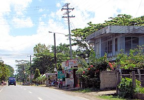 The road in Carmen | ||||
| Route information | ||||
| Maintained by Department of Public Works and Highways (DPWH) | ||||
| Length | 78.92 km (49.04 mi) | |||
| Component highways | N852 | |||
| Major junctions | ||||
| From | ||||
| (Carmen−Sagbayan−Bacani Road) in Carmen
| ||||
| To | ||||
| Location | ||||
| Provinces | Bohol | |||
| Municipalities | Loay, Loboc, Bilar Batuan, Carmen, Dagohoy, San Miguel, Trinidad | |||
| Highway system | ||||
| ||||
| ||||
The Loay Interior Road is a 78.92-kilometer (49.04 mi), two lane national secondary road that connects the municipality of Loay to the municipality of Trinidad in Bohol, Philippines.[1][2] This highway serves as one of the principal gateways to Carmen, which is known for being the main location and tourist spot of the Chocolate Hills.
The entire highway is designated as National Route 852 (N852) of Philippine highway network.
History[]
This road was designated as National Route 852 (N852) of the Philippine highway network by the Department of Public Works and Highways.
Route description[]

The route starts in Loay, as a junction from Tagbilaran East Road.[3] It traverses to Loboc, Bilar and Batuan. The road reaches Carmen and makes junctions of (N853) and (N854), respectively. The highway traverses to Dagohoy and San Miguel. After reaching Trinidad, the road ends at a Three-way intersection of Tagbilaran North Road and Tagbilaran East Road.[3]
Incidents[]
- This highway was one of the roads in Bohol to suffer from the 2013 Bohol earthquake, specifically in the Loboc section.[4] Tourist destinations were damaged along with the town's main church.
- Typhoon Seniang damaged many lunch cruise boats.
- Bilar, a town that is also part of Loay Interior Road, was known to be the location of NPA clashes that claimed 5 lives that were suspected members of the NPA and injured 1 soldier.[5] This made the road prone and dangerous to terrorist attacks.
References[]
- ^ "Bohol 3rd". www.dpwh.gov.ph. Retrieved 2021-08-03.
- ^ "Bohol 2nd". www.dpwh.gov.ph. Retrieved 2021-08-03.
- ^ a b "Road and Bridge Inventory | Department of Public Works and Highways". www.dpwh.gov.ph. Retrieved 2021-08-03.
- ^ "List of major/secondary roads and bridges affected by Central Visayas earthquake". www.officialgazette.gov.ph. Retrieved 2021-08-03.
{{cite web}}: CS1 maint: url-status (link) - ^ "5 NPAs dead, 1 soldier hurt in Bohol clash". Manila Bulletin. Retrieved 2021-08-03.
| National primary roads |
| |||||||
|---|---|---|---|---|---|---|---|---|
| National secondary roads |
| |||||||
See also: Philippine expressway network | ||||||||
- Roads in Bohol