Koolewong, New South Wales
| Koolewong Central Coast, New South Wales | |||||||||||||||
|---|---|---|---|---|---|---|---|---|---|---|---|---|---|---|---|
 Koolewong, Central Coast, NSW | |||||||||||||||
| Population | 871 (2016 census)[1] | ||||||||||||||
| • Density | 440/km2 (1,130/sq mi) | ||||||||||||||
| Postcode(s) | 2256 | ||||||||||||||
| Area | 2 km2 (0.8 sq mi) | ||||||||||||||
| Location |
| ||||||||||||||
| LGA(s) | Central Coast Council | ||||||||||||||
| Parish | Patonga | ||||||||||||||
| State electorate(s) | Gosford | ||||||||||||||
| Federal division(s) | Robertson | ||||||||||||||
| |||||||||||||||
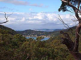
Koolewong is a suburb of the Central Coast region of New South Wales, Australia between Gosford and Woy Woy, and is mostly on a hill overlooking Brisbane Water. It is part of the Central Coast Council local government area.
The suburb contains Koolewong railway station, which is on the Main North railway line.
The land around Koolewong is flat to the southeast, but to the northwest it is hilly. The highest point in the vicinity has an elevation of 150 meters and is 1.0 km south of Koolewong. The nearest larger town is Umina, 6.5 km south of Koolewong. In the region around Koolewong, coves, bays, and beaches are unusually common.
History[]
Koolewong is an Aboriginal word for Koala amongst local Indigenous peoples.[2]
Koolewong was originally known as "Glenrock" but the name Koolewong was selected by the NSW Railways for the station and the locality subsequently also became known as Koolewong.[2]
The population of the suburb recorded at the 2016 census was 871; an increase from the 794 recorded in 2011.[3]
In February 2017, the was opened.
References[]
- ^ Australian Bureau of Statistics (27 June 2017). "Koolewong". 2016 Census QuickStats. Retrieved 30 November 2017.

- ^ a b Newsletter of the Brisbane Water Historical Society Cooranbean Courier August 2017
- ^ Australian Bureau of Statistics (31 October 2012). "Koolewong (State Suburb)". 2011 Census QuickStats. Retrieved 24 October 2013.
Coordinates: 33°27′58″S 151°19′05″E / 33.466°S 151.318°E

This Central Coast geography article is a stub. You can help Wikipedia by . |
- Suburbs of the Central Coast (New South Wales)
- Central Coast, New South Wales geography stubs