Tumbi Umbi, New South Wales
| Tumbi Umbi Central Coast, New South Wales | |||||||||||||||
|---|---|---|---|---|---|---|---|---|---|---|---|---|---|---|---|
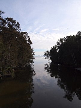 Tumbi Umbi Creek | |||||||||||||||
 Tumbi Umbi | |||||||||||||||
| Coordinates | 33°21′54″S 151°26′35″E / 33.365°S 151.443°ECoordinates: 33°21′54″S 151°26′35″E / 33.365°S 151.443°E | ||||||||||||||
| Population | 4,977 (2011 census)[1] | ||||||||||||||
| Postcode(s) | 2261 | ||||||||||||||
| Location | 7 km (4 mi) SW of The Entrance | ||||||||||||||
| LGA(s) | Central Coast Council | ||||||||||||||
| Parish | Tuggerah | ||||||||||||||
| State electorate(s) | The Entrance | ||||||||||||||
| Federal division(s) | Dobell | ||||||||||||||
| |||||||||||||||

Tumbi Umbi is a mostly semi-rural suburb of the Central Coast region of New South Wales, Australia, located northwest of Bateau Bay along Wyong Road. It is part of the Central Coast Council local government area.
History[]
Tumbi Umbi is an Aboriginal expression meaning place of tall trees.
Tumbi Umbi Secondary College opened in 1996.
Geography[]
It is a somewhat distributed community on the shores of Tuggerah Lake and associated with the creek that feeds into that body of water. In Aboriginal times the description "A place of much water" accurately described the swamp land that has now been extensively drained and populated with housing, industrial estates, a school, Mingara Recreation Club, Mingara One Fitness and Aquatic Centre, a pistol range and Glengara Retirement Village.
The more urbanised part of the suburb can be found along Wyong Road adjacent to Berkeley Vale, Killarney Vale and Bateau Bay. The more rural part is situated around Tumbi Road and Palm Valley Road, adjacent to Glenning Valley, Wamberal and Forresters Beach.
It is situated a short distance from the coast.
References[]
- ^ Australian Bureau of Statistics (31 October 2012). "Tumbi Umbi (State Suburb)". 2011 Census QuickStats. Retrieved 24 October 2013.

This Central Coast geography article is a stub. You can help Wikipedia by . |
- Suburbs of the Central Coast (New South Wales)
- Central Coast, New South Wales geography stubs