Kooloonong, Victoria
| Kooloonong Victoria | |||||||||||||||
|---|---|---|---|---|---|---|---|---|---|---|---|---|---|---|---|
 Kooloonong | |||||||||||||||
| Coordinates | 34°52′S 143°08′E / 34.867°S 143.133°ECoordinates: 34°52′S 143°08′E / 34.867°S 143.133°E | ||||||||||||||
| Postcode(s) | 3549 | ||||||||||||||
| Location | |||||||||||||||
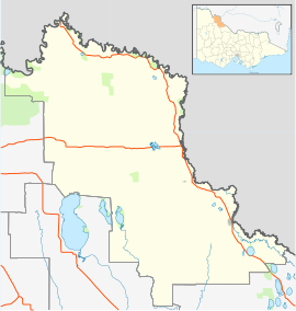
| LGA(s) | Rural City of Swan Hill | ||||||||||||||
| Federal division(s) | Mallee | ||||||||||||||
| |||||||||||||||

Kooloonong is a locality in Victoria, Australia, located approximately 147 km from Mildura, Victoria and was on the Yungera railway line.
Kooloonong was established as a soldier settlement area for returned servicemen from World War I. By the mid-1920s, it was a thriving township with a , government offices, a school, an RSL hall, a railway station and sporting facilities. The town has declined since then and now has only one occupied house, plus the rarely-used hall, a CFA shed and unused grain handling facilities.[2]
The railway north of Swan Hill was extended from Piangil to Kooloonong in March 1920[3] to support the soldier settlement farms in the area. For many years, water was carted to the location by train because there was no natural water supply.[4] The line from Piangil was closed in December 1986.[3] Kooloonong Post Office opened around June 1920 and closed in 1973.[5] It had a polling place for federal elections from 1922[6]
Yungera[]
In 1926, the railway to Kooloonong was further extended to a terminus named Yungera,[7] at what is now the boundary between the localities of Kooloonong and Boundary Bend. The line was shortened back to Kooloonong in 1957.[8] Yungera had a polling place for federal elections from 1929[9] to 1937.[10]
References[]
- ^ Travelmate Archived 24 March 2007 at the Wayback Machine[dead link]
- ^ Macfarlane, Neil (18 June 2015). "Submission to VEAC State Wide Assessment of Public Land" (PDF). Mid-Murray Field Naturalists Inc. Retrieved 1 January 2017.
- ^ a b "Kooloonong". Vicsig. Retrieved 15 March 2016.
- ^ "No Water at Kooloonong". The Argus. 27 March 1923. Retrieved 15 March 2016.
- ^ Phoenix Auctions History, Post Office List, retrieved 26 March 2021
- ^ "APPOINTMENT OF ELECTORAL REGISTRARS AND POLLING PLACES CONSEQUENT ON PROCLAMATION OF DIVISIONS UNDER THE COMMONWEALTH ELECTORAL ACT 1918-1922". Commonwealth of Australia Gazette. Australia. 5 October 1922. p. 1733. Retrieved 20 January 2020 – via Trove.
- ^ "Yungera". Victorian Railway Stations. 12 March 2012. Retrieved 1 January 2017.
- ^ Sid Brown (March 1990). "Tracks Across the State". Newsrail. Australian Railway Historical Society (Victorian Division). pp. 71–76.
- ^ "APPOINTMENT OF POLLING PLACES". Commonwealth of Australia Gazette. Australia. 20 June 1929. p. 1452. Retrieved 20 January 2020 – via Trove.
- ^ "ABOLITION OF POLLING PLACES". Commonwealth of Australia Gazette. Australia. 21 January 1937. p. 77. Retrieved 20 January 2020 – via Trove.
- Towns in Victoria (Australia)
- Towns in Mallee
- Rural City of Swan Hill