Pental Island, Victoria
| Pental Island Victoria | |||||||||||||||
|---|---|---|---|---|---|---|---|---|---|---|---|---|---|---|---|
 Pental Island Bridge at Swan Hill | |||||||||||||||
 Pental Island | |||||||||||||||
| Coordinates | 35°25′S 143°45′E / 35.417°S 143.750°ECoordinates: 35°25′S 143°45′E / 35.417°S 143.750°E | ||||||||||||||
| Population | 380 (2006 census)[1] | ||||||||||||||
| Postcode(s) | 3586 | ||||||||||||||
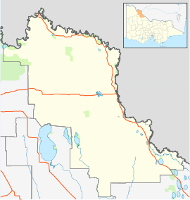
| LGA(s) | Rural City of Swan Hill | ||||||||||||||
| |||||||||||||||

Pental Island is an island and rural locality in Victoria, Australia, bordering Swan Hill, Victoria in the north. The island is bounded by the Murray River in the north and the Little Murray River in the south; the Little Murray diverging from the Murray at Fish Point and converging at Swan Hill. Pental Island is also a parish of the County of Tatchera and the boundaries of the three entities are identical. At the 2006 census, Pental Island had a population of 380.[1] The indigenous Wemba Wemba name for the island is Pakaruk.[2]
Two bridges allow access to the island from within Victoria, on Pental Island Road at Swan Hill in the west, and on Fish Point Road at Fish Point in the east. There are no crossings to the island over the Murray from New South Wales.
Boundary dispute[]
Pental Island is one of two areas (the other is Beveridge Island) which were the subject of border disputes between the states of Victoria and New South Wales. When the Murray was opened for navigation the question arose as to whether all navigable channels were part of New South Wales, as claimed by that state, or whether the Little Murray River was a continuation of the Loddon River enclosing Pental Island as claimed by Victoria. The dispute was raised in 1871 and was resolved in favour of Victoria by the Judicial Committee, with no detailed reasons given.[3][4]
References[]
- ^ a b Australian Bureau of Statistics (25 October 2007). "Pental Island (State Suburb)". 2006 Census QuickStats. Retrieved 27 June 2010.
- ^ Clark, Ian; Heydon, Toby (2002). Dictionary of Aboriginal Placenames of Victoria. Melbourne: Victorian Aboriginal Corporation for Languages.
- ^ Campbell, Enid (1971). "Suits between the governments of a federation" (PDF). Sydney Law Review. 6 (3): 331–332. Retrieved 19 November 2017.
- ^ Moore, William Harrison (1904). "The Case of Pental Island". Law Quarterly Review. 20 (3): 236.
External links[]
- County of Tatchera, Cadastral map showing county and parish boundaries, categories of lands holdings and reserves., 1880s. National Library of Australia
| Near East Gippsland | |
|---|---|
| Near Corner Inlet | |
| Near Wilsons Promontory | |
| In Western Port | |
| In Port Phillip | |
| Near Portland Bay | |
| In rivers | |
| |
This article about a location in the is a stub. You can help Wikipedia by . |
- Towns in Victoria (Australia)
- Towns in Mallee
- Rural City of Swan Hill
- Islands of Victoria (Australia)
- Murray River
- Territorial disputes of Australia
- Borders of Victoria (Australia)
- Borders of New South Wales
- River islands of Australia
- Mallee geography stubs